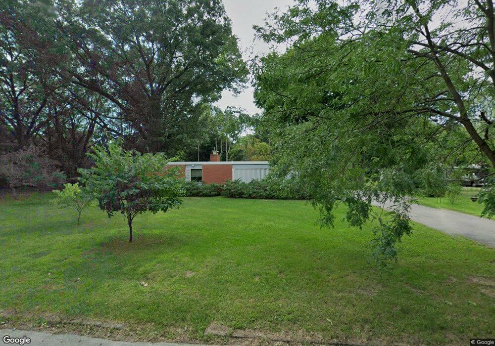
1776 Commonwealth Rd Benton Harbor, MI 49022
Fair Plain NeighborhoodEstimated Value: $366,000 - $467,417
4
Beds
4
Baths
2,900
Sq Ft
$141/Sq Ft
Est. Value
About This Home
This home is located at 1776 Commonwealth Rd, Benton Harbor, MI 49022 and is currently estimated at $409,354, approximately $141 per square foot. 1776 Commonwealth Rd is a home located in Berrien County with nearby schools including Fair Plain Middle School, Benton Harbor High School, and Benton Harbor Charter School Academy.
Ownership History
Date
Name
Owned For
Owner Type
Purchase Details
Closed on
Sep 23, 2011
Sold by
Tyler Treg and Stephens Claudia
Bought by
Elliott Scott and Elliott Eileen Cropley
Current Estimated Value
Home Financials for this Owner
Home Financials are based on the most recent Mortgage that was taken out on this home.
Original Mortgage
$148,000
Interest Rate
4.14%
Mortgage Type
New Conventional
Purchase Details
Closed on
Jun 30, 2006
Sold by
Marlatt George R and Marlatt Maria A
Bought by
Tyler Treg and Stephens Claudia
Home Financials for this Owner
Home Financials are based on the most recent Mortgage that was taken out on this home.
Original Mortgage
$161,600
Interest Rate
6.72%
Mortgage Type
New Conventional
Purchase Details
Closed on
Sep 16, 2002
Create a Home Valuation Report for This Property
The Home Valuation Report is an in-depth analysis detailing your home's value as well as a comparison with similar homes in the area
Home Values in the Area
Average Home Value in this Area
Purchase History
| Date | Buyer | Sale Price | Title Company |
|---|---|---|---|
| Elliott Scott | $185,000 | Cti | |
| Tyler Treg | $202,000 | Meridian Title Corporation | |
| -- | $142,500 | -- |
Source: Public Records
Mortgage History
| Date | Status | Borrower | Loan Amount |
|---|---|---|---|
| Closed | Elliott Scott | $148,000 | |
| Previous Owner | Tyler Treg | $161,600 |
Source: Public Records
Tax History Compared to Growth
Tax History
| Year | Tax Paid | Tax Assessment Tax Assessment Total Assessment is a certain percentage of the fair market value that is determined by local assessors to be the total taxable value of land and additions on the property. | Land | Improvement |
|---|---|---|---|---|
| 2025 | $3,491 | $185,200 | $0 | $0 |
| 2024 | $2,100 | $161,100 | $0 | $0 |
| 2023 | $2,000 | $123,900 | $0 | $0 |
| 2022 | $3,121 | $117,100 | $0 | $0 |
| 2021 | $3,060 | $124,300 | $27,800 | $96,500 |
| 2020 | $2,850 | $122,900 | $0 | $0 |
| 2019 | $2,720 | $100,400 | $18,800 | $81,600 |
| 2018 | $2,615 | $100,400 | $0 | $0 |
| 2017 | $2,579 | $104,300 | $0 | $0 |
| 2016 | $2,417 | $102,200 | $0 | $0 |
| 2015 | $2,411 | $93,300 | $0 | $0 |
| 2014 | $1,583 | $92,600 | $0 | $0 |
Source: Public Records
Map
Nearby Homes
- 424 W Napier Ave
- 484 W Napier Ave
- 235 Fisk Rd
- 1803 Heath Ct
- 1565 Miami Rd
- 513 N Ottawa Rd
- 379 Western Ave
- 117 Messner Dr
- 1510 Moccasin Trail
- 1525 Moccasin Trail
- 275 Benjamin St
- 180 Emery Ave
- 1762 Smyers Dr
- 1235 Colfax Ave
- 449 E Napier Ave
- 304 W May St
- 1606 Stanley Dr
- 287 Nickerson Ave
- 2108 Langley Ave
- 1267 Broadway
- 1780 Commonwealth Rd
- 1762 Commonwealth Rd
- 441 Hoover Ave
- 1790 Commonwealth Rd
- 1767 Commonwealth Rd
- 1798 Commonwealth Rd
- 1758 Commonwealth Rd
- 1773 Commonwealth Rd
- 1816 Commonwealth Rd
- 1789 Commonwealth Rd
- 1763 Commonwealth Rd
- 1817 Commonwealth Rd
- 1793 Commonwealth Rd
- 472 W Napier Ave
- 472 W Napier Ave
- 1797 Commonwealth Rd
- 1759 Commonwealth Rd
- 408 W Napier Ave
- 416 W Napier Ave
- 400 W Napier Ave