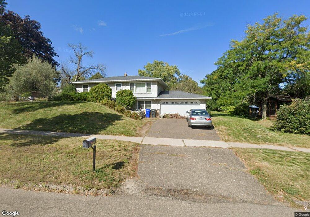
1779 Upper Afton Rd E Saint Paul, MN 55119
Battle Creek NeighborhoodEstimated Value: $282,000 - $343,000
3
Beds
2
Baths
2,080
Sq Ft
$157/Sq Ft
Est. Value
About This Home
This home is located at 1779 Upper Afton Rd E, Saint Paul, MN 55119 and is currently estimated at $327,176, approximately $157 per square foot. 1779 Upper Afton Rd E is a home located in Ramsey County with nearby schools including Battle Creek Elementary School, Battle Creek Middle School, and Harding Senior High School.
Ownership History
Date
Name
Owned For
Owner Type
Purchase Details
Closed on
Oct 30, 2020
Sold by
Fisher Robert J
Bought by
Snider Jordan and Snider Katy
Current Estimated Value
Home Financials for this Owner
Home Financials are based on the most recent Mortgage that was taken out on this home.
Original Mortgage
$274,928
Interest Rate
2.7%
Mortgage Type
FHA
Purchase Details
Closed on
Feb 6, 2018
Sold by
Fisher Robert J
Bought by
Fisher Donna M
Create a Home Valuation Report for This Property
The Home Valuation Report is an in-depth analysis detailing your home's value as well as a comparison with similar homes in the area
Home Values in the Area
Average Home Value in this Area
Purchase History
| Date | Buyer | Sale Price | Title Company |
|---|---|---|---|
| Snider Jordan | $280,000 | At Home Title | |
| Fisher Donna M | -- | None Available | |
| Snider Katy Katy | $280,000 | -- |
Source: Public Records
Mortgage History
| Date | Status | Borrower | Loan Amount |
|---|---|---|---|
| Previous Owner | Snider Jordan | $274,928 | |
| Closed | Snider Katy Katy | $274,928 |
Source: Public Records
Tax History Compared to Growth
Tax History
| Year | Tax Paid | Tax Assessment Tax Assessment Total Assessment is a certain percentage of the fair market value that is determined by local assessors to be the total taxable value of land and additions on the property. | Land | Improvement |
|---|---|---|---|---|
| 2025 | $4,442 | $325,300 | $37,000 | $288,300 |
| 2023 | $4,442 | $293,700 | $37,000 | $256,700 |
| 2022 | $3,858 | $305,700 | $37,000 | $268,700 |
| 2021 | $3,710 | $249,000 | $33,200 | $215,800 |
| 2020 | $3,370 | $233,600 | $33,200 | $200,400 |
| 2019 | $3,614 | $213,900 | $33,200 | $180,700 |
| 2018 | $3,084 | $224,100 | $33,200 | $190,900 |
| 2017 | $2,680 | $200,300 | $29,300 | $171,000 |
| 2016 | $2,286 | $0 | $0 | $0 |
| 2015 | $1,439 | $155,300 | $29,300 | $126,000 |
| 2014 | $2,740 | $0 | $0 | $0 |
Source: Public Records
Map
Nearby Homes
- 136 White Bear Ave N
- 125 Battle Creek Place
- 49 Battle Creek Place
- 1747 Louise Ave
- 1935 Warbler Ln
- 1989 N Park Dr
- 237 Sigurd St
- 138 Ruth St N Unit 9
- 2059 Parkside Dr Unit 29
- 2063 N Park Dr Unit 6
- 2069 Parkside Dr Unit G2
- 267 Hazelwood St
- 201 Dora Ct W
- 1821 Wilson Ave
- 1600 Old Hudson Rd
- 1538 Wilson Ave
- 1443 Pacific St
- 465 Ruth St N
- 2169 Glenridge Ave
- 2219 Cardinal Place
- 130 White Bear Ave N
- 1785 Upper Afton Rd E
- 1791 Upper Afton Rd E
- 1773 Upper Afton Rd
- 1773 1773 Upper Afton-Road-
- 80 White Bear Ave N
- 107 Battle Creek Place
- 1784 Upper Afton Rd E
- 101 Battle Creek Place
- 142 White Bear Ave N
- 1790 Upper Afton Rd E
- 1765 Upper Afton Rd
- 1774 1774 Upper Afton-Road-
- 1797 Upper Afton Rd E
- 1774 Upper Afton Rd
- 111 Battle Creek Place
- 70 White Bear Ave N
- 97 Battle Creek Place
- 1770 Rowe Place
- 1757 Upper Afton Rd