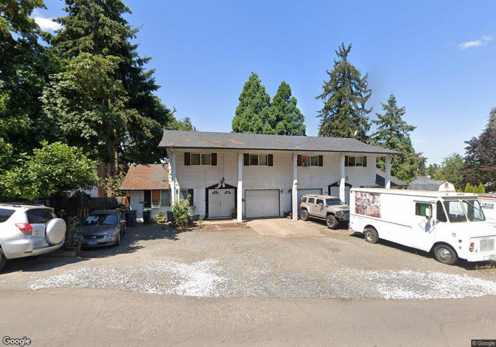
1780 Buck St Eugene, OR 97402
Churchill NeighborhoodEstimated Value: $534,000 - $590,000
8
Beds
4
Baths
2,760
Sq Ft
$202/Sq Ft
Est. Value
About This Home
This home is located at 1780 Buck St, Eugene, OR 97402 and is currently estimated at $556,950, approximately $201 per square foot. 1780 Buck St is a home located in Lane County with nearby schools including McCornack Elementary School, Kennedy Middle School, and Churchill High School.
Ownership History
Date
Name
Owned For
Owner Type
Purchase Details
Closed on
May 10, 2021
Sold by
3M Investments Partnership
Bought by
Rios Jose H
Current Estimated Value
Home Financials for this Owner
Home Financials are based on the most recent Mortgage that was taken out on this home.
Original Mortgage
$415,338
Outstanding Balance
$374,795
Interest Rate
3.1%
Mortgage Type
FHA
Estimated Equity
$182,155
Purchase Details
Closed on
Jul 25, 2012
Sold by
Moore Myrl G and Monroe Michael W
Bought by
3M Investments Partnership
Create a Home Valuation Report for This Property
The Home Valuation Report is an in-depth analysis detailing your home's value as well as a comparison with similar homes in the area
Home Values in the Area
Average Home Value in this Area
Purchase History
| Date | Buyer | Sale Price | Title Company |
|---|---|---|---|
| Rios Jose H | $423,000 | First American Title | |
| 3M Investments Partnership | -- | None Available |
Source: Public Records
Mortgage History
| Date | Status | Borrower | Loan Amount |
|---|---|---|---|
| Open | Rios Jose H | $415,338 |
Source: Public Records
Tax History
| Year | Tax Paid | Tax Assessment Tax Assessment Total Assessment is a certain percentage of the fair market value that is determined by local assessors to be the total taxable value of land and additions on the property. | Land | Improvement |
|---|---|---|---|---|
| 2025 | $5,978 | $306,809 | -- | -- |
| 2024 | $5,903 | $297,873 | -- | -- |
| 2023 | $5,903 | $289,198 | -- | -- |
| 2022 | $5,530 | $280,775 | $0 | $0 |
| 2021 | $5,195 | $272,598 | $0 | $0 |
| 2020 | $5,213 | $264,659 | $0 | $0 |
| 2019 | $4,890 | $256,951 | $0 | $0 |
| 2018 | $4,632 | $242,201 | $0 | $0 |
| 2017 | $4,380 | $242,201 | $0 | $0 |
| 2016 | $4,238 | $235,147 | $0 | $0 |
| 2015 | $4,145 | $228,298 | $0 | $0 |
| 2014 | $3,989 | $221,649 | $0 | $0 |
Source: Public Records
Map
Nearby Homes
- 2055 Broadview St
- 2953 W 15th Ave
- 1432 Fetters Loop
- 1438 Quaker St
- 1910 Hawkins Ln
- 1474 Fetters Loop
- 1326 Quaker St
- 3685 Westleigh St
- 1511 Fetters Loop
- 1999 Hawkins Ln
- 2111 Hawkins Ln Unit 45
- 2085 Trillium St
- 2239 Hawkins Ln
- 3534 Westleigh St
- 3837 Kevington Ave
- 2279 City View St
- 3732 Peppertree Dr
- 1735 Cleveland Place
- 3705 Peppertree Dr
- 2161 W 16th Ave
- 3223 W 18th Ave
- 3196 Ivy Glen Dr
- 3186 Ivy Glen Dr
- 3178 Ivy Glen Dr
- 3194 Ivy Glen Dr
- 3182 Ivy Glen Dr
- 3251 W 18th Ave
- 3174 Ivy Glen Dr
- 3166 Ivy Glen Dr
- 1730 Buck St
- 3232 W 17th Ave
- 3246 W 17th Ave
- 3250 W 18th Ave
- 3156 Ivy Glen Dr
- 3265 W 18th Ave
- 3190 W 18th Ave
- 3157 Ivy Glen Dr
- 3152 Ivy Glen Dr
- 3140 W 18th Ave
- 3153 Ivy Glen Dr
Your Personal Tour Guide
Ask me questions while you tour the home.