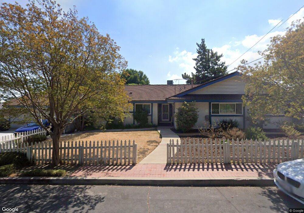
17838 Simonds St Granada Hills, CA 91344
Estimated Value: $1,291,455 - $1,444,000
4
Beds
3
Baths
2,441
Sq Ft
$568/Sq Ft
Est. Value
About This Home
This home is located at 17838 Simonds St, Granada Hills, CA 91344 and is currently estimated at $1,386,864, approximately $568 per square foot. 17838 Simonds St is a home located in Los Angeles County with nearby schools including Granada Elementary School for Advanced Studies, Patrick Henry Middle School, and Valley Academy of Arts & Sciences.
Ownership History
Date
Name
Owned For
Owner Type
Purchase Details
Closed on
Feb 9, 2022
Sold by
Kip Hilary H
Bought by
Kip Family Trust
Current Estimated Value
Purchase Details
Closed on
Mar 28, 1995
Sold by
Hartman Annette
Bought by
Hartman Annette and Kenneth & Annette Hartman 1993
Purchase Details
Closed on
Oct 8, 1993
Sold by
Hartman Kenneth W and Hartman Annette
Bought by
Hartman Kenneth W and Hartman Annette
Home Financials for this Owner
Home Financials are based on the most recent Mortgage that was taken out on this home.
Original Mortgage
$172,000
Interest Rate
6.95%
Create a Home Valuation Report for This Property
The Home Valuation Report is an in-depth analysis detailing your home's value as well as a comparison with similar homes in the area
Home Values in the Area
Average Home Value in this Area
Purchase History
| Date | Buyer | Sale Price | Title Company |
|---|---|---|---|
| Kip Family Trust | -- | None Listed On Document | |
| Kip Hilary H | -- | None Listed On Document | |
| Hartman Annette | -- | -- | |
| Hartman Kenneth W | -- | First American Title Company |
Source: Public Records
Mortgage History
| Date | Status | Borrower | Loan Amount |
|---|---|---|---|
| Previous Owner | Hartman Kenneth W | $172,000 |
Source: Public Records
Tax History Compared to Growth
Tax History
| Year | Tax Paid | Tax Assessment Tax Assessment Total Assessment is a certain percentage of the fair market value that is determined by local assessors to be the total taxable value of land and additions on the property. | Land | Improvement |
|---|---|---|---|---|
| 2025 | $7,109 | $574,689 | $273,549 | $301,140 |
| 2024 | $7,109 | $563,422 | $268,186 | $295,236 |
| 2023 | $6,975 | $552,376 | $262,928 | $289,448 |
| 2022 | $6,657 | $541,546 | $257,773 | $283,773 |
| 2021 | $6,565 | $530,928 | $252,719 | $278,209 |
| 2020 | $6,626 | $525,485 | $250,128 | $275,357 |
| 2019 | $6,371 | $515,182 | $245,224 | $269,958 |
| 2018 | $6,242 | $505,081 | $240,416 | $264,665 |
| 2016 | $5,947 | $485,470 | $231,081 | $254,389 |
| 2015 | $5,861 | $478,178 | $227,610 | $250,568 |
| 2014 | $5,887 | $468,812 | $223,152 | $245,660 |
Source: Public Records
Map
Nearby Homes
- 11180 Bertrand Ave
- 11223 White Oak Ave
- 17823 Rinaldi St
- 11158 Newcastle Ave
- 11129 White Oak Ave
- 11538 Zelzah Ave
- 17558 Lahey St
- 17916 Ludlow St
- 11628 Lerdo Ave
- 11737 Lois Ct
- 11542 Encino Ave
- 18308 Lahey St
- 10861 Lindley Ave
- 17420 Flanders St
- 18301 Ludlow St
- 18200 Sheffield Ln
- 18351 San Fernando Mission Blvd
- 18371 Lahey St
- 11410 Reseda Blvd
- 17641 Los Alimos St
- 11300 Zelzah Ave
- 11311 Zelzah Ave
- 11326 Zelzah Ave
- 17843 Simonds St
- 17833 Simonds St
- 11260 Zelzah Ave
- 17818 Simonds St
- 17823 Simonds St
- 11323 Zelzah Ave
- 17911 Index St
- 17810 Simonds St
- 11250 Zelzah Ave
- 11251 Zelzah Ave
- 11333 Zelzah Ave
- 11245 Balcom Ave
- 17811 Simonds St
- 11241 Balcom Ave
- 17921 Index St
- 17914 Index St
- 17800 Simonds St