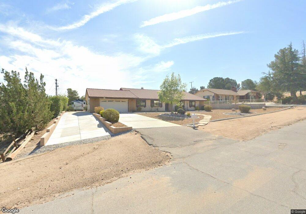
17850 Folsom Ct Hesperia, CA 92345
The Mesa NeighborhoodEstimated Value: $484,000 - $577,000
4
Beds
3
Baths
2,068
Sq Ft
$250/Sq Ft
Est. Value
About This Home
This home is located at 17850 Folsom Ct, Hesperia, CA 92345 and is currently estimated at $517,267, approximately $250 per square foot. 17850 Folsom Ct is a home located in San Bernardino County with nearby schools including Lime Street Elementary School, Ranchero Middle School, and Sultana High School.
Ownership History
Date
Name
Owned For
Owner Type
Purchase Details
Closed on
Oct 14, 2011
Sold by
Thomas Gary
Bought by
Thomas Gary and Thomas Vicki
Current Estimated Value
Purchase Details
Closed on
Jul 11, 1995
Sold by
Rice Samuel H
Bought by
Thomas Gary and Thomas Vicki
Home Financials for this Owner
Home Financials are based on the most recent Mortgage that was taken out on this home.
Original Mortgage
$105,360
Interest Rate
7.5%
Purchase Details
Closed on
Jan 28, 1994
Sold by
Rice Samuel H
Bought by
Rice Samuel H and Rice Catherine H
Create a Home Valuation Report for This Property
The Home Valuation Report is an in-depth analysis detailing your home's value as well as a comparison with similar homes in the area
Home Values in the Area
Average Home Value in this Area
Purchase History
| Date | Buyer | Sale Price | Title Company |
|---|---|---|---|
| Thomas Gary | -- | None Available | |
| Thomas Gary | -- | None Available | |
| Thomas Gary | $132,000 | First American Title Ins Co | |
| Rice Samuel H | -- | -- | |
| Rice Samuel H | -- | -- |
Source: Public Records
Mortgage History
| Date | Status | Borrower | Loan Amount |
|---|---|---|---|
| Closed | Thomas Gary | $105,360 |
Source: Public Records
Tax History Compared to Growth
Tax History
| Year | Tax Paid | Tax Assessment Tax Assessment Total Assessment is a certain percentage of the fair market value that is determined by local assessors to be the total taxable value of land and additions on the property. | Land | Improvement |
|---|---|---|---|---|
| 2025 | $2,348 | $218,788 | $52,665 | $166,123 |
| 2024 | $2,348 | $214,498 | $51,632 | $162,866 |
| 2023 | $2,321 | $210,293 | $50,620 | $159,673 |
| 2022 | $2,266 | $206,169 | $49,627 | $156,542 |
| 2021 | $2,224 | $202,127 | $48,654 | $153,473 |
| 2020 | $2,197 | $200,054 | $48,155 | $151,899 |
| 2019 | $2,151 | $196,132 | $47,211 | $148,921 |
| 2018 | $2,109 | $192,286 | $46,285 | $146,001 |
| 2017 | $2,070 | $188,515 | $45,377 | $143,138 |
| 2016 | $2,025 | $184,818 | $44,487 | $140,331 |
| 2015 | -- | $182,042 | $43,819 | $138,223 |
| 2014 | $1,970 | $178,476 | $42,961 | $135,515 |
Source: Public Records
Map
Nearby Homes
- 17788 Buckthorn Ave
- 18016 Westlawn St
- 8871 Avocado Ave
- 18124 Westlawn St
- 17601 Bangor Ave
- 17550 Buckthorn Ave
- 8926 Avocado Ave
- 17539 Adobe St
- 8951 Grapefruit Ave
- 8925 Buckthorn Ave
- 17520 Aspen St
- 8960 Buckthorn Ave
- 18146 Orange St
- 18169 Danbury Ave
- 8167 Windsor Ave
- 18236 Danbury Ave
- 18221 Orange St
- 8150 Minstead Ave
- 18303 Westlawn St
- 8937 Sumac Ave
- 17842 Folsom Ct
- 17886 Bangor Ave
- 17818 Folsom Ct
- 17820 Bangor Ave
- 17898 Bangor Ave
- 17834 Folsom Ct
- 17851 Bangor Ave
- 17867 Bangor Ave
- 17831 Bangor Ave
- 17881 Bangor Ave
- 8573 Pico Ave
- 8591 Pico Ave
- 8607 Pico Ave
- 17899 Bangor Ave
- 17789 Bangor Ave
- 17850 Hinton St
- 17911 Bangor Ave
- 17906 Hinton St
- 17771 Bangor Ave
- 17822 Hinton St