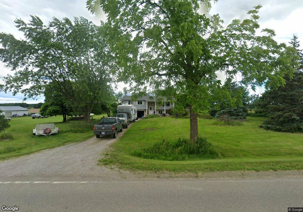
1787 Carland Rd Owosso, MI 48867
Estimated Value: $188,000 - $230,505
3
Beds
2
Baths
1,858
Sq Ft
$115/Sq Ft
Est. Value
About This Home
This home is located at 1787 Carland Rd, Owosso, MI 48867 and is currently estimated at $213,126, approximately $114 per square foot. 1787 Carland Rd is a home located in Shiawassee County with nearby schools including Leonard Elementary School, E.E. Knight Elementary School, and Ovid-Elsie Middle School.
Ownership History
Date
Name
Owned For
Owner Type
Purchase Details
Closed on
Feb 25, 2015
Sold by
Federal Natl Mtg Assn Fnma
Bought by
Abuja-Burns Teresa and Abuja-Burns Garza
Current Estimated Value
Home Financials for this Owner
Home Financials are based on the most recent Mortgage that was taken out on this home.
Original Mortgage
$91,413
Outstanding Balance
$69,806
Interest Rate
3.6%
Mortgage Type
FHA
Estimated Equity
$143,320
Purchase Details
Closed on
Feb 22, 2013
Sold by
Wells Fargo Bank Na
Bought by
Fannie Mae
Purchase Details
Closed on
Feb 20, 2013
Sold by
Duffield Christie
Bought by
Wells Fargo Bank Na
Purchase Details
Closed on
Nov 4, 2004
Sold by
Wieber Martin R and Wieber Merijo
Bought by
Mulder Thomas D and Mulder Joelle M
Home Financials for this Owner
Home Financials are based on the most recent Mortgage that was taken out on this home.
Original Mortgage
$104,550
Interest Rate
5.8%
Mortgage Type
Purchase Money Mortgage
Create a Home Valuation Report for This Property
The Home Valuation Report is an in-depth analysis detailing your home's value as well as a comparison with similar homes in the area
Home Values in the Area
Average Home Value in this Area
Purchase History
| Date | Buyer | Sale Price | Title Company |
|---|---|---|---|
| Abuja-Burns Teresa | $93,100 | Ask Svcs Inc | |
| Fannie Mae | -- | -- | |
| Wells Fargo Bank Na | $98,615 | -- | |
| Mulder Thomas D | $123,000 | Fatic |
Source: Public Records
Mortgage History
| Date | Status | Borrower | Loan Amount |
|---|---|---|---|
| Open | Abuja-Burns Teresa | $91,413 | |
| Previous Owner | Mulder Thomas D | $104,550 |
Source: Public Records
Tax History Compared to Growth
Tax History
| Year | Tax Paid | Tax Assessment Tax Assessment Total Assessment is a certain percentage of the fair market value that is determined by local assessors to be the total taxable value of land and additions on the property. | Land | Improvement |
|---|---|---|---|---|
| 2025 | $2,161 | $95,400 | $0 | $0 |
| 2024 | $2,064 | $89,100 | $0 | $0 |
| 2023 | $742 | $78,900 | $0 | $0 |
| 2022 | $707 | $72,800 | $0 | $0 |
| 2021 | $1,925 | $68,900 | $0 | $0 |
| 2020 | $1,905 | $68,500 | $0 | $0 |
| 2019 | $1,867 | $56,300 | $0 | $0 |
| 2018 | $1,809 | $54,900 | $0 | $0 |
| 2017 | $1,763 | $55,400 | $0 | $0 |
| 2016 | -- | $55,400 | $0 | $0 |
| 2015 | -- | $57,100 | $0 | $0 |
| 2014 | $7 | $54,000 | $0 | $0 |
Source: Public Records
Map
Nearby Homes
- 4600 W M 21
- 9992 Middleton Rd
- 9077 W M 21
- 247 E 1st St
- 1279 Leland Rd
- 326 E Clinton St
- 113 E High St
- 222 N Main St
- 129 W Pearl St
- 117 South St
- 228 W Pearl St
- 613 S Main St
- 9150 Woodworth Rd
- 8481 Walker Rd
- 2305 W Juddville Rd
- 4321 N Upton Rd
- 2930 S Ruess Rd
- 3525 S Hollister Rd
- 3575 S Hollister Rd
- 208 Wight St
- 1787 Carland Rd
- 1787 Carland Rd
- 1787 Carland Rd
- 1787 Carland Rd
- 1787 Carland Rd
- 1745 Carland Rd
- N. of 2211 Carland Rd
- 1901 Carland Rd
- 1902 Carland Rd
- 1994 Carland Rd
- 1477 Carland Rd
- 1355 Carland Rd
- 2140 Carland Rd
- 1450 Carland Rd
- 7450 W Wilkinson Rd
- 1635 Fenner Rd
- 2211 Carland Rd
- 1801 Fenner Rd
- VL Carland Rd
- 1787 Fenner Rd