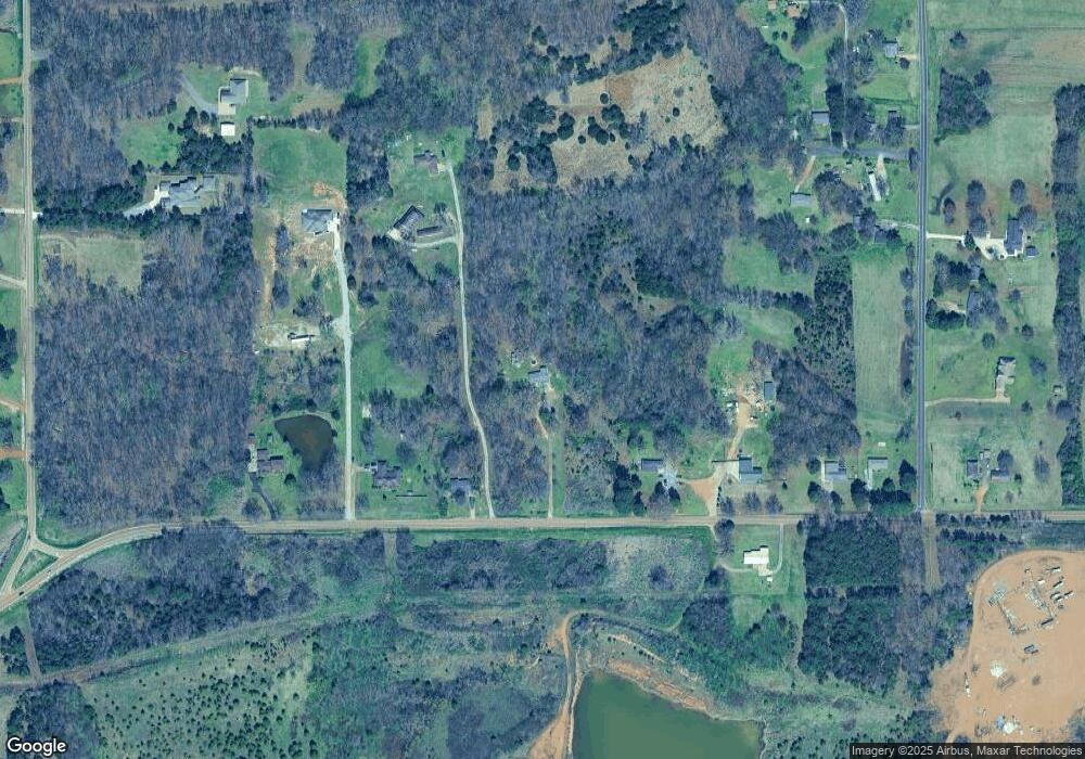
1788 Pleasant Hill Rd Nesbit, MS 38651
Pleasant Hill NeighborhoodEstimated Value: $175,000 - $296,000
2
Beds
1
Bath
1,010
Sq Ft
$235/Sq Ft
Est. Value
About This Home
This home is located at 1788 Pleasant Hill Rd, Nesbit, MS 38651 and is currently estimated at $237,060, approximately $234 per square foot. 1788 Pleasant Hill Rd is a home located in DeSoto County with nearby schools including DeSoto Central Primary School, DeSoto Central Elementary School, and DeSoto Central Middle School.
Ownership History
Date
Name
Owned For
Owner Type
Purchase Details
Closed on
Oct 15, 2025
Sold by
Yates Robert Louis and Yates Denise Dill
Bought by
Rodriguez Marco Antonio Cruz and Luz Godinez Lopez Marbey
Current Estimated Value
Home Financials for this Owner
Home Financials are based on the most recent Mortgage that was taken out on this home.
Original Mortgage
$120,000
Outstanding Balance
$110,867
Interest Rate
6.5%
Mortgage Type
New Conventional
Estimated Equity
$126,193
Purchase Details
Closed on
Sep 7, 2011
Sold by
Bank Of America Na
Bought by
Secretary Of Housing & Urban Development
Purchase Details
Closed on
Feb 14, 2011
Sold by
Secretary Department Of Housing & Urban
Bought by
Bac Home Loans Servicing Lp
Purchase Details
Closed on
Jun 8, 2010
Sold by
Bac Home Loans Servicing Lp
Bought by
Secretary Of Housing & Urban Development
Create a Home Valuation Report for This Property
The Home Valuation Report is an in-depth analysis detailing your home's value as well as a comparison with similar homes in the area
Home Values in the Area
Average Home Value in this Area
Purchase History
| Date | Buyer | Sale Price | Title Company |
|---|---|---|---|
| Rodriguez Marco Antonio Cruz | -- | Guardian Title | |
| Secretary Of Housing & Urban Development | -- | None Available | |
| Bac Home Loans Servicing Lp | -- | None Available | |
| Secretary Of Housing & Urban Development | -- | None Available | |
| Bac Home Loans Servicing Lp | $174,119 | None Available |
Source: Public Records
Mortgage History
| Date | Status | Borrower | Loan Amount |
|---|---|---|---|
| Open | Rodriguez Marco Antonio Cruz | $120,000 | |
| Closed | Rodriguez Marco Antonio Cruz | $120,000 |
Source: Public Records
Tax History
| Year | Tax Paid | Tax Assessment Tax Assessment Total Assessment is a certain percentage of the fair market value that is determined by local assessors to be the total taxable value of land and additions on the property. | Land | Improvement |
|---|---|---|---|---|
| 2025 | $874 | $10,468 | $2,500 | $7,968 |
| 2024 | $805 | $7,975 | $2,500 | $5,475 |
| 2023 | $805 | $7,975 | $0 | $0 |
| 2022 | $805 | $7,975 | $2,500 | $5,475 |
| 2021 | $805 | $7,975 | $2,500 | $5,475 |
| 2020 | $761 | $7,537 | $2,500 | $5,037 |
| 2019 | $761 | $7,537 | $2,500 | $5,037 |
| 2017 | $744 | $12,126 | $7,313 | $4,813 |
| 2016 | $744 | $7,313 | $2,500 | $4,813 |
| 2015 | $744 | $12,126 | $7,313 | $4,813 |
| 2014 | $736 | $7,313 | $0 | $0 |
| 2013 | $733 | $7,313 | $0 | $0 |
Source: Public Records
Map
Nearby Homes
- 002 Baptist Rd
- 2154 Laughter Rd N
- 2768 Black Rock Rd
- 2830 Manning Cir S
- 2147 Chancellor Cove
- 1623 Imboden Cove
- 5252 Watson View Dr
- 5185 Watson View Dr
- 1777 Starlanding Rd E
- 2948 Grove Meadow Dr
- 970 Coahoma Ct
- 1287 Dogwood Hollow Dr
- 940 Coahoma Ct
- 4789 Bakers Trail E
- 3390 Hatton Dr
- 654 Tallahatchie St
- 928 Coahoma Ct
- 838 Quitman Ct W
- 636 Tallahatchie St
- 828 Quitman Ct W
- 1736 Pleasant Hill Rd
- 1858 Pleasant Hill Rd
- 1676 Pleasant Hill Rd
- 1750 Pleasant Hill Rd
- 1878 Pleasant Hill Rd
- 1660 Pleasant Hill Rd
- 1654 Pleasant Hill Rd
- 1885 Pleasant Hill Rd
- 1650 Pleasant Hill Rd
- 1950 Pleasant Hill Rd
- 1921 Lenton Rd
- 1892 Pleasant Hill Rd
- 1695 Tchulahoma Rd
- 1920 Lenton Rd
- 1772 Baptist Rd
- 1740 Baptist Rd
- 1789 Tchulahoma Rd
- 1860 Baptist Rd
- 1690 Tchulahoma Rd
- 1831 Tchulahoma Rd
Your Personal Tour Guide
Ask me questions while you tour the home.
