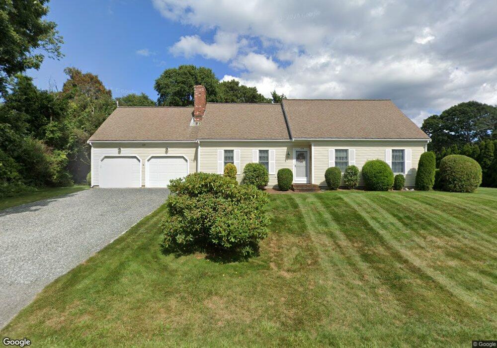
179 Ambergris Cir Brewster, MA 02631
Estimated Value: $1,389,000 - $1,683,000
4
Beds
3
Baths
1,996
Sq Ft
$755/Sq Ft
Est. Value
About This Home
This home is located at 179 Ambergris Cir, Brewster, MA 02631 and is currently estimated at $1,507,330, approximately $755 per square foot. 179 Ambergris Cir is a home located in Barnstable County with nearby schools including Stony Brook Elementary School, Eddy Elementary School, and Nauset Regional Middle School.
Ownership History
Date
Name
Owned For
Owner Type
Purchase Details
Closed on
Oct 14, 2011
Sold by
Bernard R Danti 1993 R
Bought by
Hissey David W and Hissey Rebecca A
Current Estimated Value
Home Financials for this Owner
Home Financials are based on the most recent Mortgage that was taken out on this home.
Original Mortgage
$417,000
Outstanding Balance
$286,459
Interest Rate
4.25%
Mortgage Type
Purchase Money Mortgage
Estimated Equity
$1,220,871
Purchase Details
Closed on
Oct 16, 2009
Sold by
Danti Nt
Bought by
Constance M Danti Ret
Home Financials for this Owner
Home Financials are based on the most recent Mortgage that was taken out on this home.
Original Mortgage
$938,250
Interest Rate
5.14%
Mortgage Type
Reverse Mortgage Home Equity Conversion Mortgage
Purchase Details
Closed on
Mar 25, 1997
Sold by
Mirtle Roderick G
Bought by
Danti Bernard R and Danti Constance M
Create a Home Valuation Report for This Property
The Home Valuation Report is an in-depth analysis detailing your home's value as well as a comparison with similar homes in the area
Home Values in the Area
Average Home Value in this Area
Purchase History
| Date | Buyer | Sale Price | Title Company |
|---|---|---|---|
| Hissey David W | $740,000 | -- | |
| Constance M Danti Ret | -- | -- | |
| Danti Bernard R | $101,000 | -- |
Source: Public Records
Mortgage History
| Date | Status | Borrower | Loan Amount |
|---|---|---|---|
| Open | Hissey David W | $417,000 | |
| Previous Owner | Constance M Danti Ret | $938,250 |
Source: Public Records
Tax History Compared to Growth
Tax History
| Year | Tax Paid | Tax Assessment Tax Assessment Total Assessment is a certain percentage of the fair market value that is determined by local assessors to be the total taxable value of land and additions on the property. | Land | Improvement |
|---|---|---|---|---|
| 2025 | $8,983 | $1,305,600 | $753,100 | $552,500 |
| 2024 | $8,391 | $1,232,200 | $710,500 | $521,700 |
| 2023 | $6,847 | $979,600 | $507,400 | $472,200 |
| 2022 | $6,420 | $817,800 | $422,700 | $395,100 |
| 2021 | $6,146 | $716,300 | $367,500 | $348,800 |
| 2020 | $6,033 | $699,900 | $367,500 | $332,400 |
| 2019 | $5,804 | $676,500 | $353,500 | $323,000 |
| 2018 | $1,916 | $689,400 | $378,700 | $310,700 |
| 2017 | $6,173 | $735,800 | $441,800 | $294,000 |
| 2016 | $5,979 | $709,200 | $433,300 | $275,900 |
| 2015 | $5,758 | $697,100 | $424,700 | $272,400 |
Source: Public Records
Map
Nearby Homes
- 26 Bluefish Ln
- 49 Ambergris Cir
- 59 Ambergris Cir
- 0 Ambergris Cir
- 27 Sand Bar Ln
- 182 Ambergris Cir
- 201 Ambergris Cir
- 170 Ambergris Cir
- 27 Bluefish Ln
- 190 Ambergris Cir
- 18 Bluefish Ln
- 164 Ambergris Cir
- 17 Sand Bar Ln
- 17 Bluefish Ln
- 200 Ambergris Cir
- 223 Ambergris Cir
- 40 Sand Bar Ln
- 28 Sand Bar Ln
- 154 Ambergris Cir
- 25 Ambergris Cir