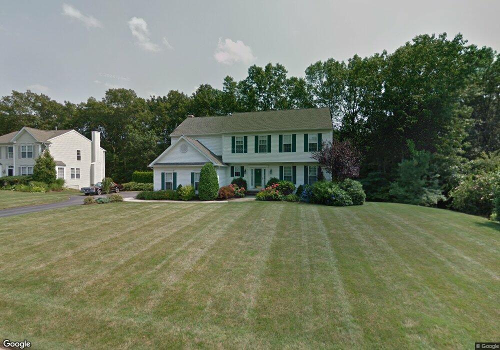
179 Castle Rocks Rd Warwick, RI 02886
Cowesett NeighborhoodEstimated Value: $778,485 - $896,000
4
Beds
3
Baths
2,502
Sq Ft
$343/Sq Ft
Est. Value
About This Home
This home is located at 179 Castle Rocks Rd, Warwick, RI 02886 and is currently estimated at $857,621, approximately $342 per square foot. 179 Castle Rocks Rd is a home located in Kent County with nearby schools including Our Lady of Mercy School.
Ownership History
Date
Name
Owned For
Owner Type
Purchase Details
Closed on
Jan 14, 2000
Sold by
Pulte Home Corp Ne
Bought by
Granata Joseph G and Granate Joanne
Current Estimated Value
Create a Home Valuation Report for This Property
The Home Valuation Report is an in-depth analysis detailing your home's value as well as a comparison with similar homes in the area
Home Values in the Area
Average Home Value in this Area
Purchase History
| Date | Buyer | Sale Price | Title Company |
|---|---|---|---|
| Granata Joseph G | $255,500 | -- |
Source: Public Records
Mortgage History
| Date | Status | Borrower | Loan Amount |
|---|---|---|---|
| Closed | Granata Joseph G | $170,000 | |
| Closed | Granata Joseph G | $60,000 | |
| Closed | Granata Joseph G | $235,000 | |
| Closed | Granata Joseph G | $196,000 |
Source: Public Records
Tax History
| Year | Tax Paid | Tax Assessment Tax Assessment Total Assessment is a certain percentage of the fair market value that is determined by local assessors to be the total taxable value of land and additions on the property. | Land | Improvement |
|---|---|---|---|---|
| 2025 | $8,158 | $642,400 | $155,700 | $486,700 |
| 2024 | $8,304 | $573,900 | $135,400 | $438,500 |
| 2023 | $8,144 | $573,900 | $135,400 | $438,500 |
| 2022 | $8,221 | $438,900 | $98,400 | $340,500 |
| 2021 | $8,221 | $438,900 | $98,400 | $340,500 |
| 2020 | $8,221 | $438,900 | $98,400 | $340,500 |
| 2019 | $8,221 | $438,900 | $98,400 | $340,500 |
| 2018 | $8,081 | $388,500 | $98,400 | $290,100 |
| 2017 | $7,863 | $388,500 | $98,400 | $290,100 |
| 2016 | $7,853 | $388,000 | $98,400 | $289,600 |
| 2015 | $8,076 | $389,200 | $101,500 | $287,700 |
| 2014 | $7,807 | $389,200 | $101,500 | $287,700 |
| 2013 | $7,702 | $389,200 | $101,500 | $287,700 |
Source: Public Records
Map
Nearby Homes
- 486 Greenbush Rd
- 442 Sleepy Hollow Farm Rd
- 510 Greenbush Rd
- 520 Greenbush Rd
- 181 Heritage Dr
- 33 Eagle Run
- 146 Edmond Dr
- 2 Eagle Run
- 10 Arrowhead Way
- 39 Ledge Rd
- 24 Hyland Ave
- 0 Spencer Ave
- 28 Hill Top Dr
- 0 Cedar St
- 52 Bruce Ln
- 246 Spencer Woods Dr
- 155 Birkshire Dr
- 752 Quaker Ln Unit A-210
- 88 Greene St
- 123 Cowesett Rd
- 187 Castle Rocks Rd
- 167 Castle Rocks Rd
- 235 Gilbert Stuart Dr
- 197 Castle Rocks Rd
- 188 Castle Rocks Rd
- 172 Castle Rocks Rd
- 255 Gilbert Stuart Dr
- 155 Castle Rocks Rd
- 221 Gilbert Stuart Dr
- 208 Castle Rocks Rd
- 205 Castle Rocks Rd
- 160 Castle Rocks Rd
- 141 Castle Rocks Rd
- 150 Castle Rocks Rd
- 1 Valleybrook Dr
- 214 Gilbert Stuart Dr
- 275 Gilbert Stuart Dr
- 217 Castle Rocks Rd
- 224 Castle Rocks Rd
- 132 Castle Rocks Rd
Your Personal Tour Guide
Ask me questions while you tour the home.