Estimated Value: $339,912 - $404,000
Studio
2
Baths
2,365
Sq Ft
$157/Sq Ft
Est. Value
About This Home
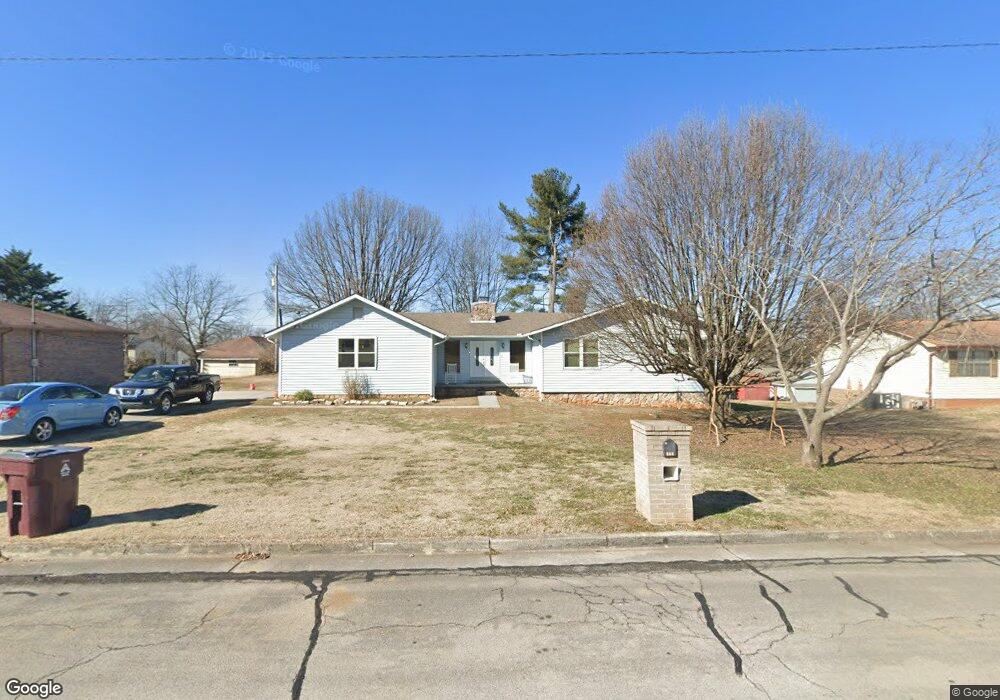
This home is located at 179 E Howe St, Alcoa, TN 37701 and is currently estimated at $370,478, approximately $156 per square foot. 179 E Howe St is a home located in Blount County with nearby schools including Alcoa Elementary School, Alcoa Middle School, and Alcoa High School.
Ownership History
Date
Name
Owned For
Owner Type
Purchase Details
Closed on
Apr 2, 2002
Sold by
Robinson Rosalind
Bought by
Allen Robert
Current Estimated Value
Home Financials for this Owner
Home Financials are based on the most recent Mortgage that was taken out on this home.
Original Mortgage
$71,900
Interest Rate
6.8%
Purchase Details
Closed on
Jan 1, 1984
Bought by
Richardson Audrey J
Create a Home Valuation Report for This Property
The Home Valuation Report is an in-depth analysis detailing your home's value as well as a comparison with similar homes in the area
Home Values in the Area
Average Home Value in this Area
Purchase History
| Date | Buyer | Sale Price | Title Company |
|---|---|---|---|
| Allen Robert | $89,900 | -- | |
| Richardson Audrey J | $2,000 | -- |
Source: Public Records
Mortgage History
| Date | Status | Borrower | Loan Amount |
|---|---|---|---|
| Closed | Richardson Audrey J | $71,900 |
Source: Public Records
Tax History
| Year | Tax Paid | Tax Assessment Tax Assessment Total Assessment is a certain percentage of the fair market value that is determined by local assessors to be the total taxable value of land and additions on the property. | Land | Improvement |
|---|---|---|---|---|
| 2025 | -- | $74,175 | $11,250 | $62,925 |
| 2024 | -- | $74,175 | $11,250 | $62,925 |
| 2023 | $2,433 | $74,175 | $11,250 | $62,925 |
| 2022 | $1,909 | $40,275 | $7,125 | $33,150 |
| 2021 | $1,909 | $40,275 | $7,125 | $33,150 |
| 2020 | $1,909 | $40,275 | $7,125 | $33,150 |
| 2019 | $1,909 | $40,275 | $7,125 | $33,150 |
| 2018 | $1,417 | $32,000 | $4,175 | $27,825 |
| 2017 | $1,417 | $32,000 | $4,175 | $27,825 |
| 2016 | $1,417 | $32,000 | $4,175 | $27,825 |
| 2015 | $1,315 | $32,000 | $4,175 | $27,825 |
| 2014 | $1,338 | $32,000 | $4,175 | $27,825 |
| 2013 | $1,338 | $32,575 | $0 | $0 |
Source: Public Records
Map
Nearby Homes
- 254 W Newcomen St
- 1538 Tsuga Dr
- 1321 Nobel St Unit E
- 0 N Wright Rd
- 1240 N Wright Rd
- 1413 Perkins St
- 1362 Dalton St
- 602 Mcginley St
- 1418 Mountain Quail Cir
- 304 W Lincoln Rd
- 1330 Mountain Quail Cir
- 1310 Madison Ave
- 104 Roosevelt St
- 1631 Springbrook Rd
- 922 Poplar St
- 507 Rule St
- 504 Mcginley St
- 1450 Dalton St
- 1826 Peppertree Dr
- 207 Andy Carr Ave
- 167 E Howe St
- 191 E Howe St
- 176 E Edison St
- 168 E Edison St
- 164 E Edison St
- 182 E Edison St
- 158 E Edison St
- 206 E Edison St
- 152 E Edison St
- 212 E Edison St
- 175 E Edison St
- 167 E Edison St
- 218 E Edison St
- 163 E Edison St
- 181 E Edison St
- 157 E Edison St
- 205 E Edison St
- 227 E Howe St
- 222 E Edison St
- 151 E Edison St
Your Personal Tour Guide
Ask me questions while you tour the home.