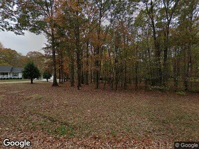
179 Hollingsworth Cove Rd Monteagle, TN 37356
Estimated Value: $175,951 - $271,000
--
Bed
1
Bath
690
Sq Ft
$317/Sq Ft
Est. Value
About This Home
This home is located at 179 Hollingsworth Cove Rd, Monteagle, TN 37356 and is currently estimated at $218,738, approximately $317 per square foot. 179 Hollingsworth Cove Rd is a home located in Grundy County.
Ownership History
Date
Name
Owned For
Owner Type
Purchase Details
Closed on
Mar 17, 2000
Sold by
Ripley Robert L
Bought by
Pilkington Scott and Pilkington Ernesti
Current Estimated Value
Purchase Details
Closed on
Jun 18, 1993
Bought by
Ripley Robert L
Purchase Details
Closed on
Jun 19, 1990
Bought by
Mccolman Carl Daniel
Purchase Details
Closed on
Apr 18, 1986
Bought by
Hollis Myrl
Create a Home Valuation Report for This Property
The Home Valuation Report is an in-depth analysis detailing your home's value as well as a comparison with similar homes in the area
Home Values in the Area
Average Home Value in this Area
Purchase History
| Date | Buyer | Sale Price | Title Company |
|---|---|---|---|
| Pilkington Scott | $35,000 | -- | |
| Ripley Robert L | $28,000 | -- | |
| Mccolman Carl Daniel | $30,500 | -- | |
| Hollis Myrl | $4,500 | -- |
Source: Public Records
Mortgage History
| Date | Status | Borrower | Loan Amount |
|---|---|---|---|
| Closed | Pilkington Ernestine | $100,000 |
Source: Public Records
Tax History Compared to Growth
Tax History
| Year | Tax Paid | Tax Assessment Tax Assessment Total Assessment is a certain percentage of the fair market value that is determined by local assessors to be the total taxable value of land and additions on the property. | Land | Improvement |
|---|---|---|---|---|
| 2024 | $431 | $30,200 | $5,800 | $24,400 |
| 2023 | $431 | $30,200 | $5,800 | $24,400 |
| 2022 | $407 | $18,375 | $3,800 | $14,575 |
| 2021 | $407 | $18,375 | $3,800 | $14,575 |
| 2020 | $407 | $18,375 | $3,800 | $14,575 |
| 2019 | $376 | $15,525 | $3,100 | $12,425 |
| 2018 | $376 | $14,800 | $3,100 | $11,700 |
| 2017 | $376 | $14,800 | $3,100 | $11,700 |
| 2016 | $376 | $14,800 | $3,100 | $11,700 |
| 2015 | $376 | $14,800 | $3,100 | $11,700 |
| 2014 | $376 | $14,813 | $0 | $0 |
Source: Public Records
Map
Nearby Homes
- 476 Deer Lick Trail
- 512 Deer Lick Trail
- 574 Deer Lick Trail
- 314 Deer Lick Trail
- 73 Twilight Point
- 75 Deer Lick Trail
- 70 Sunset Bluff Way
- 222 Sunset Bluff Way
- 5 Timberwood Trace
- 8 Holly Tree Ct
- 165 Sunset Bluff Way
- 177 Sunset Bluff Way
- 2271 Timberwood Trace
- 172 Littell Cir W
- 11845 Us 41
- 72 Woodly Branch Way
- 15 Summerfield Rd
- 0 Woodly Branch Rd Unit RTC2818461
- 0 Woodly Branch Rd Unit RTC2810742
- 506 Littell Cir W
- 179 Hollingsworth Cove Rd
- 159 Hollingsworth Cove Rd
- 225 Hollingsworth Cove Rd
- 232 Hollingsworth Cove Rd
- 115 Hollingsworth Cove Rd
- 174 Hollingsworth Cove Rd
- 230 Hollingsworth Cove Rd
- 61 Hollingsworth Cove Rd
- 435 Bud Pattie Rd
- 257 Summerfield Point Rd
- 255 Summerfield Point Rd
- 340 Bud Pattie Rd
- 388 Bud Pattie Rd
- 288 Bud Pattie Rd
- 370 Bud Pattie Rd
- 370 Bud Pattie Rd
- 159 Monteagle Falls Rd
- 4 Lot Bud Pattie Rd
- 232 Bud Pattie Rd
- 887 Summerfield Rd
