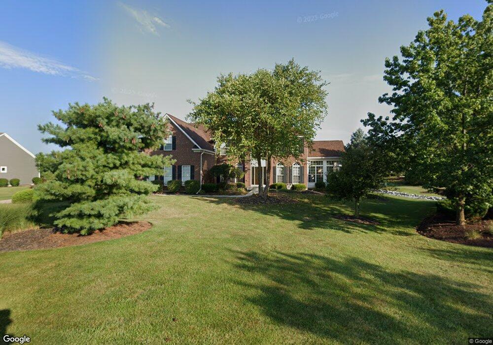
1792 Cedar Trace Dr Lebanon, OH 45036
Turtlecreek Township NeighborhoodEstimated Value: $698,008 - $837,000
4
Beds
4
Baths
5,265
Sq Ft
$143/Sq Ft
Est. Value
About This Home
This home is located at 1792 Cedar Trace Dr, Lebanon, OH 45036 and is currently estimated at $752,502, approximately $142 per square foot. 1792 Cedar Trace Dr is a home located in Warren County with nearby schools including Bowman Primary School, Berry Intermediate School, and Donovan Elementary School.
Ownership History
Date
Name
Owned For
Owner Type
Purchase Details
Closed on
Jun 15, 2009
Sold by
Yanzito Thomas A and Yanzito Martha R
Bought by
Ivanovich Lewis S and Ivanovich Betty A
Current Estimated Value
Home Financials for this Owner
Home Financials are based on the most recent Mortgage that was taken out on this home.
Original Mortgage
$180,000
Outstanding Balance
$114,216
Interest Rate
4.85%
Mortgage Type
Purchase Money Mortgage
Estimated Equity
$638,286
Purchase Details
Closed on
Aug 6, 2004
Sold by
Nvr Inc
Bought by
Yanzito Thomas A and Yanzito Martha R
Home Financials for this Owner
Home Financials are based on the most recent Mortgage that was taken out on this home.
Original Mortgage
$333,700
Interest Rate
5.25%
Mortgage Type
Purchase Money Mortgage
Create a Home Valuation Report for This Property
The Home Valuation Report is an in-depth analysis detailing your home's value as well as a comparison with similar homes in the area
Home Values in the Area
Average Home Value in this Area
Purchase History
| Date | Buyer | Sale Price | Title Company |
|---|---|---|---|
| Ivanovich Lewis S | $370,000 | Home Services Title | |
| Yanzito Thomas A | $484,900 | First Title Agency Inc | |
| Nvr Inc | $60,466 | First Title Agency Inc |
Source: Public Records
Mortgage History
| Date | Status | Borrower | Loan Amount |
|---|---|---|---|
| Open | Ivanovich Lewis S | $180,000 | |
| Previous Owner | Yanzito Thomas A | $333,700 |
Source: Public Records
Tax History Compared to Growth
Tax History
| Year | Tax Paid | Tax Assessment Tax Assessment Total Assessment is a certain percentage of the fair market value that is determined by local assessors to be the total taxable value of land and additions on the property. | Land | Improvement |
|---|---|---|---|---|
| 2024 | $8,253 | $207,490 | $42,000 | $165,490 |
| 2023 | $6,966 | $158,088 | $23,730 | $134,358 |
| 2022 | $6,882 | $158,088 | $23,730 | $134,358 |
| 2021 | $6,375 | $158,088 | $23,730 | $134,358 |
| 2020 | $6,744 | $139,353 | $21,000 | $118,353 |
| 2019 | $6,782 | $139,353 | $21,000 | $118,353 |
| 2018 | $6,114 | $139,353 | $21,000 | $118,353 |
| 2017 | $6,026 | $123,200 | $17,717 | $105,483 |
| 2016 | $6,230 | $123,200 | $17,717 | $105,483 |
| 2015 | $6,290 | $129,241 | $17,717 | $111,524 |
| 2014 | $6,426 | $120,790 | $16,560 | $104,230 |
| 2013 | $6,434 | $153,180 | $21,000 | $132,180 |
Source: Public Records
Map
Nearby Homes
- 2361 Wilmington Rd
- 1405 Stubbs Mill Rd
- 1538 Oregonia Rd
- 0 N Liberty Keuter Rd Unit 944632
- 0 N Liberty Keuter Rd Unit 1856762
- 941 Dillon Way
- B Nelson Ln
- 538 Lookout Ridge Dr
- 923 Greengate Dr
- 781 Shadow Wood Dr
- 938 Whispering Pine Way
- 0 Wilmington Rd Unit 1850287
- 0 Wilmington Rd Unit 940450
- 2696 Wilmington Rd
- 455 Lake Haven Ct
- 440 Lake Shore Dr
- 447 Lake Haven Ct
- 420 Lake Shore Dr
- 1836 Stubbs Mill Rd
- 2749 Jack Rd
- 1784 Cedar Trace Dr
- 1799 Rock Rose Ct
- 1783 Rock Rose Ct
- 1797 Cedar Trace Dr
- 1789 Cedar Trace Dr
- 1781 Cedar Trace Dr
- 1778 Cedar Trace Dr
- 1777 Rock Rose Ct
- 1773 Cedar Trace Dr
- 1790 Rock Rose Ct
- 630 Red Deer Dr
- 638 Red Deer Dr
- 482 S St Rt 123
- 1782 Rock Rose Ct
- 472 S State Route 123
- 1774 Rock Rose Ct
- 561 S State Route 123
- 1769 Cedar Trace Dr
- 1761 Cedar Trace Dr
- 435 S State Route 123