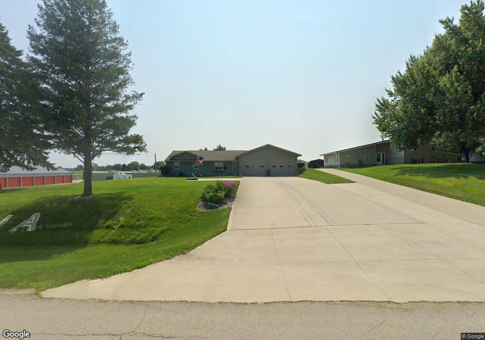
17939 Highway 64 Maquoketa, IA 52060
Estimated Value: $176,000 - $246,084
3
Beds
1
Bath
1,120
Sq Ft
$178/Sq Ft
Est. Value
About This Home
This home is located at 17939 Highway 64, Maquoketa, IA 52060 and is currently estimated at $199,521, approximately $178 per square foot. 17939 Highway 64 is a home located in Jackson County with nearby schools including Cardinal Elementary School, Briggs Elementary School, and Maquoketa Middle School.
Ownership History
Date
Name
Owned For
Owner Type
Purchase Details
Closed on
Apr 27, 2023
Sold by
Beck Steven D and Beck Luann
Bought by
Caven James S and Caven Kenneth L
Current Estimated Value
Purchase Details
Closed on
Oct 31, 2005
Sold by
Waite Don C and Waite Carolyn M
Bought by
Caven Jason R
Home Financials for this Owner
Home Financials are based on the most recent Mortgage that was taken out on this home.
Original Mortgage
$82,000
Interest Rate
5.98%
Mortgage Type
New Conventional
Create a Home Valuation Report for This Property
The Home Valuation Report is an in-depth analysis detailing your home's value as well as a comparison with similar homes in the area
Home Values in the Area
Average Home Value in this Area
Purchase History
| Date | Buyer | Sale Price | Title Company |
|---|---|---|---|
| Caven James S | -- | None Listed On Document | |
| Caven Jason R | $82,000 | None Available |
Source: Public Records
Mortgage History
| Date | Status | Borrower | Loan Amount |
|---|---|---|---|
| Previous Owner | Caven Jason R | $82,000 |
Source: Public Records
Tax History Compared to Growth
Tax History
| Year | Tax Paid | Tax Assessment Tax Assessment Total Assessment is a certain percentage of the fair market value that is determined by local assessors to be the total taxable value of land and additions on the property. | Land | Improvement |
|---|---|---|---|---|
| 2025 | $1,916 | $192,100 | $23,000 | $169,100 |
| 2024 | $1,916 | $174,300 | $23,000 | $151,300 |
| 2023 | $1,868 | $174,300 | $23,000 | $151,300 |
| 2022 | $1,696 | $138,500 | $23,000 | $115,500 |
| 2021 | $1,598 | $138,500 | $23,000 | $115,500 |
| 2020 | $1,598 | $126,300 | $23,000 | $103,300 |
| 2019 | $1,594 | $126,300 | $0 | $0 |
| 2018 | $1,524 | $125,600 | $0 | $0 |
| 2017 | $1,392 | $112,000 | $0 | $0 |
| 2016 | $1,362 | $112,000 | $0 | $0 |
| 2015 | $1,362 | $112,000 | $0 | $0 |
| 2014 | $1,444 | $112,000 | $0 | $0 |
Source: Public Records
Map
Nearby Homes
- 312 Rosemere Ln
- 401-435 Forest Dr
- 706 Myatt Dr Unit A & B
- 816 Vine St
- 210 S 2nd St
- 402 S 2nd St
- 318 N Main St
- 124 E Platt St
- 216 E Maple St
- 306 S Eliza St
- 108 W Monroe St
- 107 N Otto St
- 220 S Matteson St
- 412 E Pleasant St
- 208 S Clark St
- 20144 22nd St
- 109 N Dearborn St
- 708 E Platt St
- 0 Nairn Dr Unit 151992
- 510 Butternut St
- 17937 Highway 64
- 17897 Highway 64
- 17889 Highway 64
- 17958 Highway 64
- 17944 Highway 64
- 17924 Highway 64
- 17994 Highway 64
- 18035 Highway 64
- 17900 Highway 64
- 18028 Highway 64
- 17813 Highway 64
- 18095 Iowa 64
- 18032 Highway 64
- 18032 Hwy 64
- 18032 Highway 64
- 17811 Highway 64
- 18066 Iowa 64
- 18066 Highway 64
- 3613 173rd Ave
- 17999 43rd St