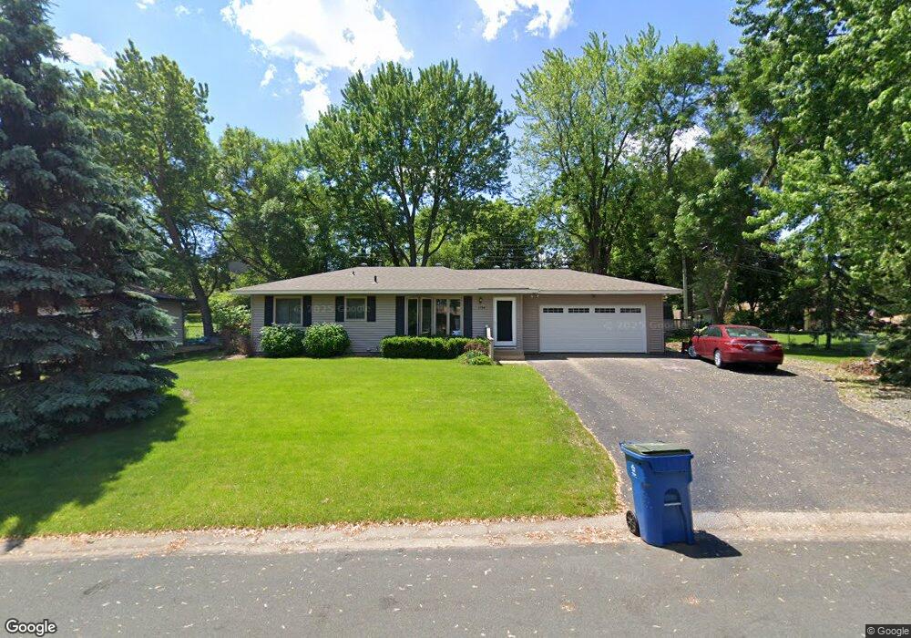
1794 E Bluestone Dr Saint Paul, MN 55122
Estimated Value: $338,623 - $412,000
3
Beds
2
Baths
912
Sq Ft
$404/Sq Ft
Est. Value
About This Home
This home is located at 1794 E Bluestone Dr, Saint Paul, MN 55122 and is currently estimated at $368,156, approximately $403 per square foot. 1794 E Bluestone Dr is a home located in Dakota County with nearby schools including Burnsville High School, Becks Montessori, and Sunrise International Montessori School.
Ownership History
Date
Name
Owned For
Owner Type
Purchase Details
Closed on
Jun 27, 2016
Sold by
Reynolds Richard Lee and Reynolds Elaine
Bought by
Lawrence Jessica L and Knutson Myles M
Current Estimated Value
Home Financials for this Owner
Home Financials are based on the most recent Mortgage that was taken out on this home.
Original Mortgage
$232,800
Outstanding Balance
$186,203
Interest Rate
3.64%
Mortgage Type
New Conventional
Estimated Equity
$181,953
Create a Home Valuation Report for This Property
The Home Valuation Report is an in-depth analysis detailing your home's value as well as a comparison with similar homes in the area
Home Values in the Area
Average Home Value in this Area
Purchase History
We collect this data history from publicly available records. To have your information removed, we recommend requesting removal directly through your county’s website.
| Date | Buyer | Sale Price | Title Company |
|---|---|---|---|
| Lawrence Jessica L | $240,000 | Burnet Title |
Source: Public Records
Mortgage History
We collect this data history from publicly available records. To have your information removed, we recommend requesting removal directly through your county’s website.
| Date | Status | Borrower | Loan Amount |
|---|---|---|---|
| Open | Lawrence Jessica L | $232,800 |
Source: Public Records
Tax History
| Year | Tax Paid | Tax Assessment Tax Assessment Total Assessment is a certain percentage of the fair market value that is determined by local assessors to be the total taxable value of land and additions on the property. | Land | Improvement |
|---|---|---|---|---|
| 2024 | $3,212 | $294,700 | $83,200 | $211,500 |
| 2023 | $3,212 | $295,500 | $83,500 | $212,000 |
| 2022 | $2,358 | $284,800 | $83,300 | $201,500 |
| 2021 | $2,326 | $246,800 | $72,400 | $174,400 |
| 2020 | $2,386 | $230,800 | $69,000 | $161,800 |
| 2019 | $2,347 | $227,600 | $65,700 | $161,900 |
| 2018 | $2,163 | $215,700 | $62,600 | $153,100 |
| 2017 | $2,070 | $193,300 | $59,600 | $133,700 |
| 2016 | $2,286 | $185,800 | $56,800 | $129,000 |
| 2015 | $2,166 | $160,704 | $50,264 | $110,440 |
| 2014 | -- | $155,799 | $48,561 | $107,238 |
| 2013 | -- | $130,620 | $42,494 | $88,126 |
Source: Public Records
Map
Nearby Homes
- 1778 Gabbro Trail
- 1768 Meadowlark Ct Unit 31768
- 4143 Meadowlark Point
- 4127 Meadowlark Point
- 1715 Talon Trail
- 4013 Meadowlark Curve
- 4125 Ruby Ln
- 1846 Southpointe Terrace
- 4126 Durham Ct Unit 136
- 1773 Serpentine Dr
- 1738 Palisade Cir
- 4134 Oakbrooke Trail
- 4110 Rahn Rd Unit 201
- 4110 Rahn Rd Unit 115
- 4110 Rahn Rd Unit 121
- 4110 Rahn Rd Unit 317
- 3865 Palisade Point
- 1958 Glenfield Ct Unit 25
- 4130 Rahn Rd Unit B119
- 4130 Rahn Rd Unit B206
- 1790 E Bluestone Dr
- 1798 E Bluestone Dr
- 1799 Carnelian Ln
- 1795 Carnelian Ln
- 1803 Carnelian Ln
- 1791 Carnelian Ln
- 1791 E Bluestone Dr
- 1786 E Bluestone Dr
- 1795 E Bluestone Dr
- 1802 E Bluestone Dr
- 1787 E Bluestone Dr
- 1807 Carnelian Ln
- 1799 E Bluestone Dr
- 1787 Carnelian Ln
- 1782 E Bluestone Dr
- 4048 Halite Ln
- 1806 E Bluestone Dr
- 1783 E Bluestone Dr
- 1803 E Bluestone Dr
- 1790 Taconite Trail
Your Personal Tour Guide
Ask me questions while you tour the home.