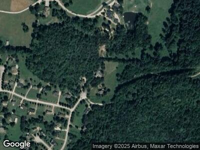
1799 Jameson Dr Franklin, TN 37064
Estimated Value: $946,000 - $1,263,151
--
Bed
5
Baths
3,525
Sq Ft
$317/Sq Ft
Est. Value
About This Home
This home is located at 1799 Jameson Dr, Franklin, TN 37064 and is currently estimated at $1,116,538, approximately $316 per square foot. 1799 Jameson Dr is a home located in Williamson County with nearby schools including Thompson's Station Middle School.
Ownership History
Date
Name
Owned For
Owner Type
Purchase Details
Closed on
Mar 14, 2019
Sold by
Mcpherson Randall K and Mcpherson Linda
Bought by
Mcpherson Randall K and Mcpherson Linda F
Current Estimated Value
Purchase Details
Closed on
Oct 16, 1998
Sold by
Denise Wiggins Dunbar Lance Harvey and Denise Tricia
Bought by
Mcpherson Randall K and Mcpherson Linda
Purchase Details
Closed on
Jul 5, 1996
Sold by
Rydin William
Bought by
Dunbar Lance Harvey
Create a Home Valuation Report for This Property
The Home Valuation Report is an in-depth analysis detailing your home's value as well as a comparison with similar homes in the area
Home Values in the Area
Average Home Value in this Area
Purchase History
| Date | Buyer | Sale Price | Title Company |
|---|---|---|---|
| Mcpherson Randall K | -- | None Available | |
| Mcpherson Randall K | $38,000 | -- | |
| Dunbar Lance Harvey | $30,000 | -- |
Source: Public Records
Mortgage History
| Date | Status | Borrower | Loan Amount |
|---|---|---|---|
| Closed | Mcpherson Randall K | $182,500 | |
| Closed | Mcpherson Randall K | $222,000 | |
| Closed | Mcpherson Linda F | $230,000 | |
| Closed | Mcpherson Randall K | $160,000 | |
| Open | Mcpherson Randall K | $390,000 |
Source: Public Records
Tax History Compared to Growth
Tax History
| Year | Tax Paid | Tax Assessment Tax Assessment Total Assessment is a certain percentage of the fair market value that is determined by local assessors to be the total taxable value of land and additions on the property. | Land | Improvement |
|---|---|---|---|---|
| 2024 | $2,899 | $154,225 | $42,000 | $112,225 |
| 2023 | $2,899 | $154,225 | $42,000 | $112,225 |
| 2022 | $2,899 | $154,225 | $42,000 | $112,225 |
| 2021 | $2,899 | $154,225 | $42,000 | $112,225 |
| 2020 | $2,682 | $120,825 | $20,000 | $100,825 |
| 2019 | $2,682 | $120,825 | $20,000 | $100,825 |
| 2018 | $2,598 | $120,825 | $20,000 | $100,825 |
| 2017 | $2,598 | $120,825 | $20,000 | $100,825 |
| 2016 | $0 | $120,825 | $20,000 | $100,825 |
| 2015 | -- | $100,750 | $16,250 | $84,500 |
| 2014 | -- | $100,750 | $16,250 | $84,500 |
Source: Public Records
Map
Nearby Homes
- 1621 Callie Way Dr
- 1633 Lewisburg Pike
- 1615 Lewisburg Pike
- 1726 Lewisburg Pike
- 5028 Rockport Ave
- 2060 Bushnell Farm Dr
- 4019 Mossy Rock Ln
- 102 Crystal Falls Cir
- 0 Pratt Ln
- 8001 Southvale Blvd
- 3548 Burgate Trail
- 4462 Harpeth School Rd
- 3549 Burgate Trail
- 3236 Knotts Dr
- 4500 Harpeth School Rd
- 3430 Burgate Trail
- 4520 Harpeth School Rd
- 3210 Long Branch Cir
- 1037 Southbrooke Blvd
- 4006 Forestside Dr
- 1799 Jameson Dr
- 1794 Jameson Dr
- 1795 Jameson Dr
- 1630 Callie Way Dr
- 1788 Jameson Dr
- 1624 Callie Way Dr
- 1780 Jameson Dr
- 1779 Jameson Dr
- 1620 Callie Way Dr
- 1629 Lewisburg Pike
- 1625 Callie Way Dr
- 1616 Callie Way Dr
- 1775 Jameson Dr
- 1771 Jameson Dr
- 1612 Callie Way Dr
- 1804 Susan Ct
- 1614 Stoddard Ct
- 1617 Callie Way Dr
- 1800 Susan Ct
- 1808 Susan Ct
