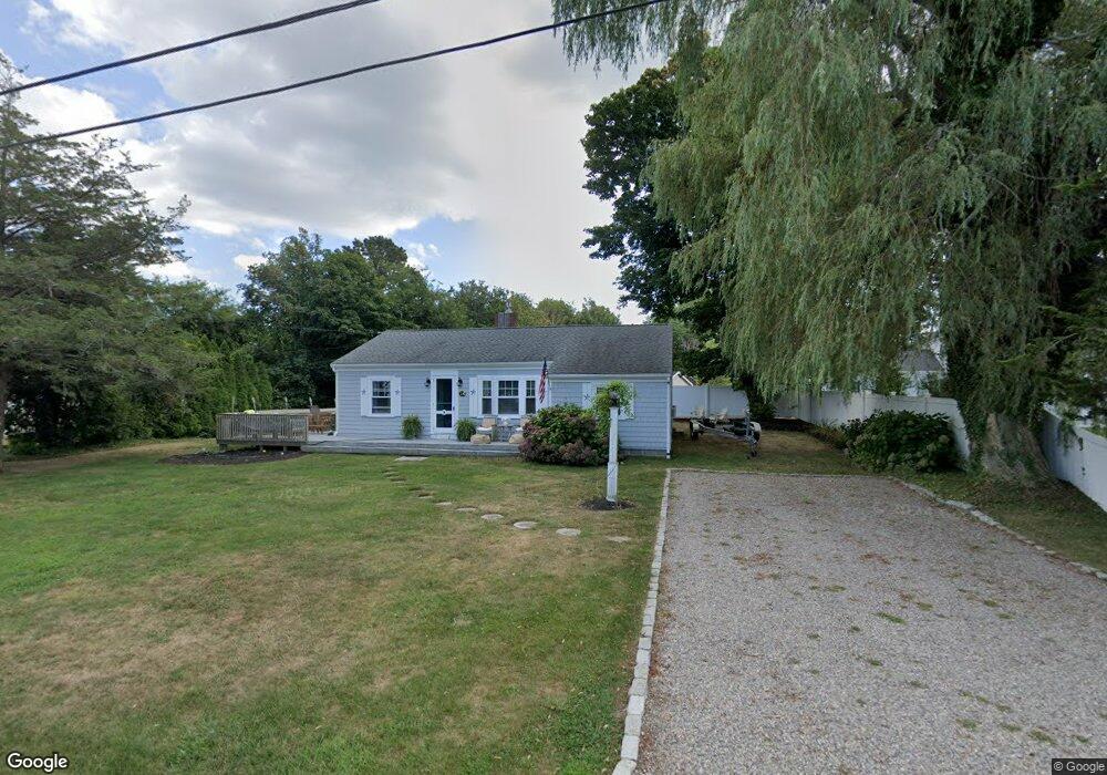
18 Hillcrest Dr Brewster, MA 02631
Estimated Value: $958,000 - $1,189,000
4
Beds
1
Bath
1,001
Sq Ft
$1,071/Sq Ft
Est. Value
About This Home
This home is located at 18 Hillcrest Dr, Brewster, MA 02631 and is currently estimated at $1,072,193, approximately $1,071 per square foot. 18 Hillcrest Dr is a home located in Barnstable County with nearby schools including Nauset Regional Middle School, Nauset Regional High School, and The Family School.
Ownership History
Date
Name
Owned For
Owner Type
Purchase Details
Closed on
Aug 16, 2010
Sold by
Mclaughlin Michael F and Mclaughlin Mary Jane
Bought by
Mclaughlin Michael F and Mclaughlin Mary Jane
Current Estimated Value
Home Financials for this Owner
Home Financials are based on the most recent Mortgage that was taken out on this home.
Original Mortgage
$250,000
Outstanding Balance
$166,025
Interest Rate
4.63%
Mortgage Type
Purchase Money Mortgage
Estimated Equity
$906,168
Purchase Details
Closed on
Mar 19, 2010
Sold by
Mclaughlin Michael F and Mclaughlin Mary Jane
Bought by
Mclaughlin Mary Jane and Mclaughlin Michael F
Purchase Details
Closed on
Mar 18, 1994
Sold by
Brandariz George R
Bought by
Citizens Bk Of Ma
Create a Home Valuation Report for This Property
The Home Valuation Report is an in-depth analysis detailing your home's value as well as a comparison with similar homes in the area
Home Values in the Area
Average Home Value in this Area
Purchase History
| Date | Buyer | Sale Price | Title Company |
|---|---|---|---|
| Mclaughlin Michael F | -- | -- | |
| Mclaughlin Mary Jane | -- | -- | |
| Citizens Bk Of Ma | $100,000 | -- |
Source: Public Records
Mortgage History
| Date | Status | Borrower | Loan Amount |
|---|---|---|---|
| Open | Mclaughlin Michael F | $250,000 | |
| Previous Owner | Citizens Bk Of Ma | $75,000 | |
| Previous Owner | Citizens Bk Of Ma | $143,000 |
Source: Public Records
Tax History Compared to Growth
Tax History
| Year | Tax Paid | Tax Assessment Tax Assessment Total Assessment is a certain percentage of the fair market value that is determined by local assessors to be the total taxable value of land and additions on the property. | Land | Improvement |
|---|---|---|---|---|
| 2025 | $6,395 | $929,500 | $701,100 | $228,400 |
| 2024 | $5,972 | $877,000 | $661,400 | $215,600 |
| 2023 | $5,202 | $744,200 | $548,300 | $195,900 |
| 2022 | $4,871 | $620,500 | $456,800 | $163,700 |
| 2021 | $4,652 | $542,200 | $397,100 | $145,100 |
| 2020 | $4,556 | $528,500 | $397,100 | $131,400 |
| 2019 | $1,521 | $508,800 | $381,900 | $126,900 |
| 2018 | $4,160 | $503,600 | $381,900 | $121,700 |
| 2017 | $4,104 | $489,200 | $381,900 | $107,300 |
| 2016 | $4,045 | $479,800 | $374,500 | $105,300 |
| 2015 | $3,895 | $471,500 | $367,100 | $104,400 |
Source: Public Records
Map
Nearby Homes
- 429 Paines Creek Rd
- 20 Spring Ln
- 21 Sea Meadow Ln
- 240 Robbins Hill Rd
- 1424 Main St
- 1580 Main St
- 309 Great Fields Rd
- 1861 Main St
- 0 Canoe Pond Dr
- 2019 Main St
- 597 Great Fields Rd
- 30 Fox Crossing Rd
- 120 Red Maple Rd
- 728 Great Fields Rd
- 88 Whiffletree Ave
- 92 Whiffletree Ave
- 11 Island Creek Ln
- 102 Wildwood Rd
- 55 Leona Terrace
- 55 Monument View Rd
- 6 Hillcrest Dr
- 28 Hillcrest Dr
- 416 Paines Creek Rd
- 7 Cedar Hill Rd
- 81 Captain Young Way
- 7 Hillcrest Dr
- 402 Paines Creek Rd
- 2 Cedar Hill Rd
- 427 Paines Creek Rd
- 429 Paine's Creek Rd Unit 429
- 38 Hillcrest Dr
- 435 Paines Creek Rd
- 19 Cedar Hill Rd
- 73 Captain Young Way
- 448 Paine's Creek Rd
- 448 Paines Creek Rd
- 415 Paines Creek Rd
- 439 Paines Creek Rd
- 14 Cedar Hill Rd
- 456 Paines Creek Rd