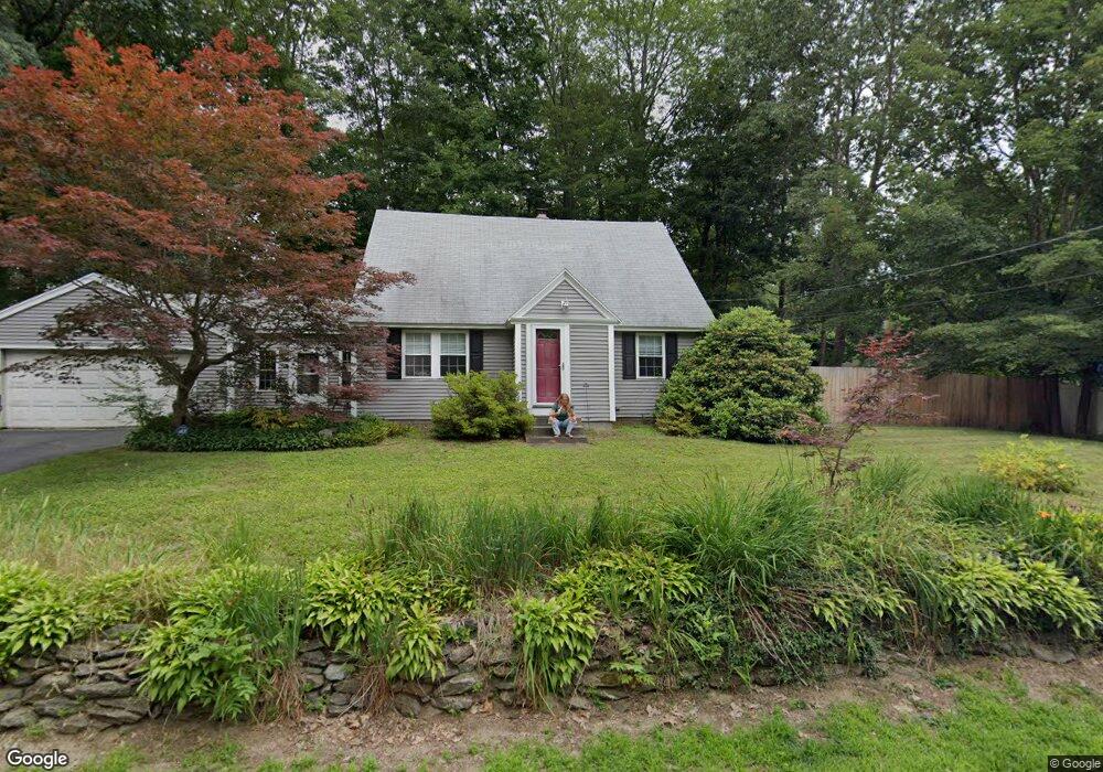
18 Maple Ave Hudson, NH 03051
Estimated Value: $469,000 - $524,545
3
Beds
2
Baths
1,600
Sq Ft
$315/Sq Ft
Est. Value
About This Home
This home is located at 18 Maple Ave, Hudson, NH 03051 and is currently estimated at $503,636, approximately $314 per square foot. 18 Maple Ave is a home located in Hillsborough County with nearby schools including White Wing School, St. Christopher Academy Lower Campus, and Clearway High School.
Ownership History
Date
Name
Owned For
Owner Type
Purchase Details
Closed on
Sep 5, 2007
Sold by
Knapp Beverly F and Knapp George R
Bought by
Stafford Thomas Brennan
Current Estimated Value
Home Financials for this Owner
Home Financials are based on the most recent Mortgage that was taken out on this home.
Original Mortgage
$270,697
Interest Rate
6.74%
Mortgage Type
Purchase Money Mortgage
Create a Home Valuation Report for This Property
The Home Valuation Report is an in-depth analysis detailing your home's value as well as a comparison with similar homes in the area
Home Values in the Area
Average Home Value in this Area
Purchase History
| Date | Buyer | Sale Price | Title Company |
|---|---|---|---|
| Stafford Thomas Brennan | $265,000 | -- |
Source: Public Records
Mortgage History
| Date | Status | Borrower | Loan Amount |
|---|---|---|---|
| Open | Stafford Thomas Brennan | $267,896 | |
| Closed | Stafford Thomas Brennan | $270,697 |
Source: Public Records
Tax History Compared to Growth
Tax History
| Year | Tax Paid | Tax Assessment Tax Assessment Total Assessment is a certain percentage of the fair market value that is determined by local assessors to be the total taxable value of land and additions on the property. | Land | Improvement |
|---|---|---|---|---|
| 2024 | $6,241 | $379,400 | $122,000 | $257,400 |
| 2023 | $5,949 | $379,400 | $122,000 | $257,400 |
| 2022 | $5,573 | $379,400 | $122,000 | $257,400 |
| 2021 | $5,652 | $260,800 | $84,300 | $176,500 |
| 2020 | $5,573 | $260,800 | $84,300 | $176,500 |
| 2019 | $5,289 | $260,800 | $84,300 | $176,500 |
| 2018 | $5,242 | $260,800 | $84,300 | $176,500 |
| 2017 | $5,143 | $260,800 | $84,300 | $176,500 |
| 2016 | $4,746 | $216,000 | $80,400 | $135,600 |
| 2015 | $4,590 | $216,000 | $80,400 | $135,600 |
| 2014 | $4,499 | $216,000 | $80,400 | $135,600 |
| 2013 | $4,441 | $216,000 | $80,400 | $135,600 |
Source: Public Records
Map
Nearby Homes
- 21 Library St
- 37 Library St
- 39 Library St
- 13 Riverside Dr
- 76 Gillis St
- 4 Chase St
- 10 Cedar St
- 73 Ferry St
- 13 Mulvanity St
- 35 B St Unit 5
- 65 Allds St
- 13 Sapphire Ln
- 19 King St Unit 87
- 4 Haines St Unit 56
- 15 Atherton Ave
- 18 Harbor Ave Unit 208
- 19 Atherton Ave
- 434 Abbott Farm Ln
- 213 Abbott Farm Ln
- 312 Abbott Farm Ln