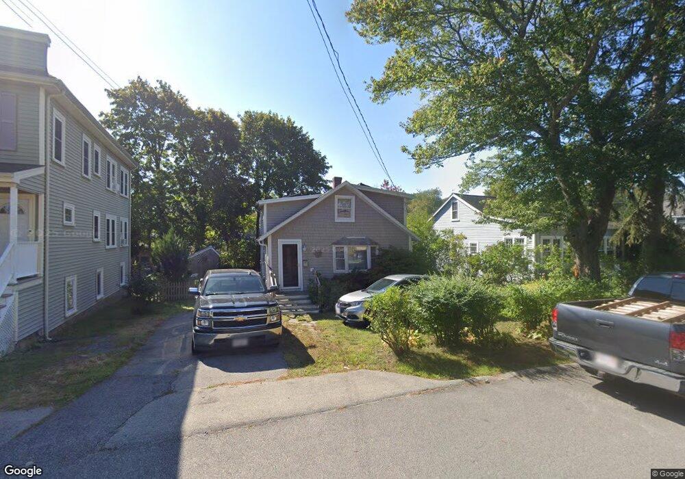
18 Maple Ave Unit 18 Scituate, MA 02066
Estimated Value: $566,710 - $675,000
3
Beds
1
Bath
1,001
Sq Ft
$632/Sq Ft
Est. Value
About This Home
This home is located at 18 Maple Ave Unit 18, Scituate, MA 02066 and is currently estimated at $632,178, approximately $631 per square foot. 18 Maple Ave Unit 18 is a home located in Plymouth County with nearby schools including Wampatuck Elementary School, Lester J. Gates Middle School, and Scituate High School.
Ownership History
Date
Name
Owned For
Owner Type
Purchase Details
Closed on
Oct 31, 2023
Sold by
Davidson Ft and Barton
Bought by
Sprunk Richard W and Sprunk Jane E
Current Estimated Value
Purchase Details
Closed on
Sep 30, 1998
Sold by
Miele Erin K and Miele Daniel V
Bought by
Walsh Christine R
Purchase Details
Closed on
May 22, 1997
Sold by
Koe Alex S and Koe Kristina M
Bought by
Miele Erin K and Miele Daniel V
Purchase Details
Closed on
Jun 20, 1994
Sold by
Affiliates Fairfield
Bought by
Koe Alex S and Koe Kristina M
Purchase Details
Closed on
Jun 10, 1994
Sold by
Veiga Esaura and Veiga Michael
Bought by
Affiliates Fairfield
Purchase Details
Closed on
Dec 7, 1993
Sold by
Veiga Esaura and Veiga Michael
Bought by
Affiliates Fairfield
Create a Home Valuation Report for This Property
The Home Valuation Report is an in-depth analysis detailing your home's value as well as a comparison with similar homes in the area
Home Values in the Area
Average Home Value in this Area
Purchase History
| Date | Buyer | Sale Price | Title Company |
|---|---|---|---|
| Sprunk Richard W | -- | None Available | |
| Walsh Christine R | $148,000 | -- | |
| Miele Erin K | $129,900 | -- | |
| Koe Alex S | $68,000 | -- | |
| Koe Alex S | $68,000 | -- | |
| Affiliates Fairfield | $73,500 | -- | |
| Fairfield Affiliates | $73,500 | -- | |
| Affiliates Fairfield | $67,900 | -- | |
| Fairfield Affiliates | $67,900 | -- |
Source: Public Records
Mortgage History
| Date | Status | Borrower | Loan Amount |
|---|---|---|---|
| Previous Owner | Fairfield Affiliates | $100,000 | |
| Previous Owner | Fairfield Affiliates | $68,000 |
Source: Public Records
Tax History
| Year | Tax Paid | Tax Assessment Tax Assessment Total Assessment is a certain percentage of the fair market value that is determined by local assessors to be the total taxable value of land and additions on the property. | Land | Improvement |
|---|---|---|---|---|
| 2025 | $4,996 | $500,100 | $386,700 | $113,400 |
| 2024 | $4,850 | $468,100 | $351,600 | $116,500 |
| 2023 | $4,508 | $427,900 | $319,600 | $108,300 |
| 2022 | $4,508 | $357,200 | $262,400 | $94,800 |
| 2021 | $4,264 | $319,900 | $237,400 | $82,500 |
| 2020 | $4,185 | $310,000 | $228,200 | $81,800 |
| 2019 | $4,174 | $303,800 | $223,700 | $80,100 |
| 2018 | $4,429 | $317,500 | $241,100 | $76,400 |
| 2017 | $4,331 | $307,400 | $231,000 | $76,400 |
| 2016 | $4,017 | $284,100 | $211,000 | $73,100 |
| 2015 | $3,589 | $274,000 | $200,900 | $73,100 |
Source: Public Records
Map
Nearby Homes
- 12 Richfield Rd
- 86 Hatherly Rd
- 32 Barker Rd Unit 3
- 38 Lauren Ln
- 105 Turner Rd
- 92 Marion Rd
- 23 Oceanside Dr
- 33 Oceanside Dr
- 25 Morton Place
- 46 Tilden Rd
- 91 Front St Unit 106
- 50 First Parish Rd
- 20 Lee Ave
- 23 Sunset Rd
- 17 Bradford Ave
- 74 Branch St Unit 15
- 111 Elm St
- 55 Crescent Ave
- 115 Elm St
- 20 Grace Way Unit 20
- 18 Maple Ave
- 18 Maple Ave Unit 1
- 20 Maple Ave
- 20 Maple Ave Unit 2
- 16 Maple Ave
- 3 Minot Light Ave
- 17 Richfield Rd
- 17 Maple Ave
- 13 Richfield Rd
- 13 Richfield Rd Unit 1
- 12 Maple Ave
- 15 Maple Ave
- 21 Richfield Rd
- 21 Richfield Rd (Winter Rental)
- 2 Minot Light Ave
- 9 Richfield Rd
- 10 Maple Ave
- 5 Minot Light Ave
- 5 Minot Light Ave
- 28 Maple Ave
Your Personal Tour Guide
Ask me questions while you tour the home.