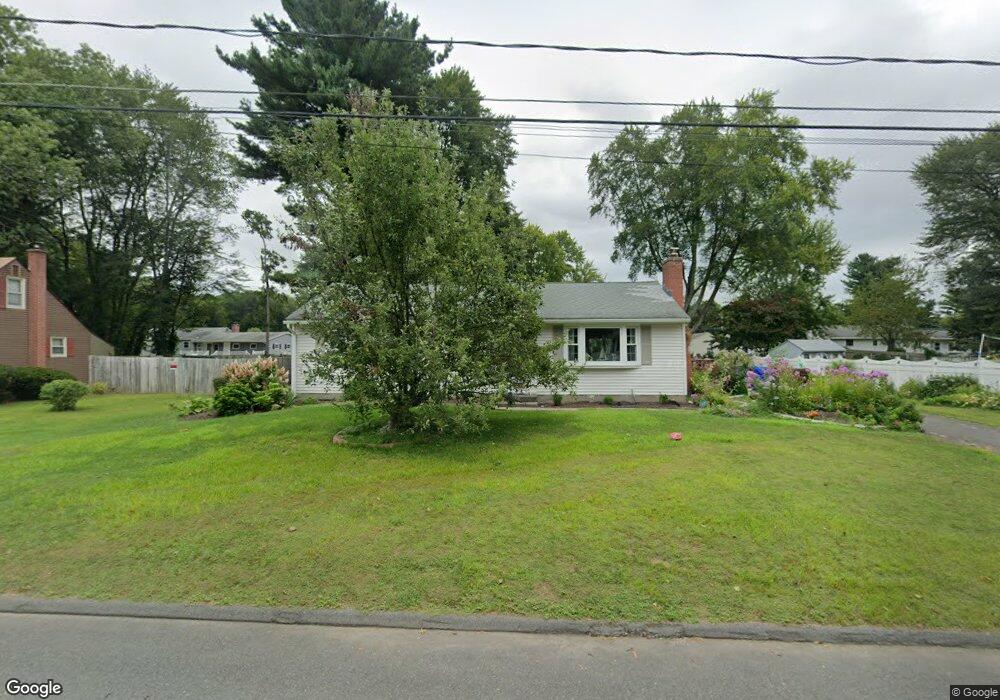
18 Missile Dr Enfield, CT 06082
Estimated Value: $283,000 - $330,000
3
Beds
1
Bath
1,056
Sq Ft
$286/Sq Ft
Est. Value
About This Home
This home is located at 18 Missile Dr, Enfield, CT 06082 and is currently estimated at $302,178, approximately $286 per square foot. 18 Missile Dr is a home located in Hartford County with nearby schools including Eli Whitney Elementary School, Hazardville Memorial Elementary School, and John F. Kennedy Middle School.
Ownership History
Date
Name
Owned For
Owner Type
Purchase Details
Closed on
Aug 5, 2021
Sold by
Trotta Kerry A
Bought by
Kerry A Trotta Lt
Current Estimated Value
Purchase Details
Closed on
Sep 8, 1992
Sold by
Pion Arthur and Pion Nancy
Bought by
Trotta Thomas
Create a Home Valuation Report for This Property
The Home Valuation Report is an in-depth analysis detailing your home's value as well as a comparison with similar homes in the area
Home Values in the Area
Average Home Value in this Area
Purchase History
| Date | Buyer | Sale Price | Title Company |
|---|---|---|---|
| Kerry A Trotta Lt | -- | None Available | |
| Trotta Thomas | $112,500 | -- |
Source: Public Records
Mortgage History
| Date | Status | Borrower | Loan Amount |
|---|---|---|---|
| Previous Owner | Trotta Thomas | $139,244 | |
| Previous Owner | Trotta Thomas | $155,250 | |
| Previous Owner | Trotta Thomas | $126,000 | |
| Previous Owner | Trotta Thomas | $106,000 |
Source: Public Records
Tax History Compared to Growth
Tax History
| Year | Tax Paid | Tax Assessment Tax Assessment Total Assessment is a certain percentage of the fair market value that is determined by local assessors to be the total taxable value of land and additions on the property. | Land | Improvement |
|---|---|---|---|---|
| 2025 | $4,951 | $141,500 | $56,600 | $84,900 |
| 2024 | $4,818 | $141,500 | $56,600 | $84,900 |
| 2023 | $4,783 | $141,500 | $56,600 | $84,900 |
| 2022 | $4,343 | $141,500 | $56,600 | $84,900 |
| 2021 | $4,107 | $109,420 | $46,890 | $62,530 |
| 2020 | $4,107 | $109,420 | $46,890 | $62,530 |
| 2019 | $4,117 | $109,420 | $46,890 | $62,530 |
| 2018 | $4,049 | $109,420 | $46,890 | $62,530 |
| 2017 | $3,822 | $109,420 | $46,890 | $62,530 |
| 2016 | $3,606 | $105,110 | $48,110 | $57,000 |
| 2015 | $3,494 | $105,110 | $48,110 | $57,000 |
| 2014 | $3,403 | $105,110 | $48,110 | $57,000 |
Source: Public Records
Map
Nearby Homes
- 30 David St
- 84 Raffia Rd
- 23 Clear St
- 10-1/2 South Rd
- 92 Post Office Rd
- 46 Beech Rd
- 233 Post Office Rd
- 18 Hudson St
- 33 Liberty Ln
- 38 Liberty Ln
- 52 Liberty Ln
- 37 Liberty Ln
- 35 Liberty Ln
- 17 Plainfield St
- 13 Plainfield St
- 1527 King St
- 86 Weymouth Rd
- 5 Spier Ave
- 83 Oldefield Farms Unit 83
- 85 Oldefield Farms Unit 85