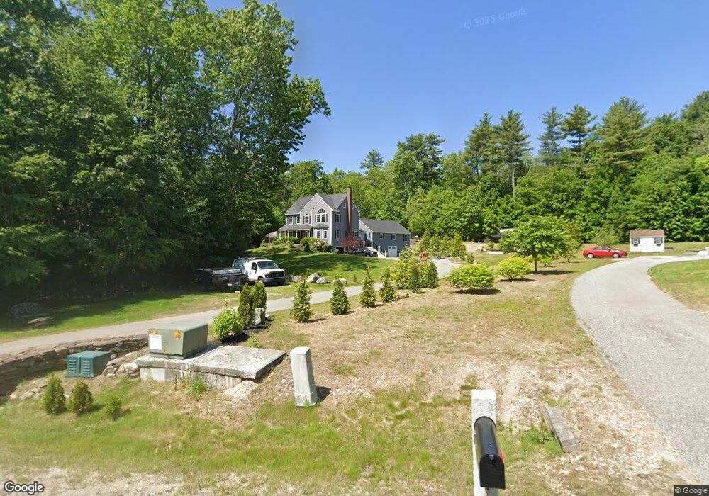
18 Phillips Pond Dr Sandown, NH 03873
Estimated Value: $776,000 - $1,005,000
4
Beds
4
Baths
3,290
Sq Ft
$267/Sq Ft
Est. Value
About This Home
This home is located at 18 Phillips Pond Dr, Sandown, NH 03873 and is currently estimated at $879,468, approximately $267 per square foot. 18 Phillips Pond Dr is a home located in Rockingham County with nearby schools including Sandown North Elementary School, Timberlane Regional Middle School, and Timberlane Regional High School.
Ownership History
Date
Name
Owned For
Owner Type
Purchase Details
Closed on
Jan 3, 2022
Sold by
Asaro Ericka
Bought by
Asaro Ericka
Current Estimated Value
Home Financials for this Owner
Home Financials are based on the most recent Mortgage that was taken out on this home.
Original Mortgage
$382,800
Outstanding Balance
$304,702
Interest Rate
3.05%
Mortgage Type
Stand Alone Refi Refinance Of Original Loan
Estimated Equity
$574,766
Purchase Details
Closed on
Nov 7, 2011
Sold by
Boemark Construction C
Bought by
Coles Ericka A
Home Financials for this Owner
Home Financials are based on the most recent Mortgage that was taken out on this home.
Original Mortgage
$316,900
Interest Rate
4.08%
Mortgage Type
Purchase Money Mortgage
Create a Home Valuation Report for This Property
The Home Valuation Report is an in-depth analysis detailing your home's value as well as a comparison with similar homes in the area
Home Values in the Area
Average Home Value in this Area
Purchase History
| Date | Buyer | Sale Price | Title Company |
|---|---|---|---|
| Asaro Ericka | -- | None Available | |
| Asaro Ericka | -- | None Available | |
| Coles Ericka A | $316,900 | -- | |
| Coles Ericka A | $316,900 | -- |
Source: Public Records
Mortgage History
| Date | Status | Borrower | Loan Amount |
|---|---|---|---|
| Open | Asaro Ericka | $382,800 | |
| Closed | Asaro Ericka | $382,800 | |
| Previous Owner | Coles Ericka A | $316,900 |
Source: Public Records
Tax History Compared to Growth
Tax History
| Year | Tax Paid | Tax Assessment Tax Assessment Total Assessment is a certain percentage of the fair market value that is determined by local assessors to be the total taxable value of land and additions on the property. | Land | Improvement |
|---|---|---|---|---|
| 2024 | $14,265 | $805,000 | $203,200 | $601,800 |
| 2023 | $16,825 | $805,000 | $203,200 | $601,800 |
| 2022 | $13,186 | $464,800 | $107,800 | $357,000 |
| 2021 | $12,004 | $414,200 | $107,800 | $306,400 |
| 2020 | $9,952 | $359,800 | $107,800 | $252,000 |
| 2019 | $9,493 | $352,100 | $107,800 | $244,300 |
| 2018 | $9,568 | $352,100 | $107,800 | $244,300 |
| 2017 | $9,323 | $302,900 | $86,300 | $216,600 |
| 2016 | $8,363 | $286,800 | $86,300 | $200,500 |
| 2015 | $7,640 | $286,800 | $86,300 | $200,500 |
| 2014 | $7,913 | $286,800 | $86,300 | $200,500 |
| 2013 | $7,767 | $286,800 | $86,300 | $200,500 |
Source: Public Records
Map
Nearby Homes
- 31 N Shore Rd
- 156 Little Mill Rd Unit A
- 1 Cameron Ct Unit 1
- 23 Stonegate Ln
- 15 Brightstone Way Unit 14
- 21 Brightstone Way Unit 17
- 8 Ians Path
- 50 Page Ln
- 648 Haverhill Rd
- 5 Johnson Meadow Rd Unit A & B
- 6 Johnson Meadow Rd Unit A & B
- 19 Johnson Meadow Rd Unit A & B
- 33 Johnson Meadow Rd Unit A & B
- 20 Johnson Meadow Rd Unit A & B
- 264 Hampstead Rd
- 30 Johnson Meadow Rd Unit A & B
- 36 Johnson Meadow Rd Unit A & B
- 4 Hastings Dr
- 37 Houstons Way
- 185 Buttrick Rd
- 22 Phillips Pond Dr
- 14 Phillips Pond Rd
- 11 Phillips Pond Dr
- 24 Phillips Pond Dr
- 6 Phillips Pond Dr Unit 11-25
- 26 Phillips Pond Dr
- 21 Phillips Pond Rd
- 17 Phillips Pond Rd
- 115 Hampstead Rd
- 121 Hampstead Rd
- Lot 9 Phillips Pond Rd
- 17 Phillips Pond Dr
- 17 Phillips Pond Dr
- 10 Phillips Pond Dr
- 6 Phillips Pond Rd
- 24 Phillips Pond Rd
- 29 Phillips Pond Dr
- 30 Phillips Pond Dr
- 11 Phillips Pond Rd
- 107 Hampstead Rd