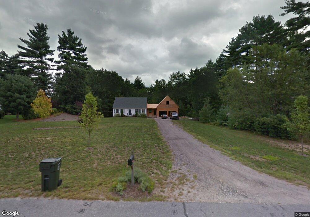
18 Sandy Brook Ln Londonderry, NH 03053
Estimated Value: $597,383 - $706,000
3
Beds
3
Baths
1,619
Sq Ft
$397/Sq Ft
Est. Value
About This Home
This home is located at 18 Sandy Brook Ln, Londonderry, NH 03053 and is currently estimated at $642,846, approximately $397 per square foot. 18 Sandy Brook Ln is a home located in Rockingham County with nearby schools including North Londonderry Elementary School, Londonderry Middle School, and Londonderry Senior High School.
Ownership History
Date
Name
Owned For
Owner Type
Purchase Details
Closed on
Jul 10, 2017
Sold by
Manzer Michael P and Manzer Amanda N
Bought by
Manzer Ft
Current Estimated Value
Purchase Details
Closed on
Oct 23, 2009
Sold by
Savoie Denise J
Bought by
Manzer Michael P and Cox Amanda N
Home Financials for this Owner
Home Financials are based on the most recent Mortgage that was taken out on this home.
Original Mortgage
$232,600
Interest Rate
5.09%
Mortgage Type
Purchase Money Mortgage
Purchase Details
Closed on
Sep 22, 2004
Sold by
Viens Denis R
Bought by
Savoie Denise J
Home Financials for this Owner
Home Financials are based on the most recent Mortgage that was taken out on this home.
Original Mortgage
$199,500
Interest Rate
5.89%
Mortgage Type
Purchase Money Mortgage
Purchase Details
Closed on
Jun 14, 2004
Sold by
Groulx Michael J
Bought by
Viens Denis R
Create a Home Valuation Report for This Property
The Home Valuation Report is an in-depth analysis detailing your home's value as well as a comparison with similar homes in the area
Home Values in the Area
Average Home Value in this Area
Purchase History
| Date | Buyer | Sale Price | Title Company |
|---|---|---|---|
| Manzer Ft | -- | -- | |
| Manzer Michael P | $254,000 | -- | |
| Savoie Denise J | $292,500 | -- | |
| Viens Denis R | $200,000 | -- |
Source: Public Records
Mortgage History
| Date | Status | Borrower | Loan Amount |
|---|---|---|---|
| Previous Owner | Viens Denis R | $228,000 | |
| Previous Owner | Viens Denis R | $232,600 | |
| Previous Owner | Viens Denis R | $199,500 |
Source: Public Records
Tax History Compared to Growth
Tax History
| Year | Tax Paid | Tax Assessment Tax Assessment Total Assessment is a certain percentage of the fair market value that is determined by local assessors to be the total taxable value of land and additions on the property. | Land | Improvement |
|---|---|---|---|---|
| 2024 | $8,012 | $496,400 | $222,200 | $274,200 |
| 2023 | $7,651 | $488,900 | $222,200 | $266,700 |
| 2022 | $7,699 | $416,600 | $166,600 | $250,000 |
| 2021 | $7,657 | $416,600 | $166,600 | $250,000 |
| 2020 | $7,425 | $369,200 | $136,000 | $233,200 |
| 2019 | $7,159 | $369,200 | $136,000 | $233,200 |
| 2018 | $6,581 | $301,900 | $112,900 | $189,000 |
| 2017 | $6,524 | $301,900 | $112,900 | $189,000 |
| 2016 | $6,491 | $301,900 | $112,900 | $189,000 |
| 2015 | $6,346 | $301,900 | $112,900 | $189,000 |
| 2014 | $6,367 | $301,900 | $112,900 | $189,000 |
| 2011 | -- | $271,100 | $112,900 | $158,200 |
Source: Public Records
Map
Nearby Homes
- 15 Tamarack Ct
- 67 Pullman St
- 8 Iroquois Cir
- 53 Pine Ave
- 29 Watts Landing Unit 24
- 4543 Brown Ave
- 4481 Brown Ave
- 4243 Brown Ave
- 3-C Mustang Dr Unit MODEL
- 769 Daniel Webster Hwy
- 9 Mustang Dr Unit C
- 9 Mustang Dr Unit B
- 7 Mustang Dr Unit C
- 7 Mustang Dr Unit END UNIT-A
- 15 Harvey Rd
- 490 Charles Bancroft Hwy
- 5 Webster Rd
- 34 Chatham Dr
- 25 Chatfield Dr
- 27 Buckingham Dr
- 16 Sandy Brook Ln
- 20 Sandy Brook Ln
- 22 Sandybrook Ln
- 15 Sandy Brook Ln
- 15 Sandybrook Ln
- 14 Sandy Brook Ln
- 17 Sandy Brook Ln
- 27 Woodside Dr
- 13 Sandy Brook Ln
- 12 Sandybrook Ln
- 29 Woodside Dr
- 19 Sandy Brook Ln
- 21 Woodside Dr
- 10 Sandy Brook Ln
- 19 Woodside Dr
- 28 Woodside Dr
- 11 Sandy Brook Ln
- 9 Sandy Brook Ln
- 17 Woodside Dr
- 24 Woodside Dr