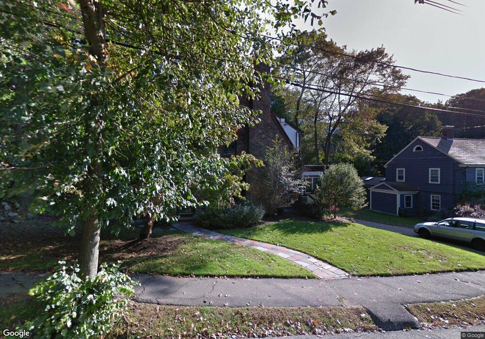
18 Wauwinet Rd West Newton, MA 02465
West Newton NeighborhoodEstimated Value: $1,550,069 - $1,989,000
3
Beds
3
Baths
1,976
Sq Ft
$893/Sq Ft
Est. Value
About This Home
This home is located at 18 Wauwinet Rd, West Newton, MA 02465 and is currently estimated at $1,765,017, approximately $893 per square foot. 18 Wauwinet Rd is a home located in Middlesex County with nearby schools including Peirce Elementary School, F.A. Day Middle School, and Newton North High School.
Ownership History
Date
Name
Owned For
Owner Type
Purchase Details
Closed on
Mar 14, 2025
Sold by
Rubin Audrey
Bought by
18 Wauwinet Road Rt and Rubin
Current Estimated Value
Purchase Details
Closed on
Jun 26, 2007
Sold by
Boggs Jason S and Boggs Stephanie A
Bought by
Rubin Audrey
Home Financials for this Owner
Home Financials are based on the most recent Mortgage that was taken out on this home.
Original Mortgage
$350,000
Interest Rate
6.14%
Mortgage Type
Purchase Money Mortgage
Purchase Details
Closed on
Oct 30, 2003
Sold by
Miller Iris L
Bought by
Boggs Stephanie A and Boggs Jason S
Home Financials for this Owner
Home Financials are based on the most recent Mortgage that was taken out on this home.
Original Mortgage
$625,000
Interest Rate
6.05%
Mortgage Type
Purchase Money Mortgage
Purchase Details
Closed on
Apr 29, 1988
Sold by
Salzberg Harry E
Bought by
Linsky Bruce E
Create a Home Valuation Report for This Property
The Home Valuation Report is an in-depth analysis detailing your home's value as well as a comparison with similar homes in the area
Home Values in the Area
Average Home Value in this Area
Purchase History
| Date | Buyer | Sale Price | Title Company |
|---|---|---|---|
| 18 Wauwinet Road Rt | -- | None Available | |
| 18 Wauwinet Road Rt | -- | None Available | |
| Rubin Audrey | $952,000 | -- | |
| Rubin Audrey | $952,000 | -- | |
| Boggs Stephanie A | $799,000 | -- | |
| Boggs Stephanie A | $799,000 | -- | |
| Linsky Bruce E | $410,000 | -- |
Source: Public Records
Mortgage History
| Date | Status | Borrower | Loan Amount |
|---|---|---|---|
| Previous Owner | Linsky Bruce E | $339,650 | |
| Previous Owner | Rubin Audrey | $350,000 | |
| Previous Owner | Boggs Stephanie A | $625,000 |
Source: Public Records
Tax History Compared to Growth
Tax History
| Year | Tax Paid | Tax Assessment Tax Assessment Total Assessment is a certain percentage of the fair market value that is determined by local assessors to be the total taxable value of land and additions on the property. | Land | Improvement |
|---|---|---|---|---|
| 2025 | $13,218 | $1,348,800 | $1,197,600 | $151,200 |
| 2024 | $12,781 | $1,309,500 | $1,162,700 | $146,800 |
| 2023 | $12,190 | $1,197,400 | $894,700 | $302,700 |
| 2022 | $11,664 | $1,108,700 | $828,400 | $280,300 |
| 2021 | $11,254 | $1,045,900 | $781,500 | $264,400 |
| 2020 | $10,919 | $1,045,900 | $781,500 | $264,400 |
| 2019 | $10,611 | $1,015,400 | $758,700 | $256,700 |
| 2018 | $10,177 | $940,600 | $691,700 | $248,900 |
| 2017 | $9,868 | $887,400 | $652,500 | $234,900 |
| 2016 | $9,437 | $829,300 | $609,800 | $219,500 |
| 2015 | $8,998 | $775,000 | $569,900 | $205,100 |
Source: Public Records
Map
Nearby Homes
- 308 Prince St
- 39 Valentine Park
- 61 Lakeview Ave
- 18 Sewall St
- 318 Austin St Unit A
- 40 Sewall St
- 123 Mount Vernon St Unit 2
- 123-125 Mount Vernon St
- 10 Ruane Rd
- 12 Wiswall St
- 4 Wiswall St
- 27 Cross St Unit 27
- 22 Walnut Place Unit 1
- 887 Commonwealth Ave
- 34 Morton Rd
- 25 Allen Ave
- 957 Washington St Unit 1
- 1430 Beacon St
- 54 Garland Rd
- 935 Washington St Unit 8
- 24 Wauwinet Rd
- 155 Valentine St
- 151 Valentine St
- 17 Wauwinet Rd
- 167 Valentine St
- 9 Wauwinet Rd
- 32 Wauwinet Rd
- 25 Wauwinet Rd
- 177 Valentine St
- 3 Wauwinet Rd
- 74 Colbert Rd E
- 150 Valentine St
- 38 Wauwinet Rd
- 68 Colbert Rd E
- 83 Bonad Rd
- 79 Colbert Rd E
- 6 Risley Rd
- 138 Valentine St
- 129 Valentine St
- 46 Wauwinet Rd