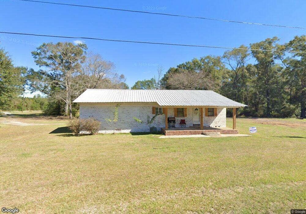
180 Anderson Subdivision Cir Lucedale, MS 39452
Estimated Value: $104,026 - $242,000
--
Bed
--
Bath
1,181
Sq Ft
$138/Sq Ft
Est. Value
About This Home
This home is located at 180 Anderson Subdivision Cir, Lucedale, MS 39452 and is currently estimated at $163,507, approximately $138 per square foot. 180 Anderson Subdivision Cir is a home with nearby schools including George County High School.
Ownership History
Date
Name
Owned For
Owner Type
Purchase Details
Closed on
Oct 14, 2020
Sold by
Nationstar Mortgage Llc
Bought by
Andrews Melissa Tillman and Andrews Charles Brandon
Current Estimated Value
Purchase Details
Closed on
Aug 3, 2020
Sold by
Mccalla Raymer Leibert Pierce Llc
Bought by
Nationstar Mortgage Llc
Purchase Details
Closed on
Aug 20, 2018
Sold by
Falutt David E
Bought by
Nationstar Mortgage Llc
Purchase Details
Closed on
Jan 7, 2008
Sold by
Boykin Donald and Boykin Judy
Bought by
Evans Dem and Evans Tammy
Create a Home Valuation Report for This Property
The Home Valuation Report is an in-depth analysis detailing your home's value as well as a comparison with similar homes in the area
Home Values in the Area
Average Home Value in this Area
Purchase History
| Date | Buyer | Sale Price | Title Company |
|---|---|---|---|
| Andrews Melissa Tillman | -- | None Available | |
| Nationstar Mortgage Llc | -- | None Available | |
| Nationstar Mortgage Llc | $31,200 | None Available | |
| Evans Dem | -- | -- |
Source: Public Records
Tax History Compared to Growth
Tax History
| Year | Tax Paid | Tax Assessment Tax Assessment Total Assessment is a certain percentage of the fair market value that is determined by local assessors to be the total taxable value of land and additions on the property. | Land | Improvement |
|---|---|---|---|---|
| 2025 | $742 | $8,195 | $0 | $0 |
| 2024 | $742 | $6,066 | $0 | $0 |
| 2023 | $145 | $1,187 | $0 | $0 |
| 2022 | $145 | $1,187 | $0 | $0 |
| 2021 | $145 | $1,187 | $0 | $0 |
| 2020 | $147 | $1,199 | $0 | $0 |
| 2019 | $242 | $3,012 | $0 | $0 |
| 2018 | $242 | $3,012 | $0 | $0 |
| 2015 | -- | $3,209 | $0 | $0 |
| 2014 | -- | $3,209 | $0 | $0 |
Source: Public Records
Map
Nearby Homes
- 76 Acres Mississippi 612
- 297 Dozier Rogers Rd
- 28 Acres Harmon Pope Rd
- 8105 Highway 613
- 147 Blue Spring Rd
- 134 Lynne Ln
- 120 Trevor Ln
- 158 Emmanuel Dr
- 6118 Mississippi 612
- 0 Buddy Finch Rd
- Lot 17 Pine Ridge Ln
- Lot 14 Pine Ridge Ln
- Lot 12 Pine Ridge Ln
- Lot 11 Pine Ridge Ln
- 5211 Agricola Latonia Rd
- Lot 13 Pine Ridge Ln
- Lot 7 Pine Ridge Ln
- Lot 6 Pine Ridge Ln
- Lot 10 Pine Ridge Ln
- Lot 5 Pine Ridge Ln
- 193 Anderson Subdivision Cir
- 187 Anderson Subdivision Cir
- 192 Anderson Subdivision Cir
- 206 Anderson Subdivision Cir
- 230 Anderson Subdivision Cir
- 246A Anderson Subdivision Cir
- 2195 Highway 612
- 223 Anderson Subdivision Cir
- 144 Anderson Subdivision Cir
- 211B Anderson Subdivision Cir
- 111 Broderick Ln
- 211 Anderson Subdivision Cir
- 211 Anderson Subdivision Cir
- 234 Anderson Subdivision Cir
- 2227 Highway 612
- 2239 Highway 612
- 108 Anderson Subdivision Cir
- 243 Anderson Subdivision Cir
- 123 Broderick Ln
- 2153 Highway 612