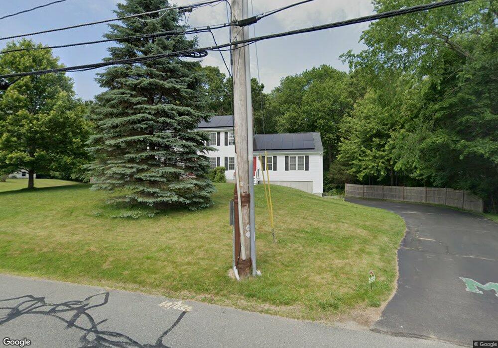
180 Branch St Mansfield, MA 02048
Estimated Value: $871,703 - $930,000
5
Beds
3
Baths
2,404
Sq Ft
$371/Sq Ft
Est. Value
About This Home
This home is located at 180 Branch St, Mansfield, MA 02048 and is currently estimated at $892,676, approximately $371 per square foot. 180 Branch St is a home located in Bristol County with nearby schools including Everett W. Robinson Elementary School, Jordan/Jackson Elementary School, and Harold L. Qualters Middle School.
Ownership History
Date
Name
Owned For
Owner Type
Purchase Details
Closed on
Jul 9, 2007
Sold by
Rezendes Deborah A and Rezendes Jeffrey T
Bought by
Low Dawn M and Low Greg A
Current Estimated Value
Purchase Details
Closed on
Jul 1, 1996
Sold by
Maystar Realty Corp
Bought by
Rezendes Jeffrey T and Rezendes Deborah A
Purchase Details
Closed on
May 27, 1994
Sold by
Mansfield Coop Bk
Bought by
Maystar Rlty Corp
Create a Home Valuation Report for This Property
The Home Valuation Report is an in-depth analysis detailing your home's value as well as a comparison with similar homes in the area
Home Values in the Area
Average Home Value in this Area
Purchase History
| Date | Buyer | Sale Price | Title Company |
|---|---|---|---|
| Low Dawn M | $454,000 | -- | |
| Rezendes Jeffrey T | $174,000 | -- | |
| Maystar Rlty Corp | $45,500 | -- |
Source: Public Records
Mortgage History
| Date | Status | Borrower | Loan Amount |
|---|---|---|---|
| Open | Maystar Rlty Corp | $259,000 | |
| Closed | Maystar Rlty Corp | $263,000 |
Source: Public Records
Tax History Compared to Growth
Tax History
| Year | Tax Paid | Tax Assessment Tax Assessment Total Assessment is a certain percentage of the fair market value that is determined by local assessors to be the total taxable value of land and additions on the property. | Land | Improvement |
|---|---|---|---|---|
| 2025 | $9,334 | $708,700 | $261,300 | $447,400 |
| 2024 | $9,057 | $670,900 | $261,300 | $409,600 |
| 2023 | $8,732 | $619,700 | $261,300 | $358,400 |
| 2022 | $8,365 | $551,400 | $242,600 | $308,800 |
| 2021 | $5,657 | $546,500 | $211,800 | $334,700 |
| 2020 | $5,147 | $527,900 | $202,000 | $325,900 |
| 2019 | $7,581 | $498,100 | $169,300 | $328,800 |
| 2018 | $4,437 | $484,900 | $161,900 | $323,000 |
| 2017 | $2,228 | $471,800 | $157,600 | $314,200 |
| 2016 | $6,894 | $447,400 | $150,100 | $297,300 |
| 2015 | $6,704 | $432,500 | $150,100 | $282,400 |
Source: Public Records
Map
Nearby Homes
- 414 Branch St
- 28 Court St
- 442 Ware St
- 460 Ware St
- 150 Rumford Ave Unit 110
- 571 Ware St
- 82 Brook St
- 22 Pleasant St Unit C
- 166 Chauncy St
- 631 East St Unit E203
- 28 Angell St
- 44 Angell St Unit 44
- 277 Central St
- 619 N Main St
- 18 Columbine Rd
- 212 Mill St
- 15 Reservoir St Unit 44
- 6 Erick Rd Unit 73
- 151 Stearns Ave
- 356 Central St