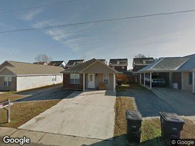
180 Mike Ave Guntown, MS 38849
Estimated Value: $127,000 - $180,166
--
Bed
--
Bath
1,134
Sq Ft
$133/Sq Ft
Est. Value
About This Home
This home is located at 180 Mike Ave, Guntown, MS 38849 and is currently estimated at $151,055, approximately $133 per square foot. 180 Mike Ave is a home located in Lee County with nearby schools including Saltillo Elementary School, Saltillo Primary School, and Guntown Middle School.
Ownership History
Date
Name
Owned For
Owner Type
Purchase Details
Closed on
Nov 30, 2009
Sold by
David Swain Construction Inc
Bought by
Gilliam Monica D
Current Estimated Value
Home Financials for this Owner
Home Financials are based on the most recent Mortgage that was taken out on this home.
Original Mortgage
$84,500
Outstanding Balance
$57,389
Interest Rate
5.01%
Mortgage Type
Unknown
Estimated Equity
$97,182
Purchase Details
Closed on
Dec 17, 2007
Sold by
Robison W T and Robison Mike
Bought by
David Swain Const Llc
Purchase Details
Closed on
Jun 15, 2007
Sold by
Robison W T and Robison Mike
Bought by
David Swain Construction Llc
Create a Home Valuation Report for This Property
The Home Valuation Report is an in-depth analysis detailing your home's value as well as a comparison with similar homes in the area
Home Values in the Area
Average Home Value in this Area
Purchase History
| Date | Buyer | Sale Price | Title Company |
|---|---|---|---|
| Gilliam Monica D | -- | -- | |
| David Swain Construction Llc | -- | -- |
Source: Public Records
Mortgage History
| Date | Status | Borrower | Loan Amount |
|---|---|---|---|
| Open | Gilliam Monica D | $84,500 |
Source: Public Records
Tax History Compared to Growth
Tax History
| Year | Tax Paid | Tax Assessment Tax Assessment Total Assessment is a certain percentage of the fair market value that is determined by local assessors to be the total taxable value of land and additions on the property. | Land | Improvement |
|---|---|---|---|---|
| 2024 | $1,878 | $13,932 | $0 | $0 |
| 2023 | $1,649 | $12,099 | $0 | $0 |
| 2022 | $1,606 | $12,099 | $0 | $0 |
| 2021 | $1,606 | $12,099 | $0 | $0 |
| 2020 | $1,603 | $12,099 | $0 | $0 |
| 2019 | $1,546 | $11,633 | $0 | $0 |
| 2018 | $1,555 | $11,633 | $0 | $0 |
| 2017 | $1,507 | $11,633 | $0 | $0 |
| 2016 | $1,460 | $11,633 | $0 | $0 |
| 2015 | $609 | $10,764 | $0 | $0 |
| 2014 | $609 | $7,176 | $0 | $0 |
Source: Public Records
Map
Nearby Homes
- 132 Greenhill Dr
- 661 Mitchell Ave
- 121 Pam Ave
- 115 Saint Thomas Dr
- 743 Ford Ave
- 161 Benelli Dr
- 182 Rd 1303
- 436 Cr 601
- 0 Long St
- 117 Deerfield Rd
- 139 Drive 2322
- 296 County Road 2446
- 1812 Hwy 145
- 0 Rd 2500 Unit 11360321
- Lot 18 Mallard Lake Dr
- Lot 19 Mallard Lake Dr
- Lot 15 Mallard Lake Dr
- Lot 17 Mallard Lake Dr
- Lot 16 Mallard Lake Dr
- 0 Mallard Lake Dr