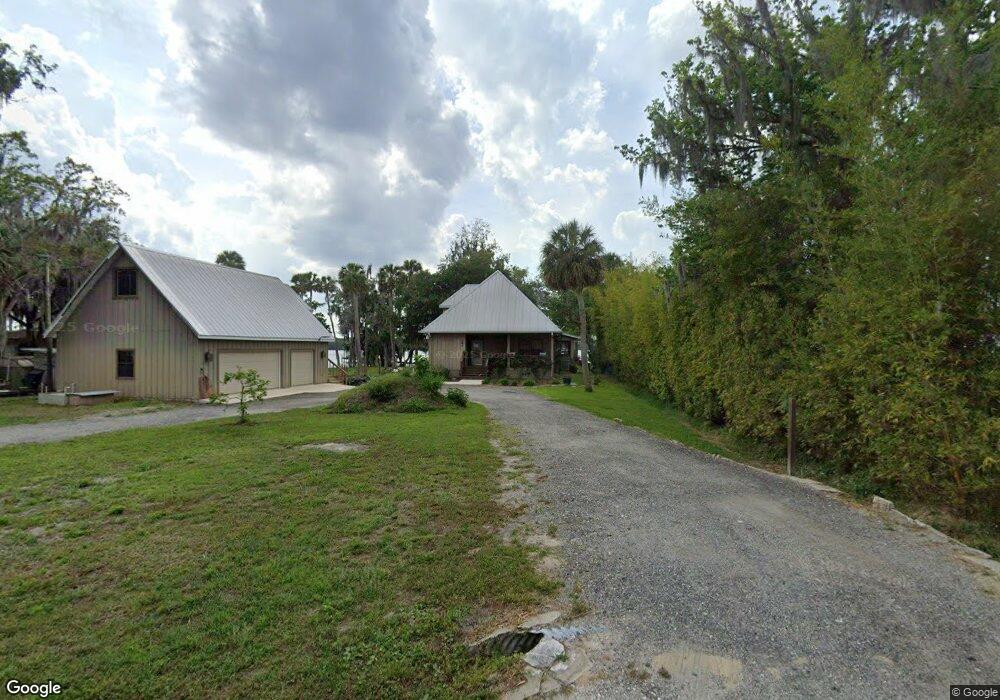
180 Palm Dr Georgetown, FL 32139
Estimated Value: $674,000 - $739,000
3
Beds
3
Baths
1,877
Sq Ft
$376/Sq Ft
Est. Value
About This Home
This home is located at 180 Palm Dr, Georgetown, FL 32139 and is currently estimated at $704,916, approximately $375 per square foot. 180 Palm Dr is a home located in Putnam County with nearby schools including Middleton-Burney Elementary School and Crescent City Junior/Senior High School.
Ownership History
Date
Name
Owned For
Owner Type
Purchase Details
Closed on
Jan 28, 2019
Sold by
Filer Sherry L and Tattersall Fred
Bought by
Thompson Curtis L and Thompson Sammi W
Current Estimated Value
Home Financials for this Owner
Home Financials are based on the most recent Mortgage that was taken out on this home.
Original Mortgage
$55,000
Interest Rate
7%
Mortgage Type
Balloon
Purchase Details
Closed on
Dec 16, 2008
Sold by
Tattersall Fred
Bought by
Tattersall Fred and Filer Sherry L
Purchase Details
Closed on
Sep 20, 2004
Sold by
Tattersall Peter
Bought by
Tattersall Fred
Create a Home Valuation Report for This Property
The Home Valuation Report is an in-depth analysis detailing your home's value as well as a comparison with similar homes in the area
Home Values in the Area
Average Home Value in this Area
Purchase History
We collect this data history from publicly available records. To have your information removed, we recommend requesting removal directly through your county’s website.
| Date | Buyer | Sale Price | Title Company |
|---|---|---|---|
| Thompson Curtis L | $365,000 | Gullett Title Inc | |
| Tattersall Fred | -- | Attorney | |
| Tattersall Fred | -- | -- |
Source: Public Records
Mortgage History
We collect this data history from publicly available records. To have your information removed, we recommend requesting removal directly through your county’s website.
| Date | Status | Borrower | Loan Amount |
|---|---|---|---|
| Closed | Thompson Curtis L | $55,000 |
Source: Public Records
Tax History
| Year | Tax Paid | Tax Assessment Tax Assessment Total Assessment is a certain percentage of the fair market value that is determined by local assessors to be the total taxable value of land and additions on the property. | Land | Improvement |
|---|---|---|---|---|
| 2025 | $5,181 | $328,620 | -- | -- |
| 2023 | $4,664 | $310,060 | $0 | $0 |
| 2022 | $4,430 | $301,030 | $0 | $0 |
| 2021 | $4,396 | $292,270 | $0 | $0 |
| 2020 | $4,409 | $288,240 | $0 | $0 |
| 2019 | $329 | $275,770 | $257,950 | $17,820 |
| 2018 | $331 | $270,630 | $260,360 | $10,270 |
| 2017 | $332 | $265,070 | $254,800 | $10,270 |
| 2016 | $325 | $259,620 | $0 | $0 |
| 2015 | $334 | $260,376 | $0 | $0 |
| 2014 | $395 | $244,222 | $0 | $0 |
Source: Public Records
Map
Nearby Homes
- 117 Palm Dr
- 188 Palm Dr
- 198 Palm Dr
- 205 Palm Dr
- 117 Lakeview Ave
- 130 Palm Dr
- 112 Driftwood Ln
- 107 Georgetown Point Rd
- 105 S Lake George Dr
- 121 Stella Rd
- 233 Stella Rd
- 208 Lake George Point Dr
- 124 Marie Ave
- 124 Helen Ave
- 101 Possum Hollow Rd
- 105 SE 3rd St
- 131 Georgetown Denver Rd
- 216 Marie Ave
- 222 Marie Ave
- 112 Marie Ave
Your Personal Tour Guide
Ask me questions while you tour the home.