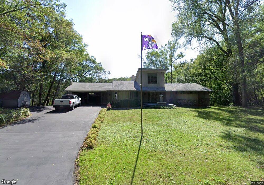
1800 Dwinnell Ave Saint Paul, MN 55115
Estimated Value: $564,000 - $790,000
5
Beds
4
Baths
4,104
Sq Ft
$167/Sq Ft
Est. Value
About This Home
This home is located at 1800 Dwinnell Ave, Saint Paul, MN 55115 and is currently estimated at $684,003, approximately $166 per square foot. 1800 Dwinnell Ave is a home located in Washington County with nearby schools including O.H. Anderson Elementary School, Wildwood Elementary School, and Mahtomedi Middle School.
Ownership History
Date
Name
Owned For
Owner Type
Purchase Details
Closed on
Aug 15, 2020
Sold by
Roesner Jay O and Roesner Sandra L
Bought by
Mauer Joseph and Hunter Meghan
Current Estimated Value
Home Financials for this Owner
Home Financials are based on the most recent Mortgage that was taken out on this home.
Original Mortgage
$380,000
Outstanding Balance
$336,458
Interest Rate
2.9%
Mortgage Type
New Conventional
Estimated Equity
$347,545
Create a Home Valuation Report for This Property
The Home Valuation Report is an in-depth analysis detailing your home's value as well as a comparison with similar homes in the area
Home Values in the Area
Average Home Value in this Area
Purchase History
| Date | Buyer | Sale Price | Title Company |
|---|---|---|---|
| Mauer Joseph | $400,000 | Edina Realty Title Inc |
Source: Public Records
Mortgage History
| Date | Status | Borrower | Loan Amount |
|---|---|---|---|
| Open | Mauer Joseph | $380,000 |
Source: Public Records
Tax History Compared to Growth
Tax History
| Year | Tax Paid | Tax Assessment Tax Assessment Total Assessment is a certain percentage of the fair market value that is determined by local assessors to be the total taxable value of land and additions on the property. | Land | Improvement |
|---|---|---|---|---|
| 2024 | $6,782 | $599,900 | $202,000 | $397,900 |
| 2023 | $6,782 | $583,000 | $210,000 | $373,000 |
| 2022 | $5,884 | $565,300 | $208,800 | $356,500 |
| 2021 | $5,812 | $452,500 | $170,500 | $282,000 |
| 2020 | $6,124 | $462,900 | $179,500 | $283,400 |
| 2019 | $6,420 | $451,400 | $165,500 | $285,900 |
| 2018 | $5,536 | $446,900 | $171,800 | $275,100 |
| 2017 | $5,402 | $437,000 | $166,300 | $270,700 |
| 2016 | $5,590 | $402,800 | $171,800 | $231,000 |
| 2015 | $5,436 | $391,300 | $136,300 | $255,000 |
| 2013 | -- | $364,300 | $119,600 | $244,700 |
Source: Public Records
Map
Nearby Homes
- 1810 Moccasin Ave
- 1732 Briarwood Ave
- 209 Quail St
- xxx Bryant Ave
- 125 Wildwood Bay Dr
- 1401 Harmony Dr
- XXX 89th St N
- 177 Kale St
- 1130 Griffin Ave
- 1030 Griffin Ave
- 1025 Mahtomedi Ave
- 87 Juniper St
- 200 Juniper St
- 47 Juniper St Unit 47
- 10440 Hadley Cir N
- xx Iris St
- 208 Iris St
- 22 Dellwood Ave
- 42 Eldorado Cir
- 430 Park Place
- 1876 Dwinnell Ave
- 357 Quail St
- 358 358 Quail-Road-
- 1835 Morgan St
- 33 Dwinnell Ave
- 33 33 Dwinnell-Avenue-
- 1865 Morgan St
- 355 Quail St
- 362 Quail Rd
- 360 Quail Rd
- 1895 Morgan St
- 1830 Moccasin Ave
- 260 Hazel Ave
- 2139 Moccasin Ave
- 264 Dwinnell Ave
- 29 29 Dwinnell-Avenue-
- 29 Dwinnell Ave
- 358 Quail Rd
- 352 Quail Rd
- 370 Quail Rd