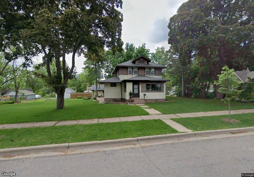
1804 Benson Ave Saint Paul, MN 55116
West Seventh NeighborhoodEstimated Value: $381,000 - $450,000
4
Beds
2
Baths
1,576
Sq Ft
$269/Sq Ft
Est. Value
About This Home
This home is located at 1804 Benson Ave, Saint Paul, MN 55116 and is currently estimated at $424,182, approximately $269 per square foot. 1804 Benson Ave is a home located in Ramsey County with nearby schools including Expo for Excellence Elementary School, Highland Park Middle School, and Highland Park Senior High.
Ownership History
Date
Name
Owned For
Owner Type
Purchase Details
Closed on
Nov 27, 2018
Sold by
Ctw Group Incorporated
Bought by
Ansorge Jeffrey A and Morocho Espinoza Maria Luisa
Current Estimated Value
Home Financials for this Owner
Home Financials are based on the most recent Mortgage that was taken out on this home.
Original Mortgage
$290,930
Outstanding Balance
$259,782
Interest Rate
5.5%
Mortgage Type
Adjustable Rate Mortgage/ARM
Estimated Equity
$164,400
Purchase Details
Closed on
Jun 9, 2018
Sold by
Burke Jeffery P and Burke Carol H
Bought by
Ctw Group Incorporated A Corporation
Home Financials for this Owner
Home Financials are based on the most recent Mortgage that was taken out on this home.
Original Mortgage
$168,800
Interest Rate
4.5%
Mortgage Type
Commercial
Create a Home Valuation Report for This Property
The Home Valuation Report is an in-depth analysis detailing your home's value as well as a comparison with similar homes in the area
Home Values in the Area
Average Home Value in this Area
Purchase History
| Date | Buyer | Sale Price | Title Company |
|---|---|---|---|
| Ansorge Jeffrey A | $299,900 | Titlesmart Inc | |
| Ctw Group Incorporated A Corporation | $178,758 | Titlesmart Inc |
Source: Public Records
Mortgage History
| Date | Status | Borrower | Loan Amount |
|---|---|---|---|
| Open | Ansorge Jeffrey A | $290,930 | |
| Previous Owner | Ctw Group Incorporated A Corporation | $168,800 |
Source: Public Records
Tax History Compared to Growth
Tax History
| Year | Tax Paid | Tax Assessment Tax Assessment Total Assessment is a certain percentage of the fair market value that is determined by local assessors to be the total taxable value of land and additions on the property. | Land | Improvement |
|---|---|---|---|---|
| 2025 | $5,608 | $394,300 | $56,000 | $338,300 |
| 2023 | $5,608 | $358,000 | $56,000 | $302,000 |
| 2022 | $5,144 | $316,900 | $56,000 | $260,900 |
| 2021 | $4,554 | $310,400 | $56,000 | $254,400 |
| 2020 | $4,684 | $285,500 | $38,100 | $247,400 |
| 2019 | $4,014 | $274,200 | $38,100 | $236,100 |
| 2018 | $3,914 | $234,800 | $38,100 | $196,700 |
| 2017 | $4,088 | $208,000 | $38,100 | $169,900 |
| 2016 | $3,964 | $0 | $0 | $0 |
| 2015 | $3,750 | $187,100 | $31,800 | $155,300 |
| 2014 | $3,886 | $0 | $0 | $0 |
Source: Public Records
Map
Nearby Homes
- 1619 Edgcumbe Rd
- 850 Syndicate St S
- 791 Lexington Pkwy S
- 1071 Otto Ave
- 1205 Eleanor Ave
- 2221 Youngman Ave Unit 503
- 633 Griggs St S
- 2040 Edgcumbe Rd
- 1368 Pleasant Ave
- 1368 Eleanor Ave
- 2275 Youngman Ave Unit 308W
- 2265 Youngman Ave Unit 207E
- 576 Lexington Pkwy S
- 1077 Sibley Memorial Hwy Unit 506
- 1077 Sibley Memorial Hwy Unit 602
- 555 Montcalm Place
- 528 Lexington Pkwy S
- 1271 - 1273 7th St W
- 1477 Eleanor Ave
- 1565 Victoria Rd S
- 1808 Benson Ave
- 1788 Benson Ave
- 1801 Ivan Way
- 1809 Ivan Way
- 1814 Benson Ave
- 1793 Ivan Way
- 1811 Ivan Way
- 1787 Ivan Way
- 1805 Benson Ave
- 1797 Benson Ave
- 1793 Benson Ave
- 1809 Benson Ave
- 1818 Benson Ave
- 1789 Benson Ave
- 1821 Ivan Way
- 1815 Benson Ave
- 1804 Ivan Way
- 1836 Benson Ave
- 1825 Benson Ave
- 1825 Ivan Way