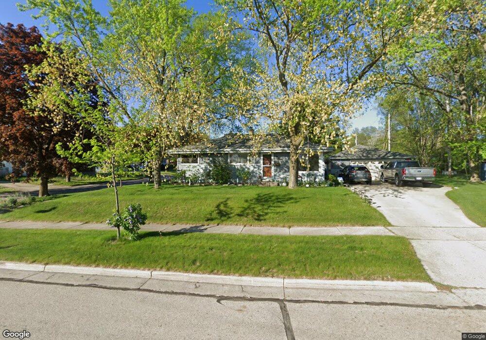
1804 Enterprise St Waukesha, WI 53189
Estimated Value: $293,000 - $338,000
3
Beds
1
Bath
996
Sq Ft
$322/Sq Ft
Est. Value
About This Home
This home is located at 1804 Enterprise St, Waukesha, WI 53189 and is currently estimated at $321,105, approximately $322 per square foot. 1804 Enterprise St is a home located in Waukesha County with nearby schools including Waukesha STEM Academy, Horning Middle School, and South High School.
Ownership History
Date
Name
Owned For
Owner Type
Purchase Details
Closed on
Aug 16, 1999
Sold by
Welch Rosemary J
Bought by
Welch Alan N
Current Estimated Value
Purchase Details
Closed on
Dec 27, 1995
Sold by
Niklasch Debbie
Bought by
Welch Alan N and Welch Rosemary J
Home Financials for this Owner
Home Financials are based on the most recent Mortgage that was taken out on this home.
Original Mortgage
$68,500
Outstanding Balance
$1,870
Interest Rate
7.41%
Estimated Equity
$319,235
Create a Home Valuation Report for This Property
The Home Valuation Report is an in-depth analysis detailing your home's value as well as a comparison with similar homes in the area
Home Values in the Area
Average Home Value in this Area
Purchase History
| Date | Buyer | Sale Price | Title Company |
|---|---|---|---|
| Welch Alan N | -- | -- | |
| Welch Alan N | $88,500 | -- |
Source: Public Records
Mortgage History
| Date | Status | Borrower | Loan Amount |
|---|---|---|---|
| Open | Welch Alan N | $68,500 |
Source: Public Records
Tax History Compared to Growth
Tax History
| Year | Tax Paid | Tax Assessment Tax Assessment Total Assessment is a certain percentage of the fair market value that is determined by local assessors to be the total taxable value of land and additions on the property. | Land | Improvement |
|---|---|---|---|---|
| 2024 | $3,624 | $247,800 | $51,800 | $196,000 |
| 2023 | $3,513 | $247,800 | $51,800 | $196,000 |
| 2022 | $3,242 | $172,400 | $55,800 | $116,600 |
| 2021 | $3,310 | $172,400 | $55,800 | $116,600 |
| 2020 | $3,212 | $172,400 | $55,800 | $116,600 |
| 2019 | $3,104 | $172,400 | $55,800 | $116,600 |
| 2018 | $2,852 | $155,300 | $49,600 | $105,700 |
| 2017 | $2,854 | $155,300 | $49,600 | $105,700 |
| 2016 | $2,956 | $150,800 | $49,600 | $101,200 |
| 2015 | $2,941 | $150,800 | $49,600 | $101,200 |
| 2014 | $2,975 | $146,400 | $49,600 | $96,800 |
| 2013 | $2,975 | $146,400 | $49,600 | $96,800 |
Source: Public Records
Map
Nearby Homes
- 1936 Cliff Alex Ct N
- 1522 Big Bend Rd Unit G
- 1432 Big Bend Rd Unit E
- 414 Standing Stone Dr Unit 8-16
- 421 Standing Stone Dr Unit 17-39
- 424 Standing Stone Dr Unit 9-17
- 455 Standing Stone Dr
- 2004 Smart Ct
- 1715 Center Rd
- 2005 Smart Ct
- 435 Standing Stone Dr Unit 16-37
- 605 Standing Stone Dr
- 609 Standing Stone Dr
- 625 Standing Stone Dr
- 613 Standing Stone Dr
- 621 Standing Stone Dr
- 633 Standing Stone Dr
- 1438 Tenny Ave Unit 101
- The Sawyer Plan at Tenny Woods
- The Everest Plan at Tenny Woods
- 361 Debbie Dr
- 374 Debbie Dr
- 337 Richard St
- 403 Debbie Dr
- 1822 Enterprise St
- 368 Debbie Dr
- 331 Richard St
- 362 Debbie Dr
- 1814 Enterprise St
- 1819 Enterprise St
- 354 Debbie Dr
- 402 Debbie Dr
- 411 Debbie Dr
- 1827 Enterprise St
- 1828 Enterprise St
- 328 Richard St
- 408 Debbie Dr
- 325 Richard St
- 336 Richard St
- 1833 Enterprise St