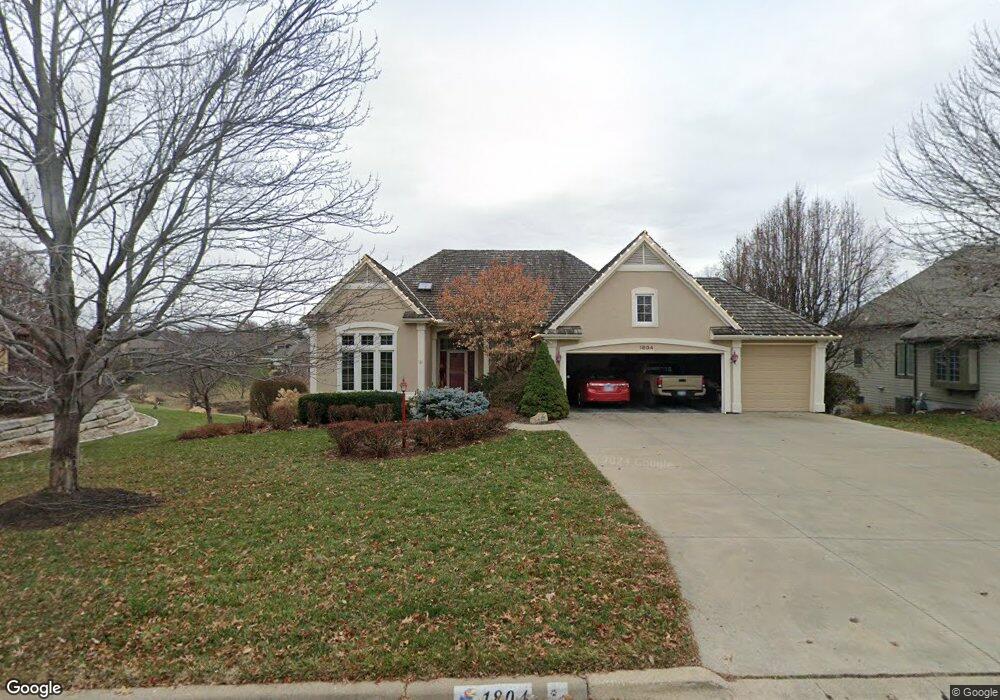
1804 Foxfire Dr Lawrence, KS 66047
West Lawrence NeighborhoodEstimated Value: $630,455 - $759,000
4
Beds
3
Baths
2,090
Sq Ft
$333/Sq Ft
Est. Value
About This Home
This home is located at 1804 Foxfire Dr, Lawrence, KS 66047 and is currently estimated at $696,114, approximately $333 per square foot. 1804 Foxfire Dr is a home located in Douglas County with nearby schools including Langston Hughes Elementary School, Southwest Middle School, and Lawrence High School.
Ownership History
Date
Name
Owned For
Owner Type
Purchase Details
Closed on
Sep 23, 2020
Sold by
Gadt Larry O and Gadt Jacqueline A
Bought by
Gadt Larry O and Gadt Jacqueline A
Current Estimated Value
Home Financials for this Owner
Home Financials are based on the most recent Mortgage that was taken out on this home.
Original Mortgage
$192,715
Interest Rate
2.9%
Mortgage Type
New Conventional
Create a Home Valuation Report for This Property
The Home Valuation Report is an in-depth analysis detailing your home's value as well as a comparison with similar homes in the area
Home Values in the Area
Average Home Value in this Area
Purchase History
| Date | Buyer | Sale Price | Title Company |
|---|---|---|---|
| Gadt Larry O | -- | None Available | |
| Gadt Larry O | -- | None Available |
Source: Public Records
Mortgage History
| Date | Status | Borrower | Loan Amount |
|---|---|---|---|
| Closed | Gadt Larry O | $192,715 |
Source: Public Records
Tax History
| Year | Tax Paid | Tax Assessment Tax Assessment Total Assessment is a certain percentage of the fair market value that is determined by local assessors to be the total taxable value of land and additions on the property. | Land | Improvement |
|---|---|---|---|---|
| 2025 | $9,864 | $78,269 | $9,200 | $69,069 |
| 2024 | $9,561 | $75,866 | $8,625 | $67,241 |
| 2023 | $9,079 | $69,978 | $8,625 | $61,353 |
| 2022 | $8,542 | $65,412 | $8,632 | $56,780 |
| 2021 | $8,014 | $59,685 | $8,632 | $51,053 |
| 2020 | $7,858 | $58,823 | $8,632 | $50,191 |
| 2019 | $7,784 | $58,328 | $8,632 | $49,696 |
| 2018 | $7,753 | $57,673 | $8,632 | $49,041 |
| 2017 | $7,611 | $55,994 | $8,632 | $47,362 |
| 2016 | $6,866 | $52,773 | $6,901 | $45,872 |
| 2015 | $6,718 | $51,635 | $6,901 | $44,734 |
| 2014 | $6,560 | $50,922 | $6,901 | $44,021 |
Source: Public Records
Map
Nearby Homes
- 5020 W 18th St
- 1601 Research Park Dr
- 1604 Bob White Dr
- 1709 Lake Alvamar Dr
- 5710 Goff Ct
- 1347 Kanza Dr
- 1315 Research Park Dr
- 1216 Waverly Dr
- 2009 Riviera Ct
- 2101 Riviera Dr
- 2014 Riviera Ct
- 1608 Prestwick Dr
- 927 N 1464 Rd
- 1528 Legend Trail Dr Unit A
- 1202 Little Knife
- 2250 Lake Pointe Dr Unit 1104
- 2250 Lake Pointe Dr Unit 1900
- 2250 Lake Pointe Dr Unit 300
- 2250 Lake Pointe Dr Unit 304
- 1549 Legend Trail Dr Unit A
- 1808 Foxfire Dr
- 1800 Foxfire Dr
- 5027 W 18th St
- 1812 Foxfire Dr
- 1803 Foxfire Dr
- 1807 Foxfire Dr
- 5023 W 18th St
- 1816 Foxfire Dr
- 5103 Stonewall Ct
- 5107 Stonewall Ct
- 5028 W 18th St
- 1811 Foxfire Dr
- 5019 W 18th St
- 1820 Foxfire Dr
- 5024 W 18th St
- 5111 Stonewall Ct
- 1815 Foxfire Dr
- 5015 W 18th St
- 1824 Foxfire Dr
- 5100 Stonewall Ct
Your Personal Tour Guide
Ask me questions while you tour the home.