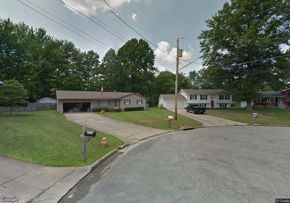
1804 Maple Trace Ct Youngstown, OH 44515
Austintown NeighborhoodEstimated Value: $251,669 - $287,000
3
Beds
2
Baths
1,988
Sq Ft
$134/Sq Ft
Est. Value
About This Home
This home is located at 1804 Maple Trace Ct, Youngstown, OH 44515 and is currently estimated at $266,917, approximately $134 per square foot. 1804 Maple Trace Ct is a home located in Mahoning County with nearby schools including Austintown Elementary School, Austintown Intermediate School, and Austintown Middle School.
Ownership History
Date
Name
Owned For
Owner Type
Purchase Details
Closed on
Nov 7, 2013
Sold by
Cox Robert L
Bought by
Cox Robert L and Cox Sophie A
Current Estimated Value
Purchase Details
Closed on
Oct 10, 2003
Sold by
Wenzel Frederick K and Landry Wenzel Valerie R
Bought by
Cox Robert L
Home Financials for this Owner
Home Financials are based on the most recent Mortgage that was taken out on this home.
Original Mortgage
$82,400
Outstanding Balance
$38,611
Interest Rate
6.87%
Mortgage Type
Purchase Money Mortgage
Estimated Equity
$228,306
Purchase Details
Closed on
Oct 27, 1997
Sold by
Hileman Donald L and Hileman Diana L
Bought by
Wenzel Frederick K and Landry Wenzel Valerie R
Purchase Details
Closed on
Aug 1, 1989
Bought by
Hileman Donald L
Create a Home Valuation Report for This Property
The Home Valuation Report is an in-depth analysis detailing your home's value as well as a comparison with similar homes in the area
Home Values in the Area
Average Home Value in this Area
Purchase History
| Date | Buyer | Sale Price | Title Company |
|---|---|---|---|
| Cox Robert L | -- | Commonwealth Suburban Title | |
| Cox Robert L | $103,000 | -- | |
| Wenzel Frederick K | $90,000 | -- | |
| Hileman Donald L | $65,200 | -- |
Source: Public Records
Mortgage History
| Date | Status | Borrower | Loan Amount |
|---|---|---|---|
| Open | Cox Robert L | $82,400 | |
| Closed | Cox Robert L | $20,600 |
Source: Public Records
Tax History
| Year | Tax Paid | Tax Assessment Tax Assessment Total Assessment is a certain percentage of the fair market value that is determined by local assessors to be the total taxable value of land and additions on the property. | Land | Improvement |
|---|---|---|---|---|
| 2025 | $3,460 | $71,770 | $9,100 | $62,670 |
| 2024 | $3,304 | $71,770 | $9,100 | $62,670 |
| 2023 | $3,248 | $71,770 | $9,100 | $62,670 |
| 2022 | $2,499 | $44,260 | $8,740 | $35,520 |
| 2021 | $2,502 | $44,260 | $8,740 | $35,520 |
| 2020 | $2,510 | $44,260 | $8,740 | $35,520 |
| 2019 | $2,495 | $39,880 | $7,880 | $32,000 |
| 2018 | $2,400 | $39,880 | $7,880 | $32,000 |
| 2017 | $2,386 | $39,880 | $7,880 | $32,000 |
| 2016 | $2,080 | $34,390 | $6,850 | $27,540 |
| 2015 | $2,017 | $34,390 | $6,850 | $27,540 |
| 2014 | $2,026 | $34,390 | $6,850 | $27,540 |
| 2013 | $2,003 | $34,390 | $6,850 | $27,540 |
Source: Public Records
Map
Nearby Homes
- 1707 Westhampton Dr
- 2063 Woodland Trace
- 4829 New Rd
- 2351 Birch Trace Dr
- 4656 Pinegrove Ave
- 1540 Pimlico Dr
- 325 S Inglewood Ave
- 2257 Breezewood Dr
- 5365 Oakcrest Ave
- 4888 Shadow Oak Dr
- 4876 Shadow Oak Dr
- 285 Aldrich Rd
- 4828 Shadow Oak Dr
- 2612 Frostwood Dr
- 238 Aldrich Rd
- 4614 Deopham Green Dr
- 5109 W Elmwood Ave
- 3313 Starwick Dr
- 148 Marcia Dr
- 3362 Starwick Dr
- 1800 Maple Trace Ct
- 1808 Maple Trace Ct
- 1796 Maple Trace Ct
- 1812 Maple Trace Ct
- 1792 Maple Trace Ct
- 1820 Penny Ln
- 1850 Penny Ln
- 1918 Burr Oaks Ct
- 1914 Burr Oaks Ct
- 5057 New Rd
- 1880 Penny Ln
- 5035 New Rd
- 1922 Burr Oaks Ct
- 1910 Penny Ln
- 1811 Penny Ln
- 5045 New Rd
- 1841 Penny Ln
- 1926 Burr Oaks Ct
- 1871 Penny Ln
- 1944 Penny Ln
Your Personal Tour Guide
Ask me questions while you tour the home.