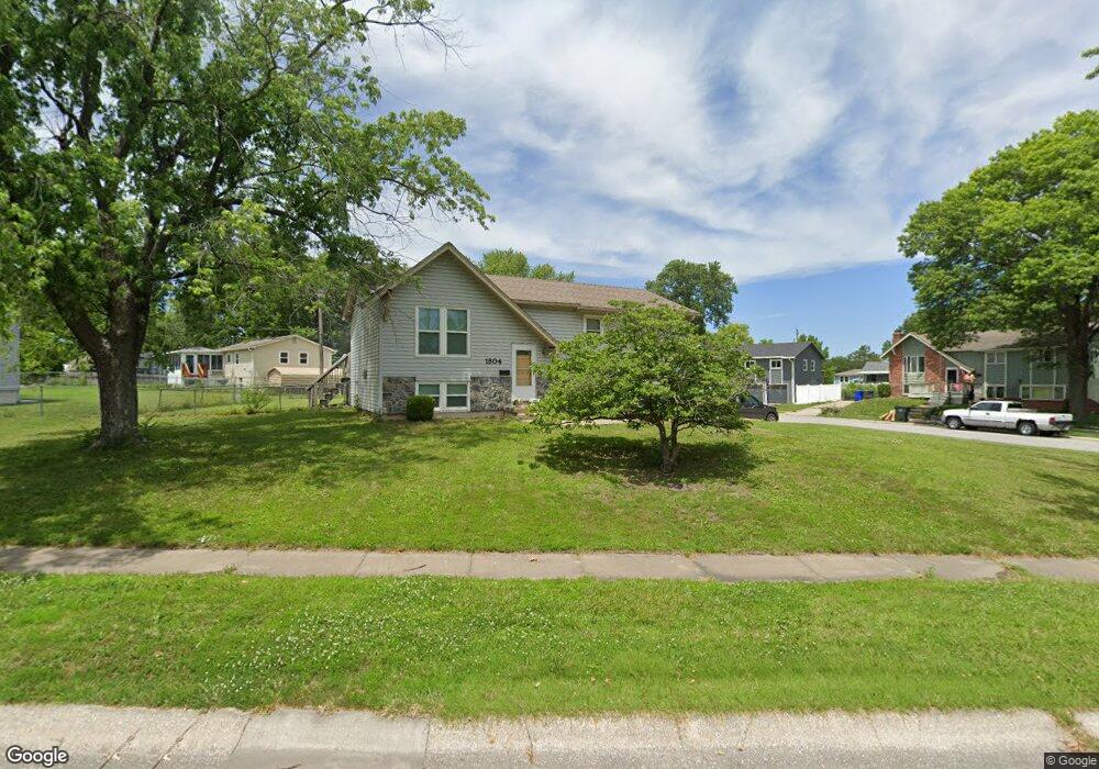
1804 W Ferrel Dr Olathe, KS 66061
Estimated Value: $294,123 - $318,000
3
Beds
2
Baths
1,008
Sq Ft
$301/Sq Ft
Est. Value
About This Home
This home is located at 1804 W Ferrel Dr, Olathe, KS 66061 and is currently estimated at $303,031, approximately $300 per square foot. 1804 W Ferrel Dr is a home located in Johnson County with nearby schools including Rolling Ridge Elementary School, Oregon Trail Middle School, and Olathe West High School.
Ownership History
Date
Name
Owned For
Owner Type
Purchase Details
Closed on
Jul 18, 2001
Sold by
Hopkins Kyle D and Hopkins Christi R
Bought by
Deeds Glenn E and Muro Rebecca J
Current Estimated Value
Home Financials for this Owner
Home Financials are based on the most recent Mortgage that was taken out on this home.
Original Mortgage
$114,098
Outstanding Balance
$44,098
Interest Rate
7.18%
Mortgage Type
FHA
Estimated Equity
$258,933
Create a Home Valuation Report for This Property
The Home Valuation Report is an in-depth analysis detailing your home's value as well as a comparison with similar homes in the area
Home Values in the Area
Average Home Value in this Area
Purchase History
| Date | Buyer | Sale Price | Title Company |
|---|---|---|---|
| Deeds Glenn E | -- | Chicago Title Insurance Co |
Source: Public Records
Mortgage History
| Date | Status | Borrower | Loan Amount |
|---|---|---|---|
| Open | Deeds Glenn E | $114,098 |
Source: Public Records
Tax History Compared to Growth
Tax History
| Year | Tax Paid | Tax Assessment Tax Assessment Total Assessment is a certain percentage of the fair market value that is determined by local assessors to be the total taxable value of land and additions on the property. | Land | Improvement |
|---|---|---|---|---|
| 2024 | $3,092 | $28,037 | $5,898 | $22,139 |
| 2023 | $3,126 | $27,543 | $5,366 | $22,177 |
| 2022 | $2,754 | $23,656 | $4,667 | $18,989 |
| 2021 | $2,588 | $21,068 | $4,667 | $16,401 |
| 2020 | $2,538 | $20,482 | $4,247 | $16,235 |
| 2019 | $2,398 | $19,240 | $4,247 | $14,993 |
| 2018 | $2,372 | $18,895 | $4,247 | $14,648 |
| 2017 | $2,124 | $16,779 | $3,539 | $13,240 |
| 2016 | $1,940 | $15,743 | $3,221 | $12,522 |
| 2015 | $1,890 | $15,352 | $3,221 | $12,131 |
| 2013 | -- | $14,007 | $3,221 | $10,786 |
Source: Public Records
Map
Nearby Homes
- 1952 W Ferrel Dr
- 531 S Oscar St
- 1947 W Oak St
- 233 S Chambery Dr
- 1604 W Cedar St
- 1200 W Sheridan St
- 1106 W Sheridan St
- 1545 W Park St
- 2427 W Fredrickson Dr
- 109 S Diane Dr
- 119 S Diane Dr
- 115 S Diane Dr
- 2251 W Dartmouth St
- 2255 W Dartmouth St
- 2291 W Dartmouth St
- 2295 W Dartmouth St
- 1425 W Poplar St
- 2607 W Park St
- 2651 W Park St
- 2630 W Park St
- 1808 W Ferrel Dr
- 1813 W Chambery Dr
- 1808 W Chambery Dr
- 1804 W Chambery Dr
- 1720 W Ferrel Dr
- 1818 W Ferrel Dr
- 1805 W Ferrel Dr
- 1809 W Ferrel Dr
- 1812 W Chambery Dr
- 1801 W Ferrel Dr
- 1817 W Chambery Dr
- 1813 W Ferrel Dr
- 1816 W Chambery Dr
- 1826 W Ferrel Dr
- 1721 W Ferrel Dr
- 1716 W Ferrel Dr
- 1817 W Ferrel Dr
- 1717 W Normandy St
- 1721 W Normandy Dr
- 1821 W Chambery Dr