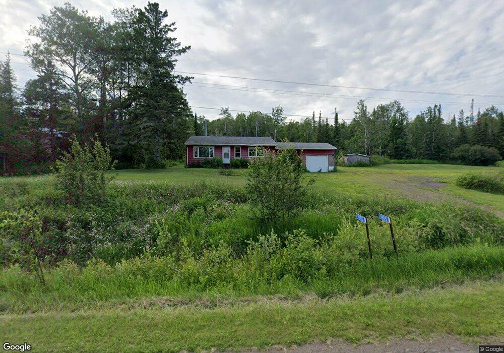
1805 Highway 61 Two Harbors, MN 55616
Estimated Value: $270,000 - $494,000
3
Beds
1
Bath
1,220
Sq Ft
$313/Sq Ft
Est. Value
About This Home
This home is located at 1805 Highway 61, Two Harbors, MN 55616 and is currently estimated at $382,000, approximately $313 per square foot. 1805 Highway 61 is a home located in Lake County with nearby schools including Minnehaha Elementary School, Two Harbors Secondary, and Northwoods Christian Academy.
Ownership History
Date
Name
Owned For
Owner Type
Purchase Details
Closed on
Jan 26, 2016
Sold by
Luchsinger Donna J and Luchsinger Lynn A
Bought by
Rasmussen Well Drilling Inc
Current Estimated Value
Home Financials for this Owner
Home Financials are based on the most recent Mortgage that was taken out on this home.
Original Mortgage
$52,959
Interest Rate
3.93%
Mortgage Type
Commercial
Create a Home Valuation Report for This Property
The Home Valuation Report is an in-depth analysis detailing your home's value as well as a comparison with similar homes in the area
Home Values in the Area
Average Home Value in this Area
Purchase History
| Date | Buyer | Sale Price | Title Company |
|---|---|---|---|
| Rasmussen Well Drilling Inc | $65,000 | Attorney |
Source: Public Records
Mortgage History
| Date | Status | Borrower | Loan Amount |
|---|---|---|---|
| Closed | Rasmussen Well Drilling Inc | $52,959 |
Source: Public Records
Tax History Compared to Growth
Tax History
| Year | Tax Paid | Tax Assessment Tax Assessment Total Assessment is a certain percentage of the fair market value that is determined by local assessors to be the total taxable value of land and additions on the property. | Land | Improvement |
|---|---|---|---|---|
| 2025 | $1,024 | $181,300 | $36,000 | $145,300 |
| 2024 | $674 | $163,200 | $36,100 | $127,100 |
| 2023 | $698 | $164,600 | $35,200 | $129,400 |
| 2022 | $900 | $154,600 | $31,800 | $122,800 |
| 2021 | $860 | $100,000 | $31,800 | $68,200 |
| 2020 | $752 | $95,200 | $31,800 | $63,400 |
| 2019 | $626 | $66,100 | $22,200 | $43,900 |
| 2018 | $649 | $66,100 | $22,200 | $43,900 |
| 2017 | $639 | $66,900 | $22,300 | $44,600 |
| 2016 | $558 | $70,200 | $25,000 | $45,200 |
| 2015 | $604 | $61,000 | $23,800 | $37,200 |
| 2014 | $604 | $0 | $0 | $0 |
| 2013 | $121 | $0 | $0 | $0 |
| 2012 | $152 | $0 | $0 | $0 |
Source: Public Records
Map
Nearby Homes
- 1928 Loop Rd
- 1690 Highway 61
- 1768 Stewart River Rd
- 1563 Highway 61
- 2202 Fors Rd
- 1621 #71 Superior Shores Unit 1/8 fractional owner
- 1611 #57B Superior Shores Unit 1/8 Interval Ownersh
- 1603 Superior Shores Dr Unit 49
- 1624 #85 Superior Shores Unit 1/8 fractional owner
- 1594 Superior Shores Dr Unit 111
- 1621 Superior Shores Dr Unit 71
- 1567 Superior Shores Dr Unit 27
- 1555 Superior Shores Dr Unit 15
- 1611 Superior Shores Dr Unit 57B
- 1611 Superior Shores Dr Unit 57A
- 1871 Highway 2
- 2036 Highway 2
- 1412 #5-302a Burlington Rd
- 1412 #5-202a Burlington Rd
- 1412 #5-404a Burlington Rd
- 1805 Highway 61
- 1793 Highway 61
- 1809 Highway 61
- 1809 Highway 61
- 1809 Highway 61
- 1809 Highway 61
- 1809 Highway 61
- 1809 Highway 61
- 1809 Highway 61
- 1809 Highway 61
- 1809 Highway 61
- 1809 Highway 61
- 1809 Highway 61
- 1809 Highway 61
- 1809 Highway 61
- 1795 Highway 61
- 1808 Highway 61 Unit & 1810
- 1808 Highway 61
- 1798 Highway 61
- 1802 Highway 61