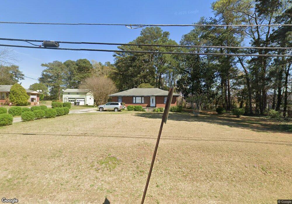
181 Daniel Dr Stockbridge, GA 30281
Estimated Value: $187,000 - $242,000
3
Beds
1
Bath
1,170
Sq Ft
$183/Sq Ft
Est. Value
About This Home
This home is located at 181 Daniel Dr, Stockbridge, GA 30281 and is currently estimated at $214,360, approximately $183 per square foot. 181 Daniel Dr is a home located in Henry County with nearby schools including Stockbridge Elementary School, Smith-Barnes Elementary School, and Stockbridge Middle School.
Ownership History
Date
Name
Owned For
Owner Type
Purchase Details
Closed on
Dec 16, 2024
Sold by
Lucksim Investor Llc
Bought by
K3 Land Investment Group Llc
Current Estimated Value
Purchase Details
Closed on
Apr 21, 2021
Sold by
Dozier Martha Dean Estate
Bought by
Lucksim Investor Llc
Purchase Details
Closed on
May 5, 2009
Sold by
Flagstar Bank Fsb
Bought by
Hud & Housing Of Urban Dev
Create a Home Valuation Report for This Property
The Home Valuation Report is an in-depth analysis detailing your home's value as well as a comparison with similar homes in the area
Home Values in the Area
Average Home Value in this Area
Purchase History
| Date | Buyer | Sale Price | Title Company |
|---|---|---|---|
| K3 Land Investment Group Llc | -- | -- | |
| Lucksim Investor Llc | -- | -- | |
| Lucksim Investor Llc | $180,000 | -- | |
| Hud & Housing Of Urban Dev | -- | -- | |
| Flagstar Bank Fsb | $140,962 | -- |
Source: Public Records
Tax History Compared to Growth
Tax History
| Year | Tax Paid | Tax Assessment Tax Assessment Total Assessment is a certain percentage of the fair market value that is determined by local assessors to be the total taxable value of land and additions on the property. | Land | Improvement |
|---|---|---|---|---|
| 2025 | $3,226 | $74,040 | $14,400 | $59,640 |
| 2024 | $3,226 | $70,480 | $14,400 | $56,080 |
| 2023 | $2,984 | $66,760 | $9,600 | $57,160 |
| 2022 | $2,196 | $50,480 | $7,680 | $42,800 |
| 2021 | $1,642 | $35,920 | $7,200 | $28,720 |
| 2020 | $1,560 | $33,760 | $7,200 | $26,560 |
| 2019 | $1,403 | $31,920 | $7,200 | $24,720 |
| 2018 | $332 | $25,360 | $7,200 | $18,160 |
| 2016 | $271 | $21,240 | $7,200 | $14,040 |
| 2015 | -- | $17,400 | $7,520 | $9,880 |
| 2014 | -- | $13,000 | $5,000 | $8,000 |
Source: Public Records
Map
Nearby Homes
- 0 Daniel Dr Unit 10628491
- 0 Hwy 138 Unit 7635399
- 0 Hwy 138 Unit 13974666
- 0 Hwy 138 Unit 10587482
- 157 Black Forest Trail
- 164 Adrian Dr
- 246 Old Atlanta Rd
- 425 Cannonball Ct
- 677 Armitage Way
- 225 Hillandale Dr
- 5005 Kens Ct
- 3465 Narrow Creek Ct
- 3460 Mount Zion Rd
- 173 Brush Creek Ct
- 101 Valleydale Dr
- 193 Brush Creek Ct
- 197 Brush Creek Ct
- 1120 Northern Run
- 7027 Biscayne Blvd
- 201 Brush Creek Ct
- 169 Daniel Dr
- 157 Daniel Dr
- 155 Spivey Chase Trail
- 147 Daniel Dr
- 110 Highway 138 W
- 101 Daniel Dr
- 89 Daniel Dr
- 7404 Davidson Cir E Unit 316
- 7404 Davidson Cir E Unit 251
- 7404 Davidson Cir E Unit 255
- 79 Daniel Dr
- 72 Georgia 138
- 72 Highway 138 W
- 7420 Davidson Cir E
- 108 Daniel Dr
- 0 Davidson Cir E
- 96 Daniel Dr
- 80 Daniel Dr
- 27 Dobbins Dr
- 0 Davidson Pkwy S Unit 7472134