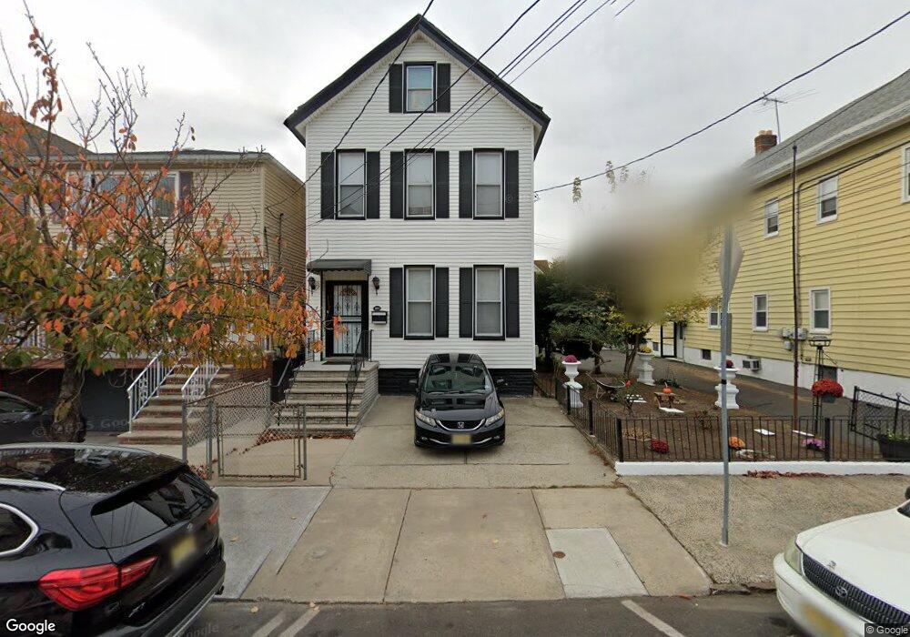
181 Pearsall Ave Jersey City, NJ 07305
Greenville NeighborhoodEstimated Value: $509,000 - $739,000
4
Beds
--
Bath
1,765
Sq Ft
$345/Sq Ft
Est. Value
About This Home
This home is located at 181 Pearsall Ave, Jersey City, NJ 07305 and is currently estimated at $608,605, approximately $344 per square foot. 181 Pearsall Ave is a home located in Hudson County with nearby schools including Number 20 Elementary School, Ezra L. Nolan Middle School, and Henry Snyder High School.
Ownership History
Date
Name
Owned For
Owner Type
Purchase Details
Closed on
Dec 13, 2004
Sold by
Carter John H and Carter Carol
Bought by
George Jacqueline and Mckinnie Venissa
Current Estimated Value
Home Financials for this Owner
Home Financials are based on the most recent Mortgage that was taken out on this home.
Original Mortgage
$39,750
Outstanding Balance
$20,056
Interest Rate
5.74%
Mortgage Type
Credit Line Revolving
Estimated Equity
$588,549
Purchase Details
Closed on
Aug 19, 1997
Sold by
Forrester Donald and Forrester Colleen
Bought by
Carter John H and Carter Carol
Home Financials for this Owner
Home Financials are based on the most recent Mortgage that was taken out on this home.
Original Mortgage
$95,000
Interest Rate
7.42%
Mortgage Type
VA
Create a Home Valuation Report for This Property
The Home Valuation Report is an in-depth analysis detailing your home's value as well as a comparison with similar homes in the area
Home Values in the Area
Average Home Value in this Area
Purchase History
| Date | Buyer | Sale Price | Title Company |
|---|---|---|---|
| George Jacqueline | $265,000 | -- | |
| Carter John H | $95,000 | -- |
Source: Public Records
Mortgage History
| Date | Status | Borrower | Loan Amount |
|---|---|---|---|
| Open | George Jacqueline | $39,750 | |
| Open | George Jacqueline | $212,000 | |
| Previous Owner | Carter John H | $95,000 |
Source: Public Records
Tax History Compared to Growth
Tax History
| Year | Tax Paid | Tax Assessment Tax Assessment Total Assessment is a certain percentage of the fair market value that is determined by local assessors to be the total taxable value of land and additions on the property. | Land | Improvement |
|---|---|---|---|---|
| 2025 | $5,446 | $243,900 | $85,000 | $158,900 |
| 2024 | $5,480 | $243,900 | $85,000 | $158,900 |
| 2023 | $5,480 | $243,900 | $85,000 | $158,900 |
| 2022 | $5,166 | $243,900 | $85,000 | $158,900 |
| 2021 | $3,912 | $243,900 | $85,000 | $158,900 |
| 2020 | $3,927 | $243,900 | $85,000 | $158,900 |
| 2019 | $3,756 | $243,900 | $85,000 | $158,900 |
| 2018 | $1,109 | $243,900 | $85,000 | $158,900 |
| 2017 | $5,811 | $74,500 | $10,000 | $64,500 |
| 2016 | $5,737 | $74,500 | $10,000 | $64,500 |
| 2015 | $5,574 | $74,500 | $10,000 | $64,500 |
| 2014 | $5,538 | $74,500 | $10,000 | $64,500 |
Source: Public Records
Map
Nearby Homes
- 171 Old Bergen Rd Unit 201
- 171 Old Bergen Rd Unit 1
- 203 Pearsall Ave
- 207 Pearsall Ave
- 167 Pearsall Ave
- 86 Bartholdi Ave
- 187 Linden Ave
- 231 Old Bergen Rd
- 236 Old Bergen Rd
- 195 Winfield Ave
- 212 Linden Ave
- 76 Greenville Ave
- 22 Bartholdi Ave
- 1677 John F. Kennedy Blvd Unit 10
- 166 Cator Ave
- 94A Linden Ave
- 87 Linden Ave
- 1709 John F. Kennedy Blvd
- 181 Bartholdi Ave Unit 2
- 115 Winfield Ave
- 179 Pearsall Ave
- 185 Pearsall Ave
- 185 Pearsall Ave Unit 2
- 177 Pearsall Ave
- 175 Pearsall Ave
- 187 Pearsall Ave
- 187 Pearsall Ave Unit 1
- 187 Pearsall Ave Unit 2
- 86 Bartholdi Ave Unit 2
- 80 Bartholdi Ave
- 189 Pearsall Ave
- 189 Pearsall Ave Unit 2
- 88 Bartholdi Ave
- 171 Pearsall Ave
- 191 Pearsall Ave
- 78 Bartholdi Ave
- 180 Pearsall Ave
- 92 Bartholdi Ave
- 92 Bartholdi Ave Unit 2
- 182 Pearsall Ave