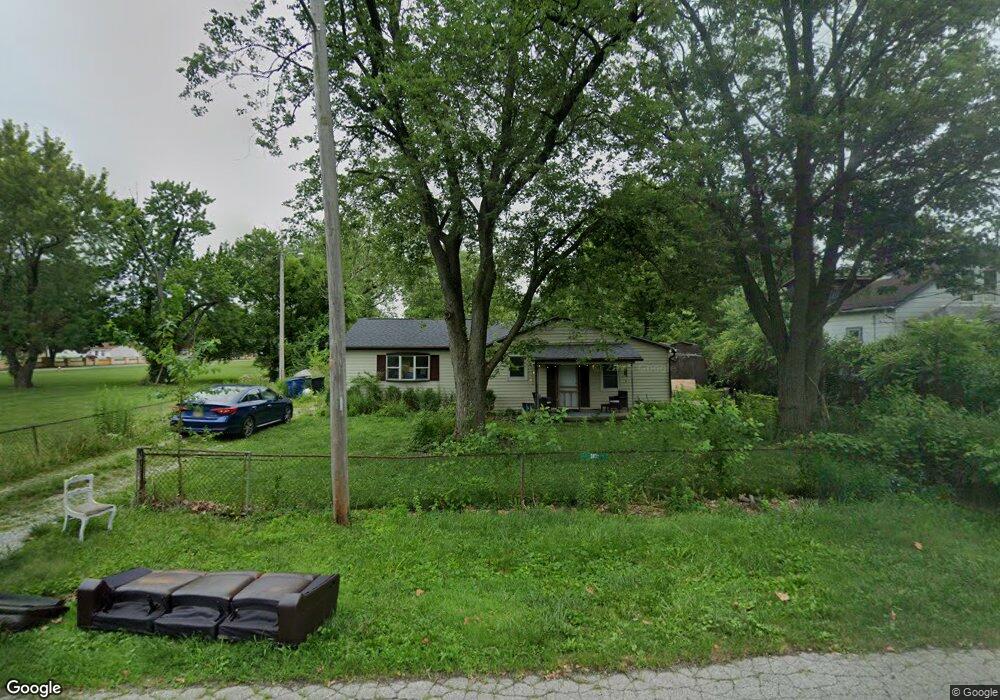
1810 Barnett Rd Columbus, OH 43227
Linwood NeighborhoodEstimated Value: $116,000 - $205,000
3
Beds
1
Bath
1,352
Sq Ft
$123/Sq Ft
Est. Value
About This Home
This home is located at 1810 Barnett Rd, Columbus, OH 43227 and is currently estimated at $166,667, approximately $123 per square foot. 1810 Barnett Rd is a home located in Franklin County with nearby schools including Scottwood Elementary School, Johnson Park Middle School, and Walnut Ridge High School.
Ownership History
Date
Name
Owned For
Owner Type
Purchase Details
Closed on
May 25, 2022
Sold by
Hostin Thomas M and Hostin Juana M
Bought by
Legacy Home Investments Llc
Current Estimated Value
Home Financials for this Owner
Home Financials are based on the most recent Mortgage that was taken out on this home.
Original Mortgage
$125,000
Interest Rate
4.43%
Mortgage Type
Construction
Purchase Details
Closed on
Jan 20, 1987
Bought by
Hostin Thomas M and Hostin Juana M
Purchase Details
Closed on
Mar 1, 1979
Create a Home Valuation Report for This Property
The Home Valuation Report is an in-depth analysis detailing your home's value as well as a comparison with similar homes in the area
Home Values in the Area
Average Home Value in this Area
Purchase History
| Date | Buyer | Sale Price | Title Company |
|---|---|---|---|
| Legacy Home Investments Llc | $92,000 | Bridge Title & Escrow Services | |
| Hostin Thomas M | $29,900 | -- | |
| -- | $22,500 | -- |
Source: Public Records
Mortgage History
| Date | Status | Borrower | Loan Amount |
|---|---|---|---|
| Closed | Legacy Home Investments Llc | $125,000 |
Source: Public Records
Tax History Compared to Growth
Tax History
| Year | Tax Paid | Tax Assessment Tax Assessment Total Assessment is a certain percentage of the fair market value that is determined by local assessors to be the total taxable value of land and additions on the property. | Land | Improvement |
|---|---|---|---|---|
| 2024 | $2,010 | $43,860 | $16,840 | $27,020 |
| 2023 | $1,985 | $43,855 | $16,835 | $27,020 |
| 2022 | $1,560 | $30,070 | $12,390 | $17,680 |
| 2021 | $1,562 | $30,070 | $12,390 | $17,680 |
| 2020 | $1,564 | $30,070 | $12,390 | $17,680 |
| 2019 | $1,501 | $24,750 | $10,330 | $14,420 |
| 2018 | $1,081 | $24,750 | $10,330 | $14,420 |
| 2017 | $997 | $24,750 | $10,330 | $14,420 |
| 2016 | $974 | $14,700 | $5,320 | $9,380 |
| 2015 | $884 | $14,700 | $5,320 | $9,380 |
| 2014 | $886 | $14,700 | $5,320 | $9,380 |
| 2013 | $643 | $21,630 | $5,915 | $15,715 |
Source: Public Records
Map
Nearby Homes
- 3325 E Deshler Ave
- 3246 E Deshler Ave
- 1664 Barnett Rd
- 1624 Miltwood Rd
- 1778 Quigley Rd
- 1836 Penfield Ct S
- 1637 S James Rd
- 1782 Newfield Rd
- 3038 Wadsworth Ct
- 3036 Wadsworth Ct
- 2844 Kingsrowe Ct Unit 27
- 2894 Landon Dr
- 3084 Clermont Rd
- 2846 Petzinger Rd Unit 70
- 2903 Scottwood Rd
- 1677 Kenview Rd
- 2810 Kingsrowe Ct Unit 13
- 2275 Cardston Ct
- 3566 Seabrook Ave
- 1304 Byron Ave
- 1816 Barnett Rd
- 1840 Barnett Rd
- 3601 Bexvie Ave
- 3550 Bexvie Ave
- 3262 Penfield Rd
- 3256 Penfield Rd
- 3270 Penfield Rd
- 3276 Penfield Rd
- 1834 Barnett Rd
- 3282 Penfield Rd
- 3496 Bexvie Ave
- 3232 Penfield Rd
- 3625 Bexvie Ave
- 3288 Penfield Rd
- 3296 Penfield Rd
- 3226 Penfield Rd
- 1864 Barnett Rd
- 1712 Barnett Rd
- 3631 Bexvie Ave
- 3302 Penfield Rd