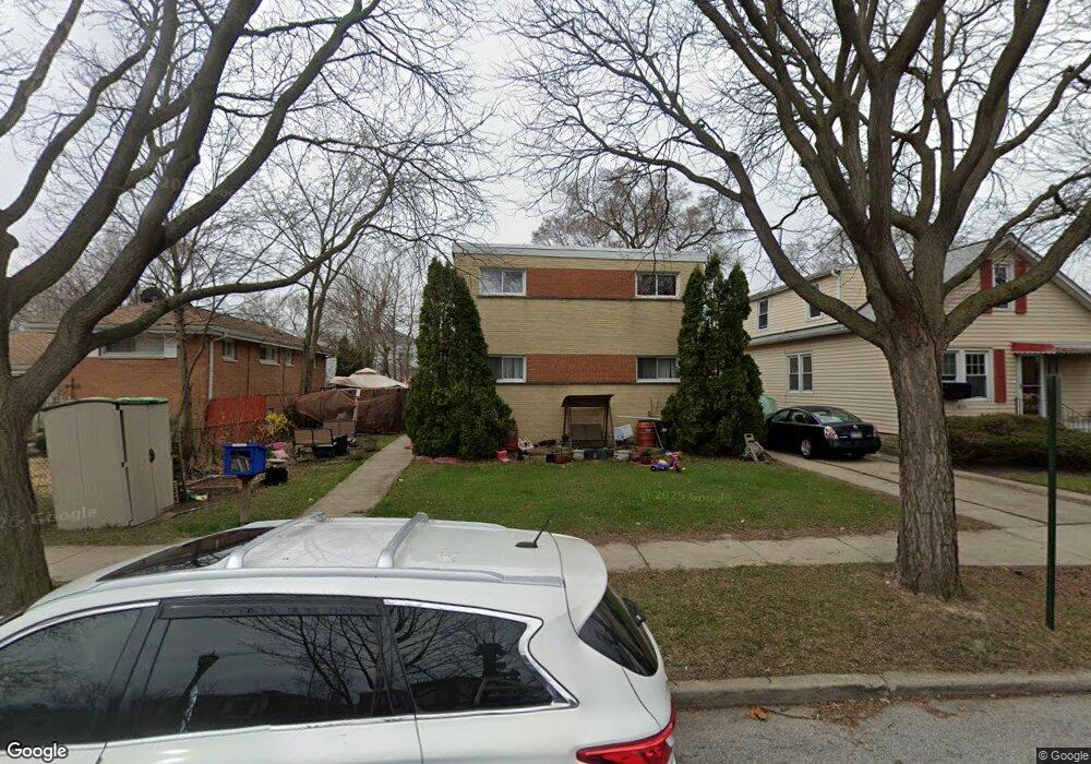
1810 Laurel Ave Unit 1 Evanston, IL 60201
West Evanston NeighborhoodEstimated Value: $361,411 - $370,000
4
Beds
3
Baths
1,400
Sq Ft
$262/Sq Ft
Est. Value
About This Home
This home is located at 1810 Laurel Ave Unit 1, Evanston, IL 60201 and is currently estimated at $366,353, approximately $261 per square foot. 1810 Laurel Ave Unit 1 is a home located in Cook County with nearby schools including Lincolnwood Elementary School, Haven Middle School, and Evanston Township High School.
Ownership History
Date
Name
Owned For
Owner Type
Purchase Details
Closed on
Jan 4, 2011
Sold by
The Bank Of New York Mellon
Bought by
Walker Toly
Current Estimated Value
Home Financials for this Owner
Home Financials are based on the most recent Mortgage that was taken out on this home.
Original Mortgage
$129,628
Interest Rate
4.67%
Mortgage Type
FHA
Purchase Details
Closed on
Dec 15, 2009
Sold by
Ailutoaei Catalin and Otara Nora
Bought by
The Bank Of New York Mellon and The Bank Of New York
Purchase Details
Closed on
Dec 26, 2006
Sold by
Stib Susan
Bought by
Ailutoaei Catalin
Home Financials for this Owner
Home Financials are based on the most recent Mortgage that was taken out on this home.
Original Mortgage
$68,900
Interest Rate
6.16%
Mortgage Type
Stand Alone Second
Create a Home Valuation Report for This Property
The Home Valuation Report is an in-depth analysis detailing your home's value as well as a comparison with similar homes in the area
Home Values in the Area
Average Home Value in this Area
Purchase History
| Date | Buyer | Sale Price | Title Company |
|---|---|---|---|
| Walker Toly | $119,000 | None Available | |
| The Bank Of New York Mellon | -- | None Available | |
| Ailutoaei Catalin | $344,500 | Pntn |
Source: Public Records
Mortgage History
| Date | Status | Borrower | Loan Amount |
|---|---|---|---|
| Previous Owner | Walker Toly | $129,628 | |
| Previous Owner | Ailutoaei Catalin | $68,900 | |
| Previous Owner | Ailutoaei Catalin | $275,600 |
Source: Public Records
Tax History Compared to Growth
Tax History
| Year | Tax Paid | Tax Assessment Tax Assessment Total Assessment is a certain percentage of the fair market value that is determined by local assessors to be the total taxable value of land and additions on the property. | Land | Improvement |
|---|---|---|---|---|
| 2024 | $6,218 | $29,000 | $3,500 | $25,500 |
| 2023 | $5,942 | $29,000 | $3,500 | $25,500 |
| 2022 | $5,942 | $29,000 | $3,500 | $25,500 |
| 2021 | $3,555 | $16,726 | $4,244 | $12,482 |
| 2020 | $3,567 | $16,726 | $4,244 | $12,482 |
| 2019 | $4,394 | $18,752 | $4,244 | $14,508 |
| 2018 | $4,405 | $16,077 | $3,473 | $12,604 |
| 2017 | $4,290 | $16,077 | $3,473 | $12,604 |
| 2016 | $4,069 | $16,077 | $3,473 | $12,604 |
| 2015 | $3,946 | $14,716 | $2,990 | $11,726 |
| 2014 | $3,908 | $14,716 | $2,990 | $11,726 |
| 2013 | $3,818 | $14,716 | $2,990 | $11,726 |
Source: Public Records
Map
Nearby Homes
- 1808 Laurel Ave
- 2309 Foster St
- 2211 Foster St
- 2122 Foster St
- 1832 Hovland Ct
- 1718 Hovland Ct
- 1801 Brown Ave
- 1633 Mcdaniel Ave
- 2022 Mcdaniel Ave
- 1940 Dodge Ave
- 2025 Bennett Ave
- 1739 Dodge Ave
- 9353 Ewing Ave
- 1801 Lyons St
- 9237 Forestview Rd
- 1918 Noyes St
- 1617 Church St
- 2113 Forestview Rd
- 3500 Church St Unit 104
- 9047 Forestview Rd
- 1810 Laurel Ave
- 1814 Laurel Ave
- 1812 Laurel Ave
- 1812 Laurel Ave Unit 2
- 1818 Laurel Ave
- 1820 Laurel Ave
- 1800 Laurel Ave
- 1822 Laurel Ave
- 1811 Laurel Ave
- 1813 Laurel Ave
- 1809 Laurel Ave
- 1815 Laurel Ave
- 2219 Lyons St
- 1807 Laurel Ave
- 1826 Laurel Ave
- 1819 Laurel Ave
- 1811 Lemar Ave
- 1815 Lemar Ave
- 1821 Laurel Ave
- 2217 Lyons St