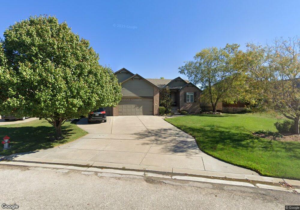
1810 N Peckham Cir Wichita, KS 67230
Estimated Value: $440,078 - $534,000
3
Beds
2
Baths
1,802
Sq Ft
$270/Sq Ft
Est. Value
About This Home
This home is located at 1810 N Peckham Cir, Wichita, KS 67230 and is currently estimated at $487,039, approximately $270 per square foot. 1810 N Peckham Cir is a home located in Sedgwick County with nearby schools including Wheatland Elementary School, Andover Middle School, and Andover High School.
Ownership History
Date
Name
Owned For
Owner Type
Purchase Details
Closed on
Nov 22, 2005
Sold by
Sharp Construction Of Augusta Inc
Bought by
Goertzen Kreg W and Goertzen Brenda K
Current Estimated Value
Home Financials for this Owner
Home Financials are based on the most recent Mortgage that was taken out on this home.
Original Mortgage
$24,208
Interest Rate
6.12%
Mortgage Type
Stand Alone Second
Create a Home Valuation Report for This Property
The Home Valuation Report is an in-depth analysis detailing your home's value as well as a comparison with similar homes in the area
Home Values in the Area
Average Home Value in this Area
Purchase History
| Date | Buyer | Sale Price | Title Company |
|---|---|---|---|
| Goertzen Kreg W | -- | None Available |
Source: Public Records
Mortgage History
| Date | Status | Borrower | Loan Amount |
|---|---|---|---|
| Closed | Goertzen Kreg W | $24,208 | |
| Open | Goertzen Kreg W | $192,976 |
Source: Public Records
Tax History Compared to Growth
Tax History
| Year | Tax Paid | Tax Assessment Tax Assessment Total Assessment is a certain percentage of the fair market value that is determined by local assessors to be the total taxable value of land and additions on the property. | Land | Improvement |
|---|---|---|---|---|
| 2025 | $5,077 | $43,701 | $11,719 | $31,982 |
| 2024 | $5,077 | $40,837 | $9,212 | $31,625 |
| 2023 | $5,077 | $40,837 | $9,212 | $31,625 |
| 2022 | $4,930 | $38,284 | $8,694 | $29,590 |
| 2021 | $4,175 | $31,982 | $4,899 | $27,083 |
| 2020 | $5,034 | $31,982 | $4,899 | $27,083 |
| 2019 | $5,374 | $30,176 | $4,899 | $25,277 |
| 2018 | $5,716 | $31,994 | $4,727 | $27,267 |
| 2017 | $5,514 | $0 | $0 | $0 |
| 2016 | $5,256 | $0 | $0 | $0 |
| 2015 | $5,115 | $0 | $0 | $0 |
| 2014 | $5,081 | $0 | $0 | $0 |
Source: Public Records
Map
Nearby Homes
- 1918 N Peckham St
- 13121 E Tallowood Dr
- 13906 E Rockhill St
- 2306 N Lindsay Cir
- 12740 E Bradford Cir
- 1934 N Castle Rock Ct
- 1315 N White Tail Ct
- 1501 N Castle Rock St
- 1701 N Split Rail St
- 12610 E Meadow Ct
- 2445 N 127th Ct E
- 13720 E Saint Andrews Place
- 2425 N Woodridge Ct
- 1162 N Woodridge Dr
- 14101 E Castle Rock St
- 14306 E Churchill Cir
- 2507 N Peckham St
- 2103 N 159th Ct E
- 2330 N Castle Rock Ct
- 1501 N Sport of Kings Ct
- 1816 N Peckham Cir
- 13109 E Bridlewood Ct
- 1822 N Peckham Cir
- 13105 E Bridlewood Ct
- 1815 N Peckham Cir
- 13101 E Bridlewood Ct
- 13113 E Bridlewood Ct
- 1809 N Peckham Cir
- 1803 N Peckham Cir
- 1828 N Peckham St
- 13016 E Bridlewood St
- 13110 E Bridlewood St
- 13125 E Bridlewood Ct
- 13117 E Bridlewood Ct
- 13116 E Bridlewood St
- 13129 E Bridlewood Ct
- 1827 N Peckham Ct
- 1902 N Peckham St
- 13122 E Bridlewood St
- 1831 N Peckham Ct