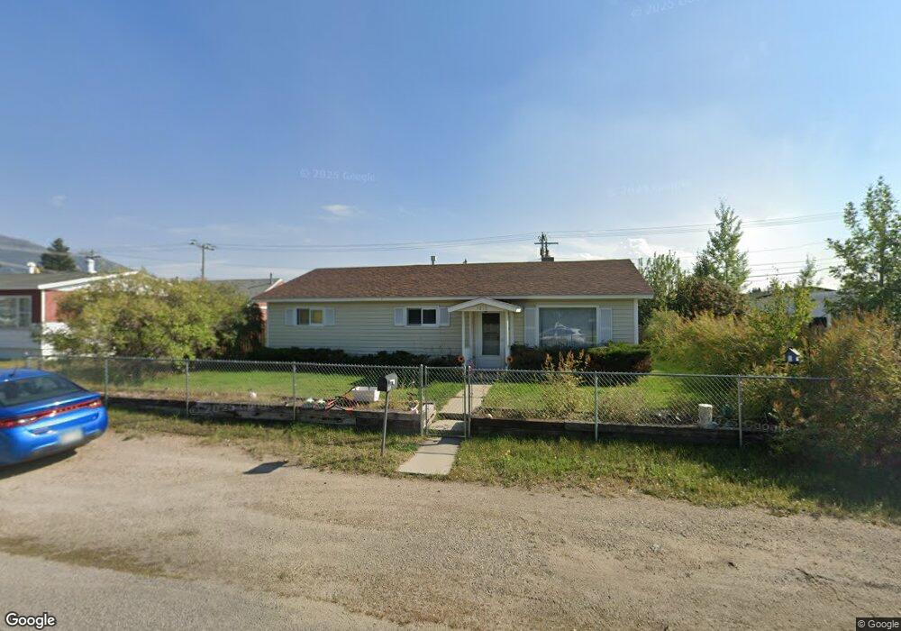
1810 Sampson St Butte, MT 59701
Bellevue NeighborhoodEstimated Value: $261,000 - $291,972
3
Beds
1
Bath
1,176
Sq Ft
$239/Sq Ft
Est. Value
About This Home
This home is located at 1810 Sampson St, Butte, MT 59701 and is currently estimated at $280,743, approximately $238 per square foot. 1810 Sampson St is a home located in Silver Bow County with nearby schools including Margaret Leary School, East Middle School, and Butte High School.
Ownership History
Date
Name
Owned For
Owner Type
Purchase Details
Closed on
May 9, 2018
Sold by
Kelly Carol J
Bought by
Crain Donald C
Current Estimated Value
Home Financials for this Owner
Home Financials are based on the most recent Mortgage that was taken out on this home.
Original Mortgage
$122,735
Outstanding Balance
$105,921
Interest Rate
4.5%
Mortgage Type
FHA
Estimated Equity
$174,822
Create a Home Valuation Report for This Property
The Home Valuation Report is an in-depth analysis detailing your home's value as well as a comparison with similar homes in the area
Home Values in the Area
Average Home Value in this Area
Purchase History
| Date | Buyer | Sale Price | Title Company |
|---|---|---|---|
| Crain Donald C | -- | None Available |
Source: Public Records
Mortgage History
| Date | Status | Borrower | Loan Amount |
|---|---|---|---|
| Open | Crain Donald C | $122,735 |
Source: Public Records
Tax History
| Year | Tax Paid | Tax Assessment Tax Assessment Total Assessment is a certain percentage of the fair market value that is determined by local assessors to be the total taxable value of land and additions on the property. | Land | Improvement |
|---|---|---|---|---|
| 2025 | $2,126 | $272,400 | $0 | $0 |
| 2024 | $2,467 | $222,700 | $0 | $0 |
| 2023 | $2,464 | $222,700 | $0 | $0 |
| 2022 | $2,146 | $146,400 | $0 | $0 |
| 2021 | $1,623 | $146,400 | $0 | $0 |
| 2020 | $2,100 | $133,377 | $0 | $0 |
| 2019 | $2,095 | $133,377 | $0 | $0 |
| 2018 | $1,973 | $127,100 | $0 | $0 |
| 2017 | $1,289 | $127,100 | $0 | $0 |
| 2016 | $1,646 | $108,300 | $0 | $0 |
| 2015 | $1,142 | $108,300 | $0 | $0 |
| 2014 | $1,301 | $42,400 | $0 | $0 |
Source: Public Records
Map
Nearby Homes
- 1800 Sampson St
- 1820 Sampson St
- 1861 Sampson St
- 1845 Sampson St
- 1809 Sampson St
- 1900 Sampson St
- 1714 Sampson St
- 1715 Sampson St
- 1910 Sampson St
- 1858 Dewey Blvd
- 2907 Paxson Ave
- 1854 Dewey Blvd
- 1864 Dewey Blvd
- 1911 Sampson St
- 1850 Dewey Blvd
- 1710 Sampson St
- 1920 Sampson St
- 1705 Sampson St
- 1710 Dewey Blvd
- 1917 Sampson St
Your Personal Tour Guide
Ask me questions while you tour the home.