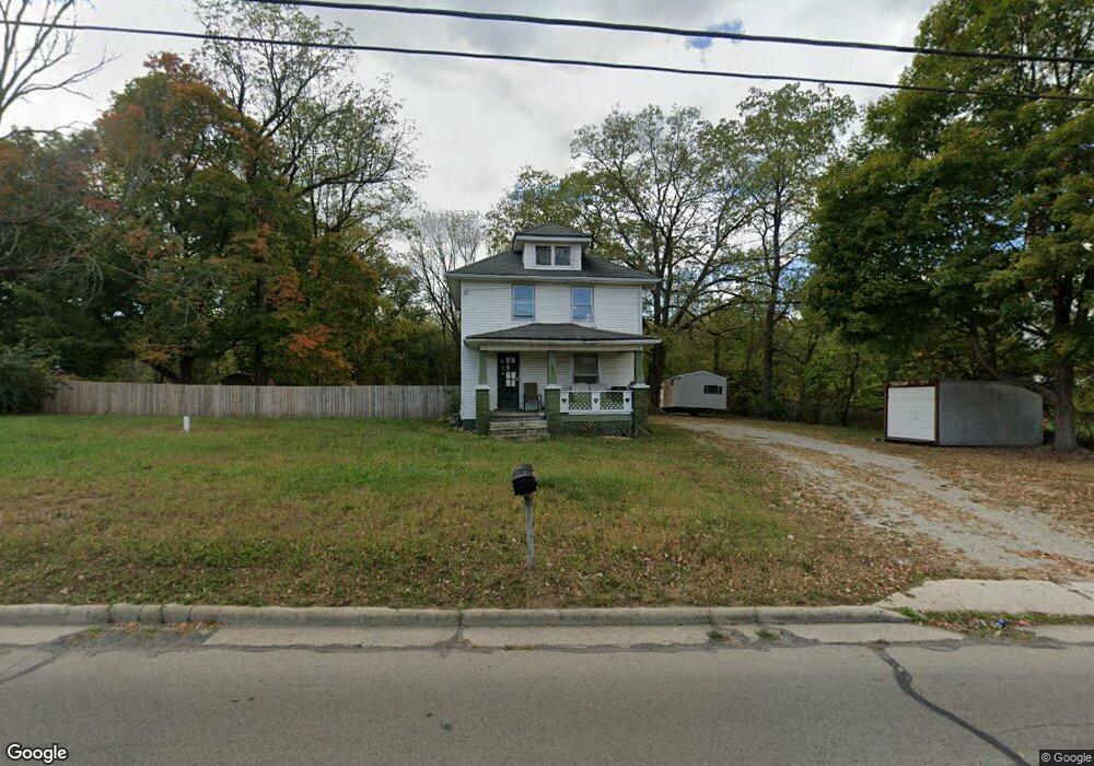
1811 S Burnett Rd Springfield, OH 45505
Estimated Value: $178,249 - $198,000
3
Beds
1
Bath
1,272
Sq Ft
$145/Sq Ft
Est. Value
About This Home
This home is located at 1811 S Burnett Rd, Springfield, OH 45505 and is currently estimated at $184,812, approximately $145 per square foot. 1811 S Burnett Rd is a home located in Clark County with nearby schools including Shawnee Middle School/High School and Springfield Preparatory & Fitness Academy.
Ownership History
Date
Name
Owned For
Owner Type
Purchase Details
Closed on
Nov 12, 2020
Sold by
White Charles
Bought by
Dornon Rita R
Current Estimated Value
Purchase Details
Closed on
Nov 2, 2020
Sold by
State Of Ohio
Bought by
Dornon Rita R
Purchase Details
Closed on
Nov 22, 2019
Sold by
Heath James E and Estate Of Steve Mougey
Bought by
Mougey Lisa
Purchase Details
Closed on
Oct 4, 2001
Sold by
Stottlemyer Erma L
Bought by
Mougey Stephen E and Mougey Lisa D
Purchase Details
Closed on
May 6, 1994
Sold by
Peck Bertha 2 and Int 5
Bought by
Mougey Steve and Mougey Lisa
Create a Home Valuation Report for This Property
The Home Valuation Report is an in-depth analysis detailing your home's value as well as a comparison with similar homes in the area
Home Values in the Area
Average Home Value in this Area
Purchase History
| Date | Buyer | Sale Price | Title Company |
|---|---|---|---|
| Dornon Rita R | $39,900 | Valmer Land Title Agency | |
| Dornon Rita R | $39,900 | Cooke Demers Llc | |
| Mougey Lisa | -- | None Available | |
| Mougey Stephen E | $40,900 | -- | |
| Mougey Steve | $19,000 | -- |
Source: Public Records
Tax History Compared to Growth
Tax History
| Year | Tax Paid | Tax Assessment Tax Assessment Total Assessment is a certain percentage of the fair market value that is determined by local assessors to be the total taxable value of land and additions on the property. | Land | Improvement |
|---|---|---|---|---|
| 2024 | $3,187 | $41,200 | $16,030 | $25,170 |
| 2023 | $2,056 | $41,200 | $16,030 | $25,170 |
| 2022 | $2,040 | $41,200 | $16,030 | $25,170 |
| 2021 | $1,768 | $31,970 | $12,420 | $19,550 |
| 2020 | $1,748 | $31,970 | $12,420 | $19,550 |
| 2019 | $1,775 | $31,970 | $12,420 | $19,550 |
| 2018 | $1,607 | $28,500 | $7,430 | $21,070 |
| 2017 | $1,646 | $28,504 | $7,434 | $21,070 |
| 2016 | $1,486 | $28,504 | $7,434 | $21,070 |
| 2015 | $1,493 | $27,692 | $7,434 | $20,258 |
| 2014 | $1,498 | $27,692 | $7,434 | $20,258 |
| 2013 | $1,302 | $27,692 | $7,434 | $20,258 |
Source: Public Records
Map
Nearby Homes
- 2218 Tanager Rd
- 2073 Stowe Dr
- 2216 Hackberry St
- 1554 S Belmont Ave
- 2605 Morton Dr
- Newcastle Plan at Sycamore Ridge
- Pendleton Plan at Sycamore Ridge
- Bellamy Plan at Sycamore Ridge
- Harmony Plan at Sycamore Ridge
- Holcombe Plan at Sycamore Ridge
- 1832 Victory Dr
- 1904 Sunset Ave
- 1915 Kenwood Ave
- 1716 N Sweetbriar Ln
- 2008 Kenton St
- 1815 Beacon St
- 1979 Kenton St
- 1630 S Sweetbriar Ln
- 1810 Kenwood Ave
- 2733 Elmore Dr
- 1821 S Burnett Rd
- 1755 S Burnett Rd
- 1737 S Burnett Rd
- 1744 S Burnett Rd
- 1736 S Burnett Rd
- 1724 S Burnett Rd
- 2604 Rocket Ave
- 1715 S Burnett Rd
- 1901 S Burnett Rd
- 2610 Rocket Ave
- 1708 S Burnett Rd
- 1713 S Burnett Rd
- 1706 S Burnett Rd
- 1649 S Burnett Rd
- 1648 S Burnett Rd
- 1641 S Burnett Rd
- 2614 Rocket Ave
- 1640 S Burnett Rd
- 1916 S Burnett Rd
- 1629 S Burnett Rd