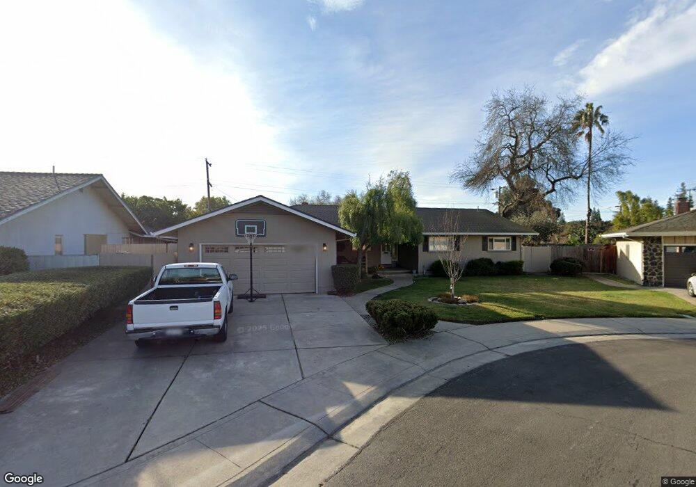
1812 Burnside Way Stockton, CA 95207
Parkwoods NeighborhoodEstimated Value: $351,000 - $549,000
3
Beds
2
Baths
1,713
Sq Ft
$281/Sq Ft
Est. Value
About This Home
This home is located at 1812 Burnside Way, Stockton, CA 95207 and is currently estimated at $481,568, approximately $281 per square foot. 1812 Burnside Way is a home located in San Joaquin County with nearby schools including Lincoln Elementary School, Sierra Middle School, and Lincoln High School.
Ownership History
Date
Name
Owned For
Owner Type
Purchase Details
Closed on
Dec 8, 2017
Sold by
Vallery Sandra and Vallery Matthew
Bought by
Vallery Karen L and Vallery Matthew
Current Estimated Value
Home Financials for this Owner
Home Financials are based on the most recent Mortgage that was taken out on this home.
Original Mortgage
$209,000
Outstanding Balance
$175,960
Interest Rate
3.94%
Mortgage Type
New Conventional
Estimated Equity
$305,608
Purchase Details
Closed on
Jan 18, 2012
Sold by
Valley Sandra
Bought by
Vallery Sandra and Vallery Matthew
Purchase Details
Closed on
Dec 21, 2010
Sold by
Conway Joan C and The Everett Conway & Joan Conw
Bought by
Vallery Sandra
Home Financials for this Owner
Home Financials are based on the most recent Mortgage that was taken out on this home.
Original Mortgage
$190,991
Interest Rate
4.75%
Mortgage Type
FHA
Create a Home Valuation Report for This Property
The Home Valuation Report is an in-depth analysis detailing your home's value as well as a comparison with similar homes in the area
Home Values in the Area
Average Home Value in this Area
Purchase History
| Date | Buyer | Sale Price | Title Company |
|---|---|---|---|
| Vallery Karen L | -- | North American Title Co Inc | |
| Vallery Sandra | $131,000 | None Available | |
| Vallery Sandra | -- | Old Republic Title Company |
Source: Public Records
Mortgage History
| Date | Status | Borrower | Loan Amount |
|---|---|---|---|
| Open | Vallery Karen L | $209,000 | |
| Previous Owner | Vallery Sandra | $190,991 |
Source: Public Records
Tax History Compared to Growth
Tax History
| Year | Tax Paid | Tax Assessment Tax Assessment Total Assessment is a certain percentage of the fair market value that is determined by local assessors to be the total taxable value of land and additions on the property. | Land | Improvement |
|---|---|---|---|---|
| 2025 | $3,557 | $251,099 | $62,772 | $188,327 |
| 2024 | $3,002 | $246,177 | $61,542 | $184,635 |
| 2023 | $2,981 | $241,351 | $60,336 | $181,015 |
| 2022 | $2,885 | $236,619 | $59,153 | $177,466 |
| 2021 | $2,848 | $231,981 | $57,994 | $173,987 |
| 2020 | $2,847 | $229,603 | $57,400 | $172,203 |
| 2019 | $2,804 | $225,102 | $56,275 | $168,827 |
| 2018 | $2,754 | $220,689 | $55,172 | $165,517 |
| 2017 | $2,699 | $216,363 | $54,091 | $162,272 |
| 2016 | $2,673 | $212,121 | $53,030 | $159,091 |
| 2014 | $2,612 | $204,844 | $51,211 | $153,633 |
Source: Public Records
Map
Nearby Homes
- 1607 Stanton Way
- 2025 W Lincoln Rd
- 1720 Mcclellan Way
- 1906 Meadow Ave
- 2140 Pennington Ct
- 7516 Brentwood Dr
- 1152 Stanton Way
- 1214 Mcclellan Way
- 7307 Woodside Dr
- 2039 W Benjamin Holt Dr
- 1703 Polk Way
- 7512 Heather Dr
- 1005 W Benjamin Holt Dr
- 2252 W Benjamin Holt Dr
- 1864 Polk Way
- 7622 Oakcreek Dr
- 1633 Porter Way
- 1489 W Swain Rd
- 1629 Porter Way
- 7709 Heather Dr
- 1751 Greeley Way
- 1804 Burnside Way
- 1820 Burnside Way
- 1743 Greeley Way
- 1759 Greeley Way
- 1819 Burnside Way
- 1735 Greeley Way
- 1811 Burnside Way
- 1750 Burnside Way
- 7013 Richmond Place
- 1764 Greeley Way
- 1727 Greeley Way
- 1748 Greeley Way
- 1818 Mcdowell Way
- 1756 Greeley Way
- 7012 Richmond Place
- 1740 Burnside Way
- 1736 Greeley Way
- 1719 Greeley Way Unit 35
- 1826 Mcdowell Way