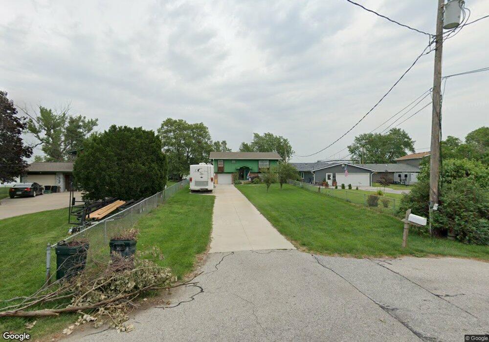
1812 Sand Point Dr Carter Lake, IA 51510
Estimated Value: $282,589 - $397,000
2
Beds
1
Bath
1,164
Sq Ft
$276/Sq Ft
Est. Value
About This Home
This home is located at 1812 Sand Point Dr, Carter Lake, IA 51510 and is currently estimated at $321,147, approximately $275 per square foot. 1812 Sand Point Dr is a home located in Pottawattamie County with nearby schools including Carter Lake Elementary School, Woodrow Wilson Middle School, and Thomas Jefferson High School.
Ownership History
Date
Name
Owned For
Owner Type
Purchase Details
Closed on
Nov 9, 2021
Sold by
Pinkerton Mary Jo and Pinkerton John R
Bought by
Pinkerton Mary Joanna and John Raymond Pinkerton Living
Current Estimated Value
Purchase Details
Closed on
Nov 8, 2021
Sold by
Jo Pinkerton Mary and Jo John R
Bought by
Mary Jo Pinkerton And John Raymond Pinkerton and Ray John
Purchase Details
Closed on
Sep 29, 2011
Sold by
Pinkerton Mary Jo and Pinkerton John R
Bought by
Pinkerton Mary Jo and Pinkerton John R
Home Financials for this Owner
Home Financials are based on the most recent Mortgage that was taken out on this home.
Original Mortgage
$128,500
Interest Rate
4.23%
Mortgage Type
New Conventional
Create a Home Valuation Report for This Property
The Home Valuation Report is an in-depth analysis detailing your home's value as well as a comparison with similar homes in the area
Home Values in the Area
Average Home Value in this Area
Purchase History
| Date | Buyer | Sale Price | Title Company |
|---|---|---|---|
| Pinkerton Mary Joanna | -- | None Available | |
| Mary Jo Pinkerton And John Raymond Pinkerton | -- | None Listed On Document | |
| Pinkerton Mary Jo | -- | Lsi |
Source: Public Records
Mortgage History
| Date | Status | Borrower | Loan Amount |
|---|---|---|---|
| Previous Owner | Pinkerton Mary Jo | $128,500 |
Source: Public Records
Tax History Compared to Growth
Tax History
| Year | Tax Paid | Tax Assessment Tax Assessment Total Assessment is a certain percentage of the fair market value that is determined by local assessors to be the total taxable value of land and additions on the property. | Land | Improvement |
|---|---|---|---|---|
| 2025 | $3,856 | $285,000 | $98,400 | $186,600 |
| 2024 | $3,856 | $259,800 | $86,900 | $172,900 |
| 2023 | $3,914 | $259,800 | $86,900 | $172,900 |
| 2022 | $3,732 | $204,000 | $76,800 | $127,200 |
| 2021 | $5,298 | $204,000 | $76,800 | $127,200 |
| 2020 | $3,162 | $157,247 | $62,767 | $94,480 |
| 2019 | $3,296 | $157,247 | $62,767 | $94,480 |
| 2018 | $3,308 | $157,247 | $62,767 | $94,480 |
| 2017 | $3,406 | $157,247 | $62,767 | $94,480 |
| 2015 | $3,370 | $157,247 | $62,767 | $94,480 |
| 2014 | $3,368 | $157,247 | $62,767 | $94,480 |
Source: Public Records
Map
Nearby Homes
- 1017 Shoal Pointe Dr
- 5111 N 13th St E
- 145 Carter Lake Club
- 1201 Avenue P
- 1317 Silver Ln
- 914 O Ave
- 1206 Redick Blvd
- Lot 1 Fort Crook Addition
- 610 Avenue Q
- 1217 Willow Dr
- 520 Coronado Cir
- 113 Shoreline Dr
- 1305 Janbrook Blvd
- 5415 N 6th Ave
- 3510 N 9th St Unit 317
- 5323 N 8th St
- 5326 N 8th St
- 3032 N 5th St
- 4744 N 13th St
- 4545 N 14th St
- 1814 Sand Point Dr
- 1810 Sand Point Dr
- 1816 Sand Point Dr
- 1818 Sand Point Dr
- 1806 Sand Point Dr
- 1902 Lagoon Dr
- 1804 Sand Point Dr
- 1904 Lagoon Dr
- 5.58 ACRES Lagoon Dr
- 1802 Sand Point Dr
- 1906 Lagoon Dr
- 1801 Lagoon Dr
- 1908 Lagoon Dr
- 1145 Waters Edge Ct
- 1140 Waters Edge Ct
- 1910 Lagoon Dr
- 17 17 & Lagoon
- 1135 Waters Edge Ct
- 1130 Waters Edge Ct Unit 1130
- 1125 Waters Edge Ct