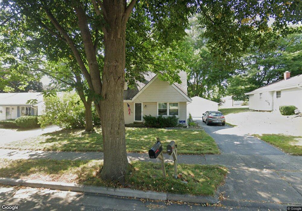
1812 Santa Barbara Dr Waukesha, WI 53189
Estimated Value: $321,479 - $352,000
3
Beds
1
Bath
1,406
Sq Ft
$240/Sq Ft
Est. Value
About This Home
This home is located at 1812 Santa Barbara Dr, Waukesha, WI 53189 and is currently estimated at $337,870, approximately $240 per square foot. 1812 Santa Barbara Dr is a home located in Waukesha County with nearby schools including Waukesha STEM Academy, Horning Middle School, and South High School.
Ownership History
Date
Name
Owned For
Owner Type
Purchase Details
Closed on
Apr 7, 2000
Sold by
Pepin Kevin C and Pepin Jane E
Bought by
Everard Bruce A and Everard Jeanne C
Current Estimated Value
Home Financials for this Owner
Home Financials are based on the most recent Mortgage that was taken out on this home.
Original Mortgage
$117,900
Outstanding Balance
$40,421
Interest Rate
8.24%
Estimated Equity
$297,449
Purchase Details
Closed on
Jul 26, 1996
Sold by
Kau Ronald L and Kau Karen A
Bought by
Pepin Kevin C and Pepin Jane E
Home Financials for this Owner
Home Financials are based on the most recent Mortgage that was taken out on this home.
Original Mortgage
$104,000
Interest Rate
7.87%
Purchase Details
Closed on
Mar 8, 1996
Sold by
Gardner Bros Const Of Wisconsin Inc
Bought by
Kau Ronald L and Kau Karen A
Create a Home Valuation Report for This Property
The Home Valuation Report is an in-depth analysis detailing your home's value as well as a comparison with similar homes in the area
Home Values in the Area
Average Home Value in this Area
Purchase History
| Date | Buyer | Sale Price | Title Company |
|---|---|---|---|
| Everard Bruce A | $131,000 | -- | |
| Pepin Kevin C | $124,000 | -- | |
| Kau Ronald L | $45,900 | -- |
Source: Public Records
Mortgage History
| Date | Status | Borrower | Loan Amount |
|---|---|---|---|
| Open | Everard Bruce A | $117,900 | |
| Previous Owner | Pepin Kevin C | $104,000 |
Source: Public Records
Tax History Compared to Growth
Tax History
| Year | Tax Paid | Tax Assessment Tax Assessment Total Assessment is a certain percentage of the fair market value that is determined by local assessors to be the total taxable value of land and additions on the property. | Land | Improvement |
|---|---|---|---|---|
| 2024 | $4,168 | $283,000 | $66,000 | $217,000 |
| 2023 | $4,046 | $283,000 | $66,000 | $217,000 |
| 2022 | $3,596 | $190,000 | $52,800 | $137,200 |
| 2021 | $3,674 | $190,000 | $52,800 | $137,200 |
| 2020 | $3,560 | $190,000 | $52,800 | $137,200 |
| 2019 | $3,443 | $190,000 | $52,800 | $137,200 |
| 2018 | $3,164 | $171,200 | $46,900 | $124,300 |
| 2017 | $3,162 | $171,200 | $46,900 | $124,300 |
| 2016 | $3,275 | $166,200 | $46,900 | $119,300 |
| 2015 | $3,257 | $166,200 | $46,900 | $119,300 |
| 2014 | $3,296 | $161,400 | $46,900 | $114,500 |
| 2013 | $3,296 | $161,400 | $46,900 | $114,500 |
Source: Public Records
Map
Nearby Homes
- 1936 Cliff Alex Ct N
- 1522 Big Bend Rd Unit G
- 414 Standing Stone Dr Unit 8-16
- 421 Standing Stone Dr Unit 17-39
- 424 Standing Stone Dr Unit 9-17
- 1432 Big Bend Rd Unit E
- 2004 Smart Ct
- 2005 Smart Ct
- 455 Standing Stone Dr
- 435 Standing Stone Dr Unit 16-37
- 605 Standing Stone Dr
- 609 Standing Stone Dr
- 625 Standing Stone Dr
- 613 Standing Stone Dr
- 621 Standing Stone Dr
- 633 Standing Stone Dr
- The Tartan Plan at The Glen at Standing Stone
- The Hawthorne Plan at The Glen at Standing Stone
- The Cypress Plan at The Glen at Standing Stone
- The Juniper Plan at The Glen at Standing Stone
- 1808 Santa Barbara Dr
- 1818 Santa Barbara Dr
- 1804 Santa Barbara Dr
- 1900 Santa Barbara Dr
- 1809 Santa Barbara Dr
- 1805 Santa Barbara Dr
- 1809 S Grand Ave
- 1817 Santa Barbara Dr
- 1821 S Grand Ave
- 1800 Santa Barbara Dr
- 1827 S Grand Ave
- 1813 Santa Barbara Dr
- 1815 S Grand Ave
- 1821 Santa Barbara Dr
- 1903 S Grand Ave
- 1711 Santa Barbara Dr
- 1904 Santa Barbara Dr
- 1901 Santa Barbara Dr
- 1708 Santa Barbara Dr
- 1909 S Grand Ave