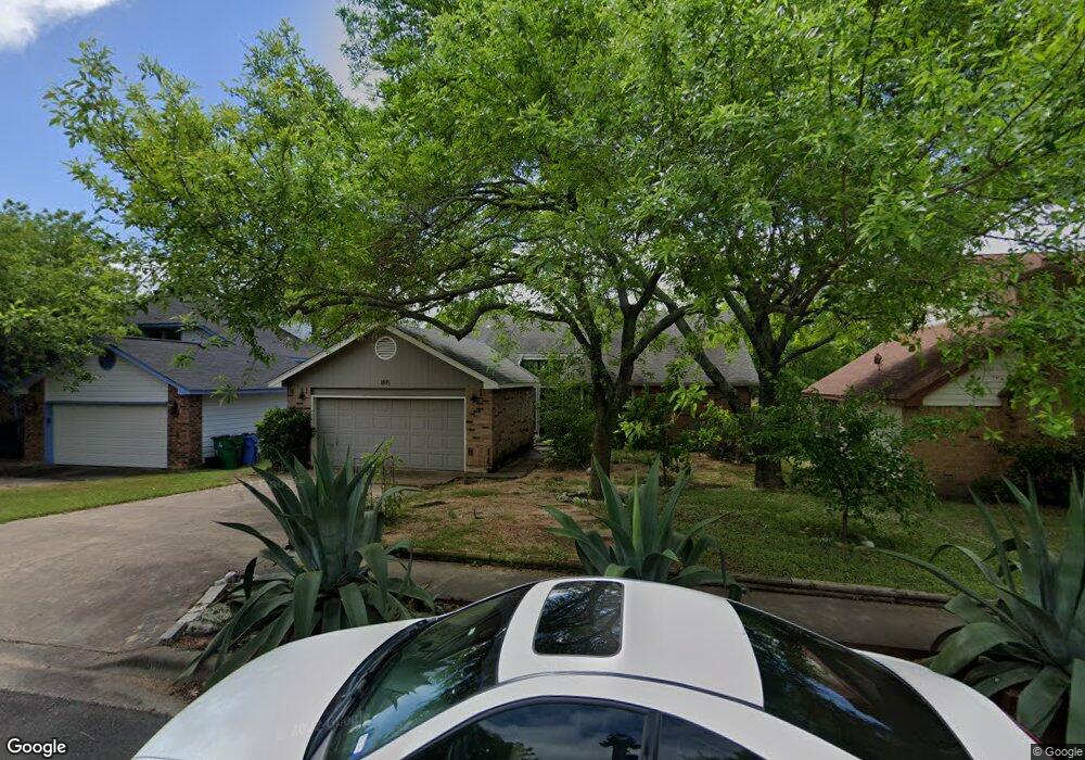
1813 Michael Wayne Dr Austin, TX 78728
Wells Branch NeighborhoodEstimated Value: $431,745 - $457,000
3
Beds
2
Baths
1,854
Sq Ft
$237/Sq Ft
Est. Value
About This Home
This home is located at 1813 Michael Wayne Dr, Austin, TX 78728 and is currently estimated at $440,186, approximately $237 per square foot. 1813 Michael Wayne Dr is a home located in Travis County with nearby schools including Northwest Elementary School, Westview Middle School, and John B Connally High School.
Ownership History
Date
Name
Owned For
Owner Type
Purchase Details
Closed on
Jul 31, 2003
Sold by
Wood Paul A and Wood Patricia E
Bought by
Riemer Jonathan A and Riemer Kari O
Current Estimated Value
Home Financials for this Owner
Home Financials are based on the most recent Mortgage that was taken out on this home.
Original Mortgage
$145,900
Outstanding Balance
$62,233
Interest Rate
5.19%
Mortgage Type
Purchase Money Mortgage
Estimated Equity
$377,953
Purchase Details
Closed on
Aug 15, 1994
Sold by
Fetterly Lawrence S and Fetterly Charlene A
Bought by
Wood Paul A and Wood Patricia E
Home Financials for this Owner
Home Financials are based on the most recent Mortgage that was taken out on this home.
Original Mortgage
$104,400
Interest Rate
8.66%
Create a Home Valuation Report for This Property
The Home Valuation Report is an in-depth analysis detailing your home's value as well as a comparison with similar homes in the area
Home Values in the Area
Average Home Value in this Area
Purchase History
| Date | Buyer | Sale Price | Title Company |
|---|---|---|---|
| Riemer Jonathan A | -- | -- | |
| Wood Paul A | -- | -- |
Source: Public Records
Mortgage History
| Date | Status | Borrower | Loan Amount |
|---|---|---|---|
| Open | Riemer Jonathan A | $145,900 | |
| Previous Owner | Wood Paul A | $104,400 |
Source: Public Records
Tax History
| Year | Tax Paid | Tax Assessment Tax Assessment Total Assessment is a certain percentage of the fair market value that is determined by local assessors to be the total taxable value of land and additions on the property. | Land | Improvement |
|---|---|---|---|---|
| 2025 | $6,288 | $431,276 | -- | -- |
| 2023 | $5,090 | $356,426 | $0 | $0 |
| 2022 | $6,704 | $324,024 | $0 | $0 |
| 2021 | $6,914 | $294,567 | $75,000 | $240,991 |
| 2020 | $6,421 | $267,788 | $75,000 | $192,788 |
| 2018 | $6,450 | $258,423 | $75,000 | $186,462 |
| 2017 | $5,924 | $234,930 | $75,000 | $165,934 |
| 2016 | $5,386 | $213,573 | $40,000 | $176,378 |
| 2015 | $4,091 | $194,157 | $40,000 | $159,330 |
| 2014 | $4,091 | $176,506 | $0 | $0 |
Source: Public Records
Map
Nearby Homes
- 1910 Margalene Way
- 1915 Margalene Way
- 2109 Haas Ln
- 2010 Cervin Blvd
- 2314 Klattenhoff Dr
- 2113 Cervin Blvd
- 2214 Gardenia Dr
- 1717 Fleischer Dr
- 1900 Scofield Ridge Pkwy Unit 203
- 2307 Daisy Dr
- 2506 Charla Cir
- 1933 Chasewood Dr
- 14712 Lake Victor Dr
- 14600 Lake Victor Dr
- 1712 Lynnville Trail
- 2632 Century Park Blvd Unit 60
- 2632 Century Park Blvd Unit 36
- 2632 Century Park Blvd Unit 62
- 15203 Wallaby Way
- 13401 Lamplight Village Ave
- 1815 Michael Wayne Dr
- 1811 Michael Wayne Dr
- 1809 Michael Wayne Dr
- 1817 Michael Wayne Dr
- 14300 Richard Walker Blvd
- 14301 Richard Walker Blvd
- 1807 Michael Wayne Dr
- 1819 Michael Wayne Dr
- 14303 Richard Walker Blvd
- 14302 Richard Walker Blvd
- 1805 Michael Wayne Dr
- 14201 Terisu Ln
- 1821 Michael Wayne Dr
- 14300 Jennave Ln
- 14305 Richard Walker Blvd
- 14302 Jennave Ln
- 14203 Terisu Ln
- 14304 Richard Walker Blvd
- 1803 Michael Wayne Dr
- 1823 Michael Wayne Dr
Your Personal Tour Guide
Ask me questions while you tour the home.