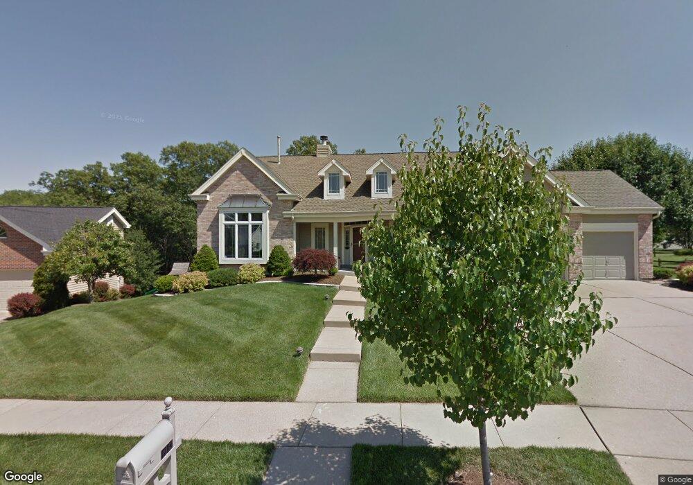
18132 Forest Briar Ct Glencoe, MO 63038
Estimated Value: $582,237 - $680,000
4
Beds
4
Baths
2,010
Sq Ft
$321/Sq Ft
Est. Value
About This Home
This home is located at 18132 Forest Briar Ct, Glencoe, MO 63038 and is currently estimated at $644,309, approximately $320 per square foot. 18132 Forest Briar Ct is a home located in St. Louis County with nearby schools including Babler Elementary School, Rockwood Valley Middle School, and Lafayette High School.
Ownership History
Date
Name
Owned For
Owner Type
Purchase Details
Closed on
May 4, 2021
Sold by
Bloomfield Donald A and Bloomfield Janette T
Bought by
Bloomfield Donald A and Bloomfield Janette T
Current Estimated Value
Purchase Details
Closed on
Aug 13, 2007
Sold by
Gross Michael K and Gross Phyllis J
Bought by
Bloomfield Donald A and Bloomfield Janette T
Home Financials for this Owner
Home Financials are based on the most recent Mortgage that was taken out on this home.
Original Mortgage
$85,980
Interest Rate
6.34%
Mortgage Type
Stand Alone Second
Purchase Details
Closed on
Jun 1, 1999
Sold by
Bartlow Michael A and Bartlow Carole F
Bought by
Gross Michael K and Gross Phyllis J
Home Financials for this Owner
Home Financials are based on the most recent Mortgage that was taken out on this home.
Original Mortgage
$247,500
Interest Rate
6.91%
Mortgage Type
Balloon
Create a Home Valuation Report for This Property
The Home Valuation Report is an in-depth analysis detailing your home's value as well as a comparison with similar homes in the area
Home Values in the Area
Average Home Value in this Area
Purchase History
| Date | Buyer | Sale Price | Title Company |
|---|---|---|---|
| Bloomfield Donald A | -- | None Available | |
| Bloomfield Donald A | $429,900 | None Available | |
| Gross Michael K | $275,000 | -- |
Source: Public Records
Mortgage History
| Date | Status | Borrower | Loan Amount |
|---|---|---|---|
| Closed | Bloomfield Donald A | $85,980 | |
| Open | Bloomfield Donald A | $343,920 | |
| Previous Owner | Gross Michael K | $247,500 |
Source: Public Records
Tax History
| Year | Tax Paid | Tax Assessment Tax Assessment Total Assessment is a certain percentage of the fair market value that is determined by local assessors to be the total taxable value of land and additions on the property. | Land | Improvement |
|---|---|---|---|---|
| 2025 | $6,251 | $101,100 | $36,800 | $64,300 |
| 2024 | $6,251 | $89,890 | $22,480 | $67,410 |
| 2023 | $6,245 | $89,890 | $22,480 | $67,410 |
| 2022 | $5,726 | $76,550 | $24,530 | $52,020 |
| 2021 | $5,684 | $76,550 | $24,530 | $52,020 |
| 2020 | $5,413 | $69,500 | $15,790 | $53,710 |
| 2019 | $5,434 | $69,500 | $15,790 | $53,710 |
| 2018 | $5,869 | $70,780 | $15,790 | $54,990 |
| 2017 | $5,729 | $70,780 | $15,790 | $54,990 |
| 2016 | $5,357 | $63,650 | $15,790 | $47,860 |
Source: Public Records
Map
Nearby Homes
- 1909 Shepard Rd
- 17824 Valley View Ln
- 17662 Garden Ridge Cir
- 2140 Dartmouth Gate Ct
- 1529 Garden Valley Dr
- 16858 Babler View Dr
- 2319 Paradise Peak Cir
- 1318 Pond Rd
- 18024 Cider Mill Dr
- 1500 Summit On Pond Ln
- 583 McBride Pointe Dr
- 32 Hickory Valley Ct
- 539 McBride Pointe Dr
- 17125 Windsor Crest Blvd
- 2319 Sandalwood Creek Ct
- 17651 Westhampton Woods Dr
- 2329 Hunters Crest Dr
- 2407 Sandalwood Creek Ct Unit A
- 16900 Red Dragon Place
- 2470 Indian Tree Cir
- 18126 Forest Briar Ct
- 1660 Ridge Bend Dr
- 18143 Bent Ridge Dr
- 18147 Bent Ridge Dr
- 1656 Ridge Bend Dr
- 18120 Forest Briar Ct
- 1605 N Woodgrove Ct
- 18125 Forest Briar Ct
- 18139 Bent Ridge Dr
- 1657 Ridge Bend Dr
- 1653 Ridge Bend Dr
- 18135 Bent Ridge Dr
- 1661 Ridge Bend Dr
- 1604 N Woodgrove Ct
- 18144 Bent Ridge Dr
- 1649 Ridge Bend Dr
- 1648 Ridge Bend Dr
- 18136 Bent Ridge Dr
- 18117 Forest Briar Ct
- 18131 Bent Ridge Dr
Your Personal Tour Guide
Ask me questions while you tour the home.