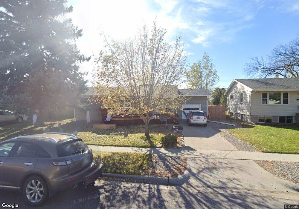
1816 Miles Ave Billings, MT 59102
East Central Billings NeighborhoodEstimated Value: $316,000 - $370,000
4
Beds
2
Baths
2,016
Sq Ft
$168/Sq Ft
Est. Value
About This Home
This home is located at 1816 Miles Ave, Billings, MT 59102 and is currently estimated at $338,663, approximately $167 per square foot. 1816 Miles Ave is a home located in Yellowstone County with nearby schools including Miles Avenue School, Lewis & Clark Junior High School, and Billings West High School.
Ownership History
Date
Name
Owned For
Owner Type
Purchase Details
Closed on
Oct 15, 2021
Sold by
Spencer Kyle P and Spencer Whitney T
Bought by
Priest John D and Priest Rebecca K
Current Estimated Value
Home Financials for this Owner
Home Financials are based on the most recent Mortgage that was taken out on this home.
Original Mortgage
$291,620
Outstanding Balance
$263,611
Interest Rate
2.8%
Mortgage Type
FHA
Estimated Equity
$75,052
Purchase Details
Closed on
Jul 15, 2020
Sold by
Seagraves Carlen and Copeland Andrew
Bought by
Spencer Kyle P and Spencer Whitey T
Home Financials for this Owner
Home Financials are based on the most recent Mortgage that was taken out on this home.
Original Mortgage
$218,500
Interest Rate
3.1%
Mortgage Type
New Conventional
Purchase Details
Closed on
Jul 14, 2016
Sold by
Gilg Charles L and Gilg Kandy K
Bought by
Seagraves Carlen and Copeland Andrew
Create a Home Valuation Report for This Property
The Home Valuation Report is an in-depth analysis detailing your home's value as well as a comparison with similar homes in the area
Home Values in the Area
Average Home Value in this Area
Purchase History
| Date | Buyer | Sale Price | Title Company |
|---|---|---|---|
| Priest John D | -- | First Montana Title Company | |
| Spencer Kyle P | -- | First Montana Title Co | |
| Seagraves Carlen | -- | First Montana Title |
Source: Public Records
Mortgage History
| Date | Status | Borrower | Loan Amount |
|---|---|---|---|
| Open | Priest John D | $291,620 | |
| Previous Owner | Spencer Kyle P | $218,500 |
Source: Public Records
Tax History
| Year | Tax Paid | Tax Assessment Tax Assessment Total Assessment is a certain percentage of the fair market value that is determined by local assessors to be the total taxable value of land and additions on the property. | Land | Improvement |
|---|---|---|---|---|
| 2025 | $2,760 | $324,300 | $47,220 | $277,080 |
| 2024 | $2,760 | $288,000 | $43,820 | $244,180 |
| 2023 | $2,759 | $288,000 | $43,820 | $244,180 |
| 2022 | $2,461 | $225,200 | $0 | $0 |
| 2021 | $2,342 | $225,200 | $0 | $0 |
| 2020 | $2,194 | $200,100 | $0 | $0 |
| 2019 | $2,093 | $200,100 | $0 | $0 |
| 2018 | $1,961 | $183,200 | $0 | $0 |
| 2017 | $1,905 | $183,200 | $0 | $0 |
| 2016 | $1,754 | $170,300 | $0 | $0 |
| 2015 | $1,715 | $170,300 | $0 | $0 |
| 2014 | $1,521 | $79,764 | $0 | $0 |
Source: Public Records
Map
Nearby Homes
- 1736 Broadwater Ave
- 16 19th St W
- 1925 Yellowstone Ave
- 1627 Yellowstone Ave
- 1705 Clark Ave
- 1537 Wyoming Ave Unit D
- 1147 18th St W Unit 3
- 1704 Burlington Ave
- 1903 Belvedere Dr
- 1342 Custer Ave
- 1823 Alderson Ave
- 2300 Clark Ave
- 1723 Alderson Ave
- 1326 Custer Ave
- 0 Wyatt Cir Unit 356590
- 11 Alma Ln
- 1310 Yellowstone Ave Unit 16
- 1310 Yellowstone Ave Unit 6
- 1245 Cook Ave
- 1288 Yellowstone Ave Unit 2
Your Personal Tour Guide
Ask me questions while you tour the home.