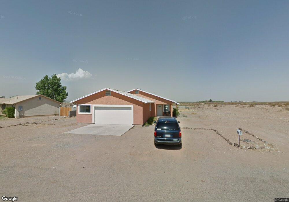
1816 N Walnut Dr Safford, AZ 85546
Estimated Value: $322,735 - $367,000
--
Bed
--
Bath
1,800
Sq Ft
$193/Sq Ft
Est. Value
About This Home
This home is located at 1816 N Walnut Dr, Safford, AZ 85546 and is currently estimated at $347,684, approximately $193 per square foot. 1816 N Walnut Dr is a home located in Graham County with nearby schools including Ruth Powell Elementary School, Dorothy Stinson School, and Lafe Nelson School.
Ownership History
Date
Name
Owned For
Owner Type
Purchase Details
Closed on
Oct 11, 2016
Sold by
Blake Holding Corporation
Bought by
Capgrow Holdings Jv Sub Ii Llc
Current Estimated Value
Purchase Details
Closed on
Jul 27, 2005
Sold by
Freddy Michael C and Freddy Connie S
Bought by
Blake Holding Corporation
Home Financials for this Owner
Home Financials are based on the most recent Mortgage that was taken out on this home.
Original Mortgage
$130,800
Interest Rate
5.56%
Mortgage Type
New Conventional
Purchase Details
Closed on
Mar 29, 2005
Sold by
Moeller W Max
Bought by
Freddy Michael C and Freddy Connie S
Home Financials for this Owner
Home Financials are based on the most recent Mortgage that was taken out on this home.
Original Mortgage
$63,000
Interest Rate
5.77%
Mortgage Type
Seller Take Back
Create a Home Valuation Report for This Property
The Home Valuation Report is an in-depth analysis detailing your home's value as well as a comparison with similar homes in the area
Home Values in the Area
Average Home Value in this Area
Purchase History
| Date | Buyer | Sale Price | Title Company |
|---|---|---|---|
| Capgrow Holdings Jv Sub Ii Llc | $167,000 | Near North Natl Title Llc | |
| Blake Holding Corporation | $163,500 | Safford Title Agency | |
| Freddy Michael C | $70,000 | Safford Title Agency |
Source: Public Records
Mortgage History
| Date | Status | Borrower | Loan Amount |
|---|---|---|---|
| Previous Owner | Blake Holding Corporation | $130,800 | |
| Previous Owner | Freddy Michael C | $63,000 |
Source: Public Records
Tax History Compared to Growth
Tax History
| Year | Tax Paid | Tax Assessment Tax Assessment Total Assessment is a certain percentage of the fair market value that is determined by local assessors to be the total taxable value of land and additions on the property. | Land | Improvement |
|---|---|---|---|---|
| 2026 | $1,663 | -- | -- | -- |
| 2025 | $1,663 | $25,319 | $1,559 | $23,760 |
| 2024 | $1,730 | $23,737 | $1,559 | $22,178 |
| 2023 | $1,730 | $19,849 | $1,559 | $18,290 |
| 2022 | $1,696 | $17,767 | $1,559 | $16,208 |
| 2021 | $1,802 | $0 | $0 | $0 |
| 2020 | $1,739 | $0 | $0 | $0 |
| 2019 | $1,800 | $0 | $0 | $0 |
| 2018 | $1,709 | $0 | $0 | $0 |
| 2017 | $1,556 | $0 | $0 | $0 |
| 2016 | $0 | $0 | $0 | $0 |
| 2015 | -- | $0 | $0 | $0 |
Source: Public Records
Map
Nearby Homes
- 257 E Walnut St
- 2030 N Calle Montecito
- 329 E Calle Mesa Verde
- 774 E Amber Ridge Rd
- 0 La Quinta Unit 1721031
- 0 N Branding Iron Ln Unit 11
- 1395 Skinner Ln
- 216 S 6th Ave
- 212 E 8th St
- 616 W 7th St
- 1104 S Central Ave
- 1552 Katelyn Ln
- 1116 S 6th Ave
- 1204 S 1st Ave
- 1210 S 1st Ave
- 1101 S 9th Place
- 1108 S 9th Ave
- 1544 Stone Willow Dr
- 1551 Hobble Creek Dr
- 120 Relation St Unit 2
- 1798 N Walnut St
- 1778 N Walnut St
- 260 E Walnut St
- 1773 N Walnut St
- 1768 N Walnut St
- 240 E Cherry St
- 279 E Walnut St
- 270 E Cherry St
- 300 E Walnut St
- 1742 N Walnut St
- 307 E Walnut St
- 290 E Cherry St
- 247 E Cherry St
- 231 E Cherry St
- 164 E Cherry St
- 327 E Walnut St
- 312 E Cherry St
- 269 E Cherry St
- 211 E Cherry St
- 293 E Cherry St