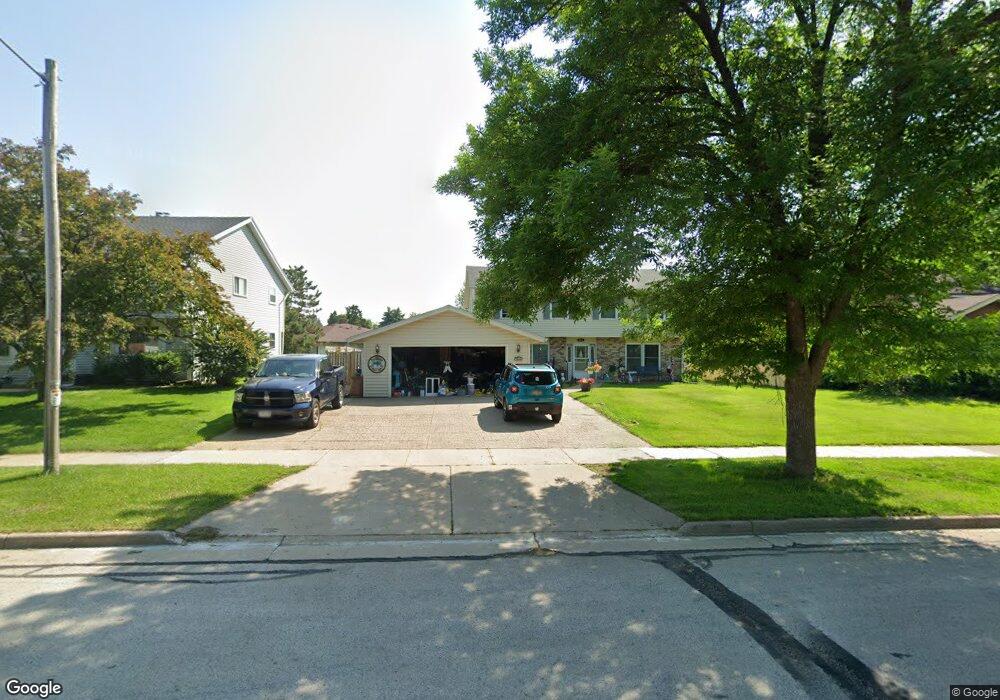
1816 Wolf Rd Waukesha, WI 53186
Estimated Value: $405,000 - $511,000
5
Beds
4
Baths
2,800
Sq Ft
$168/Sq Ft
Est. Value
About This Home
This home is located at 1816 Wolf Rd, Waukesha, WI 53186 and is currently estimated at $469,696, approximately $167 per square foot. 1816 Wolf Rd is a home located in Waukesha County with nearby schools including John F. Miller School, Banting Elementary School, and Horning Middle School.
Ownership History
Date
Name
Owned For
Owner Type
Purchase Details
Closed on
Dec 30, 2022
Sold by
Wendling Michael J and Wendling Jamie L
Bought by
Ahles-Birkholz Kayla Mae and Birkholz Jason Paul
Current Estimated Value
Home Financials for this Owner
Home Financials are based on the most recent Mortgage that was taken out on this home.
Original Mortgage
$263,200
Outstanding Balance
$257,474
Interest Rate
8.48%
Mortgage Type
New Conventional
Estimated Equity
$212,222
Purchase Details
Closed on
Sep 2, 2016
Sold by
Wendling Jeremy R
Bought by
Wendling Michael J and Wendling Jamei L
Home Financials for this Owner
Home Financials are based on the most recent Mortgage that was taken out on this home.
Original Mortgage
$200,000
Interest Rate
3.48%
Mortgage Type
New Conventional
Purchase Details
Closed on
Dec 3, 2012
Sold by
Wendling Michael John and Wendling Jeremy Richard
Bought by
Wendling Michael J and Wendling Jamie L
Home Financials for this Owner
Home Financials are based on the most recent Mortgage that was taken out on this home.
Original Mortgage
$170,000
Interest Rate
3.36%
Mortgage Type
New Conventional
Purchase Details
Closed on
Jan 30, 2012
Sold by
Wendling Michael John and Wendling Jeremy Richard
Bought by
Wendling Michael John and Wendling Jamie L
Home Financials for this Owner
Home Financials are based on the most recent Mortgage that was taken out on this home.
Original Mortgage
$174,000
Interest Rate
3.95%
Mortgage Type
New Conventional
Purchase Details
Closed on
Sep 29, 2005
Sold by
Martin Linda M
Bought by
Wendling Michael John and Wendling Jeremy Richard
Home Financials for this Owner
Home Financials are based on the most recent Mortgage that was taken out on this home.
Original Mortgage
$196,000
Interest Rate
5.89%
Mortgage Type
Fannie Mae Freddie Mac
Purchase Details
Closed on
Oct 31, 2001
Sold by
Fread Chris M and Fread Carol R
Bought by
Martin Linda M
Home Financials for this Owner
Home Financials are based on the most recent Mortgage that was taken out on this home.
Original Mortgage
$165,600
Interest Rate
6.52%
Create a Home Valuation Report for This Property
The Home Valuation Report is an in-depth analysis detailing your home's value as well as a comparison with similar homes in the area
Home Values in the Area
Average Home Value in this Area
Purchase History
| Date | Buyer | Sale Price | Title Company |
|---|---|---|---|
| Ahles-Birkholz Kayla Mae | $329,900 | None Listed On Document | |
| Wendling Michael J | $78,600 | Lakefront Title Llc | |
| Wendling Michael J | -- | None Available | |
| Wendling Michael John | -- | Knight Barry Title Inc | |
| Wendling Michael John | $245,000 | -- | |
| Martin Linda M | $103,500 | -- | |
| Martin Linda M | $103,500 | -- |
Source: Public Records
Mortgage History
| Date | Status | Borrower | Loan Amount |
|---|---|---|---|
| Open | Ahles-Birkholz Kayla Mae | $263,200 | |
| Previous Owner | Wendling Michael J | $200,000 | |
| Previous Owner | Wendling Michael J | $170,000 | |
| Previous Owner | Wendling Michael John | $174,000 | |
| Previous Owner | Wendling Michael John | $196,000 | |
| Previous Owner | Martin Linda M | $165,600 |
Source: Public Records
Tax History Compared to Growth
Tax History
| Year | Tax Paid | Tax Assessment Tax Assessment Total Assessment is a certain percentage of the fair market value that is determined by local assessors to be the total taxable value of land and additions on the property. | Land | Improvement |
|---|---|---|---|---|
| 2024 | $5,663 | $379,800 | $83,500 | $296,300 |
| 2023 | $5,512 | $379,800 | $83,500 | $296,300 |
| 2022 | $5,221 | $271,000 | $77,800 | $193,200 |
| 2021 | $5,349 | $271,000 | $77,800 | $193,200 |
| 2020 | $5,161 | $271,000 | $77,800 | $193,200 |
| 2019 | $5,004 | $271,000 | $77,800 | $193,200 |
| 2018 | $4,723 | $250,900 | $69,600 | $181,300 |
| 2017 | $5,248 | $250,900 | $69,600 | $181,300 |
| 2016 | $4,689 | $234,500 | $61,400 | $173,100 |
| 2015 | $4,660 | $234,500 | $61,400 | $173,100 |
| 2014 | $4,467 | $221,200 | $61,400 | $159,800 |
| 2013 | $4,575 | $221,200 | $61,400 | $159,800 |
Source: Public Records
Map
Nearby Homes
- 1729 Stardust Dr Unit B
- 2109 Melody Ln
- 1415 Niagara St Unit 109
- 1333 Niagara St
- 1308 Danny St
- 1116 Josephine St
- 1112 Gertrude St
- 1471 Cleveland Ave
- 918 Niagara St
- 937 E Moreland Blvd
- 925 Harding Ave
- 21525 Belgren Rd
- S17W22650 Lincoln Ave
- 1021 Arcadian Ave
- 335 Kossow Rd
- 1021 Aurora St
- 1522 Pewaukee Rd
- 2423 Kossow Rd
- 1139 White Rock Ave
- 512 E Main St
- 1821 Wolf Rd
- 1820 Wolf Rd
- 1812 Wolf Rd
- 1811 Wolf Rd
- 1705 Robin Ct
- 1712 Robin Ct
- 1708 Robin Ct
- 1704 Robin Ct
- 1709 Robin Ct
- 1824 Wolf Rd
- 1825 Wolf Rd
- 1707 Butler Dr
- 1725 Butler Dr
- 1708 Butler Dr
- 1616 Stardust Dr Unit B
- 1618 Stardust Dr Unit A
- 1620 Stardust Dr
- 1622 Stardust Dr Unit B
- 1701 Butler Dr
- 1612 Stardust Dr Unit 14