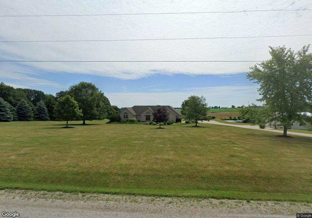
1817 County Road 1035 Ashland, OH 44805
Estimated Value: $438,000 - $464,000
2
Beds
3
Baths
2,024
Sq Ft
$223/Sq Ft
Est. Value
About This Home
This home is located at 1817 County Road 1035, Ashland, OH 44805 and is currently estimated at $452,303, approximately $223 per square foot. 1817 County Road 1035 is a home located in Ashland County with nearby schools including Hillsdale Elementary School, Hillsdale Middle School, and Hillsdale High School.
Ownership History
Date
Name
Owned For
Owner Type
Purchase Details
Closed on
Apr 29, 2010
Sold by
Bailey Margo H
Bought by
Robertson Jo A
Current Estimated Value
Purchase Details
Closed on
Aug 15, 2007
Sold by
Bailey Scott L
Bought by
Bailey Margo H
Purchase Details
Closed on
Oct 19, 2004
Sold by
Watts Matthew J
Bought by
Bailey Scott L
Purchase Details
Closed on
May 21, 2001
Sold by
Richter Arthur
Bought by
Watts Matthew J
Purchase Details
Closed on
Feb 29, 1996
Bought by
Richter Arthur
Create a Home Valuation Report for This Property
The Home Valuation Report is an in-depth analysis detailing your home's value as well as a comparison with similar homes in the area
Home Values in the Area
Average Home Value in this Area
Purchase History
| Date | Buyer | Sale Price | Title Company |
|---|---|---|---|
| Robertson Jo A | $232,500 | -- | |
| Bailey Margo H | -- | -- | |
| Bailey Scott L | $236,000 | -- | |
| Watts Matthew J | $50,000 | -- | |
| Richter Arthur | $25,000 | -- |
Source: Public Records
Tax History Compared to Growth
Tax History
| Year | Tax Paid | Tax Assessment Tax Assessment Total Assessment is a certain percentage of the fair market value that is determined by local assessors to be the total taxable value of land and additions on the property. | Land | Improvement |
|---|---|---|---|---|
| 2024 | $4,069 | $122,430 | $19,150 | $103,280 |
| 2023 | $4,069 | $122,430 | $19,150 | $103,280 |
| 2022 | $3,664 | $87,440 | $13,670 | $73,770 |
| 2021 | $3,669 | $87,440 | $13,670 | $73,770 |
| 2020 | $3,440 | $87,440 | $13,670 | $73,770 |
| 2019 | $3,236 | $80,660 | $12,640 | $68,020 |
| 2018 | $3,144 | $80,660 | $12,640 | $68,020 |
| 2017 | $2,747 | $80,660 | $12,640 | $68,020 |
| 2016 | $2,747 | $70,140 | $10,990 | $59,150 |
| 2015 | $2,713 | $70,140 | $10,990 | $59,150 |
| 2013 | $3,265 | $82,880 | $11,400 | $71,480 |
Source: Public Records
Map
Nearby Homes
- 1015 Township Road 1696
- 1690 County Road 995
- 0 Twp Rd 1806 Unit 11591470
- 1106 County Road 30a
- 1183 County Road 30a
- 1581 County Road 995
- 19 Maine St
- 820 County Road 30a
- 1653 Ohio 60
- 1653 State Route 60
- 1048 Township Road 2156
- 945 Pike Dr
- 1706 Kingwood Ct
- 3290 Shad Dr W
- 1111 Columbus Cir N
- 963 Avalon Dr
- 150 E Main St
- 1845 County Road 655
- 1696 Township Road 1419
- 1825 County Road 1035
- 1805 County Road 1035
- 1827 County Road 1035
- 1822 Co Rd 1035
- 1816 County Road 1035
- 1041 Township Road 1806
- 1822 County Road 1035
- 1830 County Road 1035
- 1013 1806
- 1017 Township Road 1806
- 1013 Township Road 1806
- 1835 County Road 1035
- 1049 Township Road 1806
- 1001 Township Road 1806
- 1843 County Road 1035
- 1771 County Road 1035
- 1864 County Road 1035
- 977 Township Road 1806
- 1863 County Road 1035
- 1045 County Road 1754