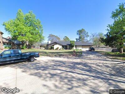
1818 Joe Taylor Cir Norman, OK 73072
Adkins Crossing NeighborhoodEstimated Value: $505,000 - $608,000
4
Beds
3
Baths
3,172
Sq Ft
$174/Sq Ft
Est. Value
About This Home
This home is located at 1818 Joe Taylor Cir, Norman, OK 73072 and is currently estimated at $551,529, approximately $173 per square foot. 1818 Joe Taylor Cir is a home located in Cleveland County with nearby schools including Monroe Elementary School, Alcott Middle School, and Norman High School.
Ownership History
Date
Name
Owned For
Owner Type
Purchase Details
Closed on
Dec 6, 2024
Sold by
Brannon Mark and Brannon Jennifer
Bought by
Brannon Mark and Brannon Jennifer
Current Estimated Value
Purchase Details
Closed on
Mar 22, 2010
Sold by
Edward Jones Trust Company
Bought by
Brannon Mark A and Brannon Jennifer H
Home Financials for this Owner
Home Financials are based on the most recent Mortgage that was taken out on this home.
Original Mortgage
$250,000
Interest Rate
5%
Mortgage Type
Purchase Money Mortgage
Purchase Details
Closed on
Apr 5, 2006
Sold by
Dotson Virginia M
Bought by
Dotson Virginia M and Virginia M Dotson Living Trust
Create a Home Valuation Report for This Property
The Home Valuation Report is an in-depth analysis detailing your home's value as well as a comparison with similar homes in the area
Home Values in the Area
Average Home Value in this Area
Purchase History
| Date | Buyer | Sale Price | Title Company |
|---|---|---|---|
| Brannon Mark | -- | None Listed On Document | |
| Brannon Mark | -- | None Listed On Document | |
| Brannon Mark A | $175,000 | None Available | |
| Dotson Virginia M | -- | None Available |
Source: Public Records
Mortgage History
| Date | Status | Borrower | Loan Amount |
|---|---|---|---|
| Previous Owner | Brannon Mark A | $266,000 | |
| Previous Owner | Brannon Mark A | $266,000 | |
| Previous Owner | Brrannon Mark A | $215,000 | |
| Previous Owner | Brannon Jennifer H | $210,000 | |
| Previous Owner | Brannon Mark A | $209,700 | |
| Previous Owner | Brannon Mark A | $26,200 | |
| Previous Owner | Brannon Mark A | $250,000 |
Source: Public Records
Tax History Compared to Growth
Tax History
| Year | Tax Paid | Tax Assessment Tax Assessment Total Assessment is a certain percentage of the fair market value that is determined by local assessors to be the total taxable value of land and additions on the property. | Land | Improvement |
|---|---|---|---|---|
| 2024 | $4,273 | $36,673 | $7,294 | $29,379 |
| 2023 | $4,156 | $35,605 | $7,291 | $28,314 |
| 2022 | $3,865 | $34,568 | $6,000 | $28,568 |
| 2021 | $4,074 | $34,568 | $6,000 | $28,568 |
| 2020 | $3,987 | $34,568 | $6,000 | $28,568 |
| 2019 | $3,944 | $33,652 | $5,841 | $27,811 |
| 2018 | $3,711 | $32,673 | $5,671 | $27,002 |
| 2017 | $3,640 | $34,569 | $0 | $0 |
| 2016 | $3,588 | $30,797 | $5,345 | $25,452 |
| 2015 | $3,376 | $29,900 | $3,721 | $26,179 |
| 2014 | $3,306 | $29,030 | $3,613 | $25,417 |
Source: Public Records
Map
Nearby Homes
- 2521 McGee Dr Unit 5
- 2015 Summit Cir
- 2108 Barton St Unit 2110
- 2022 Morning Dew Trail
- 2814 Shoreridge Ave Unit 2814
- 2812 Shoreridge Ave Unit 2814
- 1406 Aspen Ln
- 1400 Aspen Ln
- 2301 Mckown Dr
- 1516 Southern Heights Ave
- 2732 Walnut Rd
- 1301 24th Ave SW Unit 1305
- 1917 Whispering Pines Cir
- 3133 Walnut Rd
- 1114 Merrymen Green
- 1103 A Woodland Dr
- 1137 Pinehurst Dr
- 1116 Pinehurst Dr
- 1109 Pinehurst Dr
- 1312 Brookside Dr
- 1818 Joe Taylor Cir
- 1819 Joe Taylor Cir
- 1887 Trailview Dr
- 1902 Joe Taylor Cir
- 1891 Trailview Dr
- 1883 Trailview Dr
- 1901 Joe Taylor Cir
- 1901 Trailview Dr
- 1879 Trailview Dr
- 1906 Joe Taylor Cir
- 1886 Trailview Dr
- 1905 Joe Taylor Cir
- 1905 Trailview Dr
- 1890 Trailview Dr
- 1902 Trailview Dr
- 2801 Trailridge Dr
- 2804 Trailridge Dr
- 1909 Joe Taylor Cir
- 1910 Joe Taylor Cir
- 1909 Trailview Dr